Group T - Collaborative Climate Adaption Project
| Area | Amman | |||||||||||
| Place | Amman | |||||||||||
| Country | Jordan | |||||||||||
| Topic | ' | |||||||||||
| Author(s) | Miguel Rasha and Azadeh | |||||||||||

| ||||||||||||
| {{#widget:GoogleMaps | width=300 | height=200 | lat=31.971095 | lng=35.908813 | zoom=12 | centermarker=yes | maptypecontrol=yes | overviewmapcontrol=yes | largemapcontrol=yes | scalecontrol=yes
}} | ||
Rationale: Why have you selected this case study area?
Amman began as a settlement, in the early years of the 20th century, which began on the edges of a water source, the RAS AL AIN stream. The lands surrounding the stream were rich with vegetation. RAS AL AIN’s water source spread from the current Downtown area towards the north east of Jordan. The stream aided the first settlers take on farming as means of sustenance. The city slowly expanded from the downtown area towards the hills, and with the expansion, the stream became a dumpsite, and slowly turned into a hazardous area. As the expansion continued, and the settlement transformed into a city, more and more houses were built over the rich farming soil, instead of expanding the city towards the desert, and turning towards agriculture. Therefore, as a result, thousands of trees were cut down, to make way for buildings and streets, disregarding the need for open public spaces and the conservation of existing vegetation. During the 1960s & the 1970s, Greater Amman Municipality embarked on implementing the first urban plan created for Amman, the capital city of Jordan, where various large decisions were made; the main one being, covering the water stream throughout building a highway on top, and merging the stream with the current sewage system, as well as cutting down trees from various areas, such as the current site of Jordan University.
During the early 1980s, the old quarter of Amman became an area highly congested with traffic, pollution, and demographic density. The area continued expanding, not by means of organized urban planning, but through urban sprawl, which was reflected through the speed of which climate change affected the area. Within the past 20 years, the city’s climate changed rapidly, as the seasons of spring and autumn became relatively shorter, while summer and winter became much longer. Desert storms are a prominent feature, and started occurring more frequently. Lands currently suffer from desertification and water resources, mainly rainfall levels are rapidly decreasing. However, Amman has great potentials in harvesting solar energy, as the area is sunny most of the year.
Our main focus will be identifying the major problems, realize the major opportunities in order to come up with strategies to improve the current situation, and adapt to and mitigate climate change effects on the city of Amman.
Authors' perspectives
We believe that Amman has great potential for facing the future climate changes. During our research about the city we will prove that Amman is currently not very well adapted to the future climate changes and that they need a major reconfiguration of the city structure as well as a massive change in the current social and environmental practices. There is a huge potential for harvesting solar energy. The temperatures within the city of Amman and the country of Jordan as a whole are rigorously increasing, thus making it more difficult to deal with global warming challenges, which could be considered as an opportunity for conducting studies and research. We feel that there is a massive lack of ecological features in the city. The vegetation is poor and very scarce, the RAS AL AIN stream is completely buried, the city is growing in the direction of the farmlands and the concrete ratio to natural greenery is constantly increasing. One of our major concerns about the city of Amman is the current social and economic status, as we believe that it’s a major cause and solution to the current and future climate change challenges. During our initial brainstorming, a few questions came to mind: How can we take advantage of the climate in Jordan without relying on large investments? How can we improve the energy consuming rates while relying on a relatively low budget? We will attempt to answer the aforementioned inquiries, as we are confident that they are question of a highly sensitive nature, and definitely should take the greater part of our work.
Landscape and/or urban context
| Biogeography |
The original site of the city expanded over seven hills surrounding the Amman valley and the water stream, which flows from the northeastern plateau towards the Zarqa river basin. The central part of the city is located at an altitude of 725-800 meters. Expansion of the city during the past twenty-five years has resulted in the settlement of nineteen hills in total with an altitude of above 875 meters. The topography of the city consists of a series of steep hills and deep (at certain areas) narrow valleys. Most of the districts of Amman take their names from the hills on which they are situated. The initial development was mainly constructed over the upper slopes and crests, as well as the lower slopes of the hill-valley system; the increase in urban development over the last sixty years has involved extensive development on the frequently steeper mid-slope locations.

Image1. General Location of the city of Amman (from Robert B. Potter, Khadija Darmame, Nasim Barham, Stephen Nortcliff. 2007. An Introduction to the Urban Geography of Amman, Jordan)
| Cultural Features |
Amman is known for its national heritage, which mainly consists of ancient ruins from various periods of the Roman and the Abbasid times. The Roman theater, the Nymphaeum; Roman Bath, and Amman Citadel are the considered to be major national heritage elements, cultural symbols, and the main tourist attractions. Other elements, such as mosques constructed during the first half of the 20th century; the royal court and the 10 bridges constructed during the Roman reign could also be considered as some of the most important cultural symbols of the city. The city of Amman has no opera houses nor great museums or libraries. However, during the second half of the 20th century, movie theaters were highly popular. Some of the older movie theaters still exist, however they are highly deteriorated and currently associated with taboo activities, such as illegal pornography screening, as well as prostitution. The current cultural reference of Amman could be described as underground, whereas street and cafe culture are the most prominent, which is usually practiced parallel to the residential level, creating a certain level of transparency, lacking certain forms of a private sense. The cultural scene is mostly underground, and there is a boom in small businesses, where people tend to buy and renovate older structures and transform them into coffee houses or small galleries as well as smaller gatherings spaces for the creative portion of the society.
Image.2 Roman Theater, location: downtown Amman [1]
Image.3 Amman Citadel, Location: Jabal Al-Qala'a [2]
Image.4 The Temple of Hercules, Location: Jabal Al-Qala'a [3]
Image.5 The Raghadan Palace, Location: Downtown Amman [4]
Image.6 Cafe culture, Location: Jabal Amman [5]
Image.7 Cafe Culture, Location: Rainbow Street [6]
Image.8 Street Culture, Location: Rainbow Street [7]
Image.9 Cafe & Art culture, Location: Jabal Amman [8]
| Planning |
The Greater Amman Municipality has recently initiated a metropolitan growth master plan, scheduled for finalization in 2025. The metropolitan growth plan concentrates on encouraging a compact urban growth, so as to use the existing services to their full potential, promote the transit use and improve the pedestrian movement. Another key focus of the proposed master plan is to direct the growth of the designated expansion areas that are close to the existing urban core, as well as improve the livelihood of the existing urban core, promote mixed land use so as to push towards a diverse economy, create a clear distinction between the urban, suburban and traditional communities in order to protect the environmental aspects and agricultural land, as well as support the traditional culture. The plan also focuses on transforming the current dependence on cars for transportation, into a total dependence on a contemporary transportation system that is fully integrated with the pedestrian movement. And finally, the new master plan will ensure the conservation of cultural heritage and include the contemporary city heritage and the natural heritage within the current definition of heritage, which mainly focuses on ancient structures, as well as a few political and religious monuments.
The new master plan has divided the master plan into two main categories:
- Primary Growth Areas: These include Settlement Areas, Employment Areas, Metropolitan Corridors, and Metropolitan Growth centers. The Urban Envelope includes the existing built-up areas of Amman and extends beyond them in designated areas to align with the Amman Development Corridor. This Urban Envelope will contain 85% of Amman’s planned growth.
- Limited and No Growth Areas: These include Natural Heritage Areas, Cultural Heritage Areas, Agricultural Areas, and Mining and Quarry Areas where development is limited or prohibited. The natural heritage system incorporates features that are located on lands with difficult terrain and poor shallow soil.
In general, the quality of the City’s natural system could be described as severely degraded and definitely presents many opportunities for improvement. The main goal is to protect environmentally sensitive areas such as watersheds, valleys, wildlife areas, forests and plantations from further development, as well as rehabilitated and restored sites. In order to preserve Amman’s distinctive urban form, quarrying and mineral extraction will continue within the Metropolitan Planning Area, ensuring that Amman continues to be built out of local resources using local craftsmanship. Another main goal is to Protect and conserve valuable agricultural resources, especially high quality agricultural land, and also reduce agricultural water use and improve water quality for agriculture, as well as support and facilitate urban agriculture, increased water harvesting, and conservation, ensure compatible uses in areas adjacent to agricultural land and encourage high value-added economic and environmentally sustainable agricultural production such as organic farming.

Image.10 Greater Amman Municipality boundary (from Amman Municipality (2007): Metropolitan Growth Plan 2007-2025, Amman. Jordan)
Image.11 Built up areas and planned building expansion (from Amman Municipality (2007): Metropolitan Growth Plan 2007-2025, Amman. Jordan)
Image.12 Natural Soil distribution (from Amman Municipality (2007): Metropolitan Growth Plan 2007-2025, Amman. Jordan)
| Overall character |
Amman has transformed into a congested city in where it is becoming increasingly difficult to drive and almost impossible to walk. Reflecting its uncontrolled and unplanned growth, the city does not have an integrated public transportation system. Although almost 30% of Jordanians use public transport, and these are generally the relatively poor, the dominance of the automobile is highly reflected in the city’s network of major roads and tunnels, which grew exponentially during the period 1960-1980. The Greater Amman municipality has already planned two new urban transport projects, the Abdoun Bridge and the Amman-Zarqa light railway project, of which only the first has been realized.
When considering water issues, the city of Amman receives around 50% of its water reserve from the Jordan Valley area, which is pumped to and treated at Zai treatment plant, located northwest of the city at an altitude of 1035 m. The remaining water demands of Amman are met from Al-Mafraq well, the Azraq aquifer, as well as Qatrana, Swaqa and Wala situated to the south of the city of Amman. Unlike many cities in the developing world, 98% of households in Amman are connected to the water supply network, causing major challenges in water management, delivering water to the citizens on time, and major water storage challenges. Most of the city’s residents within the east and central quarters of the city, the poorer areas, depend on receiving water from the municipality on weekly basis, whilst the western quarter of the city depend on installed rooftop water tanks, which are frequently filled by water delivery trucks.
Amman is well knows of it's local small businesses, where the government has no or limited input on the city's economic growth. The city's urban city-scape is known of it's mused use buildings, where street shops and cafes create the public sphere of the city, as major governmental and public institutions have a minor role in the city's economic growth.
| History & Dynamics |
Amman was named after the Ammonites who originally ruled the area. In 1200 BC, Amman was an urban settlement. After that, the area lived through a series of occupations beginning with the Assyrians, Babylonians, Persians, Greeks, Romans and ending with Muslims. In the mid 19th century, and under the rule of the Ottomans, Circassian tribes escaping religious prosecution from Russia settled on the ancient site of Amman around the seasonal stream that flows in an east to west direction, as their livelihood depended on cultivation and farming on both sides of the stream. The next major development came with the construction of the Hijaz Railway in 1902. The Railway linked Amman directly with Damascus in the north and Medina in the south. The first Municipal Council of Amman was established in 1907, at which time the settlement consisted of little more than 300 small families. In 1921, Prince Abdullah declared Amman the capital of the new state of Trans-Jordan and from then onwards, the city became the administrative and economic hub of the country. The development of the city was parallel to the political development of the country. Amman in its development as a city reflects various political events, attracting migrants from all over the Middle East region. Other religious and ethnic minorities, such as the Kurds and Armenians also settled in the city of Amman. The main reason behind the various migrations is the city’s status of being the main governmental core. People looking for employment within the public sector moved to Amman creating a rather rent seeking mentality, which still dominates the behavior and practices of the political economy of the entire country.

Image.13 Historic table (Rasha Aboodi, Ramez Masannat, Nizar Taha, Hamza Maysara & Noor Al-Faraj. 2010. Graduation Project Thesis. Design of Philadelphia Hotel in Downtown Amman. Amman, Jordan.)
| Land-use patterns |
The Greater Amman municipality designated the land plots into three main categories; category A, B, C & D. Plots designated as Category A have an area of at least 900 square meters with a setback of 5 meters at the street façade level, 7 meters from the backside, and 5 meters on the sides. The built-up area can’t exceed 39% of the plot, leaving space for greenery. Category A residential land is almost exclusively located to the west of the city center, a corridor which extends to 1.5 KM to the outer boundaries of the Municipality borders. There is a secondary cluster to the north of the city and a few plots to the south of the city. Category B residential plots are between 750 and 900 square meters in area, with the setbacks of 4 meters from the front, 6 meters from the back and 4 meters from the sides. The built-up area of the plot cannot exceed 45% of the plot. Category B is more distributed that category A, however, mainly concentrated within the areas of West Amman, indicating a clear distinction between East & West Amman, where the general architectural character is marked by larger plot sizes, higher wealth rates, modern urban services, and a more regular water supply. Category C refers to plots of an area of 400 square meters, and residential buildings occupying a maximum of 51% of the plot. Setbacks are set to 4 meters on the front and back, and 3 meters on the sides. Category C is mainly dispersed throughout the southern and eastern quarters of the city. Finally, category D describes plots of 200 square meters of area or less, with setbacks of less than 3 meters on the sides, 2.5 meters on the front and back. Category D is mainly concentrated within the central part of the city, extending to the outer boundaries of east Amman, as it includes Palestinian refugee camps, such as Al-Wehdat refugee camp and Jabal Al-Hussain refugee camp, just to name a few. In terms of the intra-urban location of business cores within the city, a number of spatial nodes stand out. These include the entire Abdali area, the old bus and taxi station and the western entrance to the city with 8,154 enterprises; Al-Qwaismeh (7258 enterprises), Wadies Sir (7256), the downtown area (7095) and Tla’ Ali (7019) to the northwest side of the city. Once again a generalized west-east seggregation emerges, with the western parts of the city housing the city’s most modern shopping centers, universities, hotels, sports stadium and other facilities.

Image.14 Metropolitan Corridor distribution (from Amman Municipality (2007): Metropolitan Growth Plan 2007-2025, Amman. Jordan)
Image.15 Mining query distribution (from Amman Municipality (2007): Metropolitan Growth Plan 2007-2025, Amman. Jordan)
Image.16 National heritage network (from Amman Municipality (2007): Metropolitan Growth Plan 2007-2025, Amman. Jordan)

Image.17 Open space network (from Amman Municipality (2007): Metropolitan Growth Plan 2007-2025, Amman. Jordan)
Image.18 Natural Heritage Network (from Amman Municipality (2007): Metropolitan Growth Plan 2007-2025, Amman. Jordan)

Image.19 Residential Landuse growth (from Robert B. Potter, Khadija Darmame, Nasim Barham, Stephen Nortcliff. 2007. An Introduction to the Urban Geography of Amman, Jordan. )
Image.20 Past City Expansion plan (from Robert B. Potter, Khadija Darmame, Nasim Barham, Stephen Nortcliff. 2007. An Introduction to the Urban Geography of Amman, Jordan. )

Image.21 Amman Metropolitan Growth Master Plan (from Amman Municipality (2007): Metropolitan Growth Plan 2007-2025, Amman. Jordan)
Image.22 City growth area designation (from Amman Municipality (2007): Metropolitan Growth Plan 2007-2025, Amman. Jordan)
Image.23 City expansion concepts (from Amman Municipality (2007): Metropolitan Growth Plan 2007-2025, Amman. Jordan)
Cultural/social/political context
| Culture |
East and central areas of Amman, including the Downtown, is a home to the urbanized poor: it’s characterized as more conservative, mainly Islamic in its traditional and social practices, and includes a larger portion of Palestinian refugee camps. Western Amman is a total opposite, with contemporary residential districts, trendy cafes and bars, impressive art galleries, and reflects more liberal social practices. Locals refer to the upmarket district of Shmeisani as ‘Shiny Amman’ while the Abdoun area is sometimes referred to as Paris. This picture of two different realities in Amman reflects the concentration of wealthy socio-economic groups to the west and the north of the city. Consequently, higher land prices characterize this area. Thus, today the western part of the city exhibits relatively low population densities.
Image.23 Downtown Amman, Location: Saqf Al-Seil street [9]
Image.24 A view on East Amman [10]
Image.25 Downtown Amman, Location: Faisal street [11]
Image.26 West Amman, location: Abdoun [12]
Image.27 West Amman, Location: Shmeisani, Culture street [13]
Image.28 West Amman, Location: Business district [14]
| Political economy |
Amman is the main economic center of the Kingdom. More than 80% of all industrial and service activities are located in Greater Amman together with the industrial suburbs and semi-urban zones expanding towards the city of Al-Zarqa northeast. General levels of prosperity and incomes are higher in the capital than elsewhere in Jordan. The average income of Ammani households is estimated as 6533 JD per year, while the national annual average is estimated to be 5590 JD. The main employment categories in Amman are wholesale and retail trade, as well as vehicle servicing and the wholesale of personal and household goods. Amman dominates the national tourism sector, with 75.2% of all direct employment in the sector being located in Amman. Also, more than two-thirds of all hotel beds in Jordan are located in Amman.
| Legal framework |
The Greater Amman Municipality is responsible for giving agreements, as technical review of the detailed plans by GAM representatives that is considered mandatory before issuing a construction license, which leads to a development agreement that includes terms, conditions, requirements, obligations, and responsibilities of all parties associated with any Project. The content of a development agreement usually includes conditions of approval from the design review process, capital improvement charges for services, roads and transportation, storm water drainage, open space acquisition fee, purchase of development rights fee, off-site construction completion by both the developer and the municipality.
If changes in building and construction regulations, as well as infrastructure specifications are required, the approval process is escalated to Prime Minister of Jordan. One such example is Al-Abdali development project, which consists of various architectural, urban design developments, within the area Al-Abdali district, in an attempt to create a contemporary business and mixed-use hubs, promoting the project as the new Downtown of Amman. The project was associated with various violations, as various regulations were ignored and/or changed. The main violations dealt with such as setback regulations, building height standards, and access to infrastructure such as streets, water drainage system, and land use. The project is situated among one of the oldest residential quarters in the city of Amman, and proceeding with the project will cause future problems related to an increased traffic congestion, absence of proper services, such as waste management that could lead to sewers flooding within the entire surrounding area, as well as major deficiencies in clean water provision, not to mention threats of increasing pollution rates.

Image.29 National Policies and Agenda table (from Amman Municipality (2007): Metropolitan Growth Plan 2007-2025, Amman. Jordan)
Image.30 Abdali Development Project 3D Model, Location: Abdali [15]
Image.31 Abdali Development Project 3D Rendering, Location: Abdali [16]
Image.32 Abdali Development Project 3D Rendering II, Location: Abdali [17]
Local Climate
| Local Climate |
Amman has a relatively wet rainy season between the months of November and April, while the rest of the year is usually dry. Spring and autumn are relatively short. Summer, which extends from late May to approximately the end of September, is a rainless season. Spring (lasting during a very short period between April and May) and autumn (lasting during a very short period between September and October) have temperatures reaching up to 23 C. and are characterized by low humidity and frequent breezes. The winter period (starting from the beginning of November through early April) has nighttime temperatures close to or below zero, with occasional snow, particularly in the months of December and January. Daytime temperatures during this period average between 12 C and 21 C. Annual winter rainfall average if approximately 300mm, normally with the highest amounts of rainfall in January and February. However, in the recent years, the amount of rainfall has gradually increased, and the chance of snowing increased annually from only once to two or three times a year.

Image.34 General climate data [18]
Image.35 Daylight Graphic [19]
Image.36 Daylight saving time [20]
Image.37 Sun Path [21]
Image.38 Rainfall Data [22]
In January 2013, Amman suffered a massive storm, where the rainfall amounts exceeded the usual rates and caused major floods all over the city. The infrastructure deficiency came to surface as Jordan faced major rainfall and subsequently massive snowfall during a span of one week. During the latest storm, the government had no adequate equipment and technology to drain the excess water, which caused various problems within the street infrastructure, paving, electricity poles, as well as the drainage and sewage system. The people of Amman responded to the government's reaction through humor, while many communities formed help groups to aid those in need, linking the latest catastrophe with the current political status, after the occurrence of this natural phenomenon, a satire movement spread all over the web, criticizing politicians for their lack of interest in environmental studies.
Image.39 Flood I [23]
Image.40 Flood II [24]
Image.41 Flood III [25]
Image.42 Furniture turned to bridges I [26]
Image.43 Furniture turned to bridges II [27]
Image.44 Public response to flood [28]
| Future Climate Changes |
Climate change will have a major impact on Amman, as droughts and flooding are major natural hazards to be considered. Jordan is characterized with a high scarcity in water resources, and relies mainly on groundwater, which proves to be not sustainable as almost 90% of the available water reserve is used. Summers are characterized with an evident lack of water provided to the citizens by pumping water directly to households. Regarding the quality of Amman’s air, there is an absence of systematic measuring, and there are numerous sources of CO2 emissions in the city, however little data exists, making it difficult to determine the main pollution sources, and therefore making it harder to determine the efforts needed to minimize pollution. The future predicts a general increase in temperatures all over Jordan reaching up to 4 C, as well as reduced precipitation up to 20%, and unknown impacts on groundwater. Another issue facing Amman in the future is the threat of increasing dry lands, and magnification of the effects of sandstorms coming from the east. However, there is no real evidence on the aforementioned future climate predictions, as there has been a serious lack of interest regarding environmental aspects.

Image.45 Current and future scenarios of Green-Blue ratio (from Amman Municipality (2007): Metropolitan Growth Plan 2007-2025, Amman. Jordan)
Analysis of vulnerability
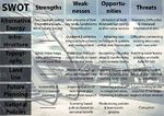
When considering the future climate changes, various aspects of the city should be considered. The most important aspect is the environmental and sustainable planning; a new master plan that would address the pollution rates in the congested areas of the city, where cleaning these areas from polluting agents must take a priority before addressing the building standards and land use within these areas. However, this process should also take even greater lengths through raising awareness for zero emission vehicles and transportation, pedestrian movement, and general street hygiene. Another measure that could be planned is the utilization of rooftops, in a manner that would generate profit to the building owners, as many of East and central Amman residents are impoverished, and in major need for improved livelihood. The current infrastructure is a major setback for any future development, as the current state of the infrastructure renders it as incapable of absorbing the current population load. One major aspect of the infrastructure is storm water drainage network, sewage system, and underground water reservoirs. A huge portion of the annual rainfall is lost, due to infrastructure deficiency, and this must be adequately addressed. Planning greenbelts on the dry borders of the city is a major need, as currently sandstorms create a major risk, not only in polluting the air, but also increasing the rates of desertification on the green borders of the city, as well as leaving dryer lands within the eastern quarter and outskirts of Amman. The slope should be addressed in a well-studied manner, as a main requirement to full utilization for directing rainwater flow. The major threat for implementing any strategies are the current political and national policies, as the political status of the country is rather unstable, due to political corruption, social segregation, and financial challenges that the Greater Amman Municipality and the entire country is currently facing, as during the past few months, the Greater Amman Municipality has declared it's bankruptcy, due to lawsuits and charges of illegal land purchase.

Image.46 SWOT Analysis
Proposals for Climate Change Adaptation
Amman could become more resilient to climate change through improving the infrastructure and service sectors, as well as increasing green spaces and connecting creating a network of greenery that would ensure further stability when facing different climate challenges. The current infrastructure challenges can be summed up in narrow streets, water management deficiency, and scarcity in public green spaces within highly dense areas.
After analyzing the strengths, opportunities, weaknesses and threats of various aspects within the city of Amman, we propose the following measures to adapt to future climate change scenarios:
- In order to manage water reserve, and utilize the future predictions of increased rainfall to the maximum degrees possible, we propose enforcing the installation of underground water reservoirs for each new urban expansion development, making it a major requirement for each new construction within the newly designed areas, which will be used to collect direct rainfall and connect it to the grey water system utilized in gardening and building grey water systems. This will require the restructuring of the current building specifications and regulations, in order to ensure implementation. As for ensuring the sustainability of this law, the Greater Amman Municipality could provide certain incentives at the beginning of the initial proposal implementation phase, such as reducing taxes on connecting newly built buildings to existing services. Regarding the existing built up areas of the city, the aforementioned measure will require massive construction works, so as to integrate water reservoirs to residences located within the less dense areas, mainly West Amman, and when considering East Amman, the Greater Amman Municipality should consider connecting a number of residences together to one central water reservoir that will provide grey water to the residents, and thus, reducing the cost, damage and time required for implementation.
- Another measure that could be considered when thinking about the city’s air quality, water absorption, and decreasing CO2 emissions, is the improvement of green public open spaces, as well as constructing more community gardens. However, this will require a main change in the current governmental laws, regarding public space designation, as the country is currently discouraging the construction of open public spaces, in an attempt to prevent group gatherings and protests. Another challenge rises when considering open spaces is the soil quality, as most parts of the east Amman quarters has poor soil quality due to drought and desertification. The Greater Amman Municipality should consider imposing laws that will designate at least 40% of each plot within the planned expansion areas as a required minimum for constructing private gardens within newly built structures. Another suggestion would be designating the empty plots within the existing built up area for building community parks. The Greater Amman Municipality can ensure the sustainability of such projects through planned community approach, where they would engage members of the communities themselves within each neighborhood in the design and planning process, as well during the construction phase.
Proposals for Climate Change Mitigation
In order to mitigate and prevent future climate change conditions from negatively affecting the city, and ensuring the livelihood of the city’s neighborhoods for future generations, the Greater Amman Municipality must consider a series of environmental developments, that include new construction within expansion areas and also within the existing built up areas, as well as various building restoration projects on existing building structures implemented within environmental friendly and green building standards. We have proposed the following measures, which we believe are the most realistic and relevant to the current status of the city and the challenges ahead:
- The greater Amman municipality must consider the effects of Sandstorms on the soil quality of the city and its affects on agricultural areas, as well as effects on buildings themselves and the air quality in the city. Our proposal is initiating a series of green area expansion, heading towards the eastern, dryer areas of the city and reaching up to the empty dry lands located on the city borders, so as to form a dense green belt, which could absorb the greater amounts of sand carried through wind, and also act as a barrier lowering the wind speed. This will require a change in the current proposed Metropolitan Growth Plan, where a certain portion of dry lands have been designated as expansion areas for gated communities outside the city. The Greater Amman Municipality should also amend their land use laws, and designate the eastern land plots for re-creating forests. In order to ensure the sustainability of such projects, the Greater Amman Municipality should consider designating replacement areas for future developments, employ local contractors and horticulturists, as well as promote public awareness of the dangers of sandstorms.
- Another measure that we propose for eliminating CO2 emissions, is creating pedestrian areas within each vital economic, political, or residential hub, designed in a manner that would provide a fair portion of greenery within such quarters, and set a ban on individual vehicle movement within these quarters. This will require a restructuring of the transportation strategies and projects, where public transportation systems would be encouraged, and would provide access to each pedestrian zone, as well as promoting the use of public transportation, in an effort to decrease the number of cars in the streets. Another requirement for the aforementioned measure is rerouting the current vehicular system, in a manner that would decrease the traffic congestion within the city. In order to ensure the sustainability of such measures, a new and modern transportation system should be implemented, where public transport would provide easy access, efficient movement schedule, safety, and comfort.
- The Greater Amman Municipality should consider using clean, alternative energy. One major potential is the solar energy, as Amman is sunny during most days of the year. Solar should be the main focus for alternative energy utilization, as it’s the most promising energy form of all. The Greater Amman Municipality could propose a law that would force each household to install solar panels on the rooftops, which doesn’t require major structure alterations, as buildings in Jordan are characterized by leaving unfinished rooftops for future generations. In order to ensure the implementation of this project, the Greater Amman Municipality should enforce another law, of hindering vertical expansion of existing buildings, which could later be transformed into a complete ban. The Greater Amman Municipality could also offer certain incentives, such as reduced taxes on services for households where solar panels are installed.
Your scenario
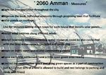
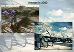
In our opinion, we believe that Amman in 2060 would be completely transformed, from a polluted, inefficient, highly dense and congested city, into a contemporary city, capable of withstanding climate challenges that would arise. We see Amman in 2060, as a city with improved local, individual economy, a higher level of education and awareness, and a great improvement in social practices. We believe that Amman will have already implemented clean and renewable energy systems, and replaced cars running on fuel with hybrid or vehicles. We see Amman as a city with a well organized transportation system, and greener areas, where the ratio between the green-blue designations within the newly constructed settlements consists of more green spaces per each land plot.
One project that we believe has a priority over others is improving public transportation, which implies creating central bus and train stations, as a light rail train system would finally be introduced within the city. This also implies replacing all current buses, which produce high rates of CO2, with new, modern larger buses that rely on a lighter form of fuel. This also means that the new transportation system would provide its users with easy access to stops, realistic charge rates, safety and comfort. This project would create a large opportunity to create pedestrian friendly zones, as well as strictly pedestrian zones within the more dense areas of the city, such as Downtown Amman, and parts of the eastern Amman quarters, which would also create room for green open space expansion, and create another level of interaction between the residential and street levels, as well as improve the various collective social practices of single communities. This will require parking space management and designation all throughout the city, and imposing strict traffic laws for drivers who park in illegal spots. A few other projects could be implemented, such as installing wind turbines in areas outside the urban envelope, installing solar panels on rooftops, and within the new settlements, local organic farming could be introduced, which would improve the local economy as well as promote local production. For filtering rainwater, filters could be installed in apartment buildings, in order to facilitate the utilization of rainwater for other uses. For green spaces, drip irrigation could replace the current irrigation system, and low water consuming landscapes could replace the current plants within parks and private gardens, so as to decrease water consumption.
What can be generalized from this case study?
Are there any important theoretical insights?
After considering the Amman case study, one should consider carefully planned scenarios regarding renewable energy utilization in Amman, as well as reconsider the individual priority in constructing more concrete structures, rather than focusing on conserving the green areas and expanding them. One major concern arises; the social awareness, as the city of Amman is known as the city that buried its river, and we must consider insurances that such decisions wouldn’t be repeated when designing and planning for future projects.
Which research questions does it generate?
- How does a city with the solar energy potential like Amman, make no benefit from such resource?
- Why hasn’t the wind energy been utilized?
- What are the major problems people have in a dry land?
- How is the green space distribution along the city is being managed?
- How can Amman reconstruct the Seil River if a highway, while attempting to maintain the least damage possible to surrounding heritage structures, covers it?
- How can Amman ensure that upon reconstructing the buried river, it wouldn’t cause floods and further damage to surrounding structures?
Short statement plus background notes
Considering the future climate change challenges in Amman, one could sum up the entire situation with the following statements:
- Amman is bound to face many difficulties, upon which are climate change dangers, as well as economic downfall and a major degradation in its political, social, and urban fabric.
- Upon embarking on any future developments, the citizens of Amman must gain awareness on the current challenges and future threats, as this will be the ultimate insurance of the sustainability of any future development.
- The city of Amman has much potential in dealing and utilizing clean, environmental planning resources, as it already uses local building materials for all building construction projects, which would make it easier to readapt single structures to environmental standards.
- Finally, Amman is a city of colored origins, which is highly reflected in it’s modern heritage structures, therefore the local Ammani Heritage should be well protected, in order to prevent the loss of local identity, as well as preserve it’s recent history for the future generations, as Amman and Jordan in particular, have always been on the front row and central position between all Arabic conflicts, uprisings, development, and downfall.
Presentation Slides
-
 Slide One
 -
 Slide Two
 -
 Slide Three


![[1]](http://upload.wikimedia.org/wikipedia/commons/2/25/Amman_Roman_theatre.jpg)
![[2]](http://jordanamman.net/images/amman/Amman-The-Citadel.jpg)
![[3]](http://www.geographylists.com/jordan_amman_citadel_ruins.jpg)
![[4]](http://a2.ec-images.myspacecdn.com/images02/114/364e466b7bf549cdac9bdd8e43d60d43/l.jpg)
![[5]](http://www.jordanjubilee.com/images/outdoors/xwildjordan_coffeeshop.jpg)
![[6]](http://thelevantpost.com/wp-content/uploads/2012/06/rainbow-street1.jpg)
![[7]](http://www.yourmiddleeast.com/media/news/images/2012/photo_1337190689025-1-0.jpg)
![[8]](http://static.flickr.com/92/219700633_01d126744f_o.jpg)
![[9]](http://4.bp.blogspot.com/_By3kCN3q21w/TRD5hv2msoI/AAAAAAAAAIw/MngfWg9jwx8/s1600/DSC01338.JPG)
![[10]](http://wanderlustmuslimah.files.wordpress.com/2012/02/weibdeh.jpg)
![[11]](http://cache.virtualtourist.com/4/6318356-Al_Hashemi_St_Downtown_Amman_Dec_2010_Amman.jpg)
![[12]](http://www.sit.edu/Images/ssa_images/phot_joi-SIT-Jordan-Center-from-roof.jpg)
![[13]](http://www.jordanienonline.de/img/pho/culture/shmeisani4_culturestreet.jpg)
![[14]](http://www.360east.com/wp-content/digital-city1.jpg)
![[15]](http://3.bp.blogspot.com/_RUVV1mvn6wk/R0_qOmaPI1I/AAAAAAAAAY0/RlTGrSIVIC0/s1600-R/Abdali.jpg)
![[16]](http://farm1.static.flickr.com/149/399918151_142935ef0f_o.jpg)
![[17]](http://www.architecturalpapers.ch/images/articles/69_6_w1000h600.jpg)
![[23]](http://www.khaberni.com/assets/news_gallery/90431_2_1357632209.jpg)
![[24]](http://www.khaberni.com/assets/news_gallery/90431_1_1357632380.JPG)
![[26]](https://fbcdn-sphotos-b-a.akamaihd.net/hphotos-ak-snc7/312334_396346723780809_624094729_n.jpg)
![[27]](https://fbcdn-sphotos-f-a.akamaihd.net/hphotos-ak-snc7/299685_317252465053788_1468877856_n.jpg)
![[28]](https://fbcdn-sphotos-d-a.akamaihd.net/hphotos-ak-ash3/734093_143774202445013_807430646_n.jpg)
Image.47 Nadim Karam & Atelier Hapsitus, The dialogue of the Hills, Location: Amman [29]
Image.48 Mohammad Mango, Graduation Project 2012, German Jordanian University, Location: Amman [30]
Image Gallery
-
your image text
-
your image text
-
your image text
-
your image text
-
your image text
-
your image text
-
your image text
-
your image text
References
Literature
Abu-Dayyeh, N (2004a): ‘Persistent vision: plans for a modern Arab capital, Amman, 1955-2002’, Planning Perspectives, 19, 79-110
Al-Asad, M (2004a): ‘Public transportation’, Jordan Times, 27 May 2005
Amman Municipality (1987): Greater Amman Comprehensive Development Plan 1985-2005, Amman. Jordan
Amman Municipality (2007): Metropolitan Growth Plan 1985-2005, Amman. Jordan
Razzaz, O M (1996): ‘Land conflicts, property rights and urbanization east of Amman’.
Rosenberg et al (2008) Water International. “Intermittent water supplies: challenges and opportunities for residential water users in Jordan.”
“Green City” Approach from Freiburg, Germany to Amman, Jordan. (11- 15 September). A brief on Amman Institute / Greater Amman Municipality Delegation To Freiburg, Germany
FOOD SECURITY AND CLIMATE CHANGE IN DRY AREAS. Presentation by The National Center for Agricultural Research and Extension (NCARE), the Ministry of Agriculture of Jordan and The International Center for Agricultural Research in the Dry Areas (ICARDA)
Ammar Gharaybeh. City Manager, Greater Amman Municipality. May 2009. Innovative Climate Change Initiatives in Amman, Jordan. Cities Climate Change and Finance & Carbon Expo. Barcelona, Spain.
The Evolving Arab City: Tradition, Modernity and Urban Development (Planning History and Environment). Edited by Yasser Elsheshtawy. 2011.
Robert B. Potter, Khadija Darmame, Nasim Barham, Stephen Nortcliff. 2007. An Introduction to the Urban Geography of Amman, Jordan.
Omar Maani, Mayor of Amman. 2007. High Rise Towers: An Integral Part of Amman’s Urban Landscape.
Greater Amman Municipality. 2007. Amman Master Plan PMU. Interim growth strategy. High density mixed use development manual.
Web
http://jordantimes.com/hurricane-wadha-becomes-comedy-fodder-on-social-media
http://www.gaisma.com/en/location/amman.html
http://www.venture-mag.com/index.php/opinion/postscript/item/169-amman-a-tale-of-one-city.html
http://www.eco-web.com/reg/04441.html
http://ascelibrary.org/doi/abs/10.1061/%28ASCE%29WR.1943-5452.0000172
http://dapa.ciat.cgiar.org/climate-change-in-dry-areas-the-amman-declaration/
http://ascelibrary.org/doi/abs/10.1061/%28ASCE%29WR.1943-5452.0000172
http://ammanvoice.blogspot.com/2007/11/more-abdali-high-rise-buildings-more.html
http://en.wikipedia.org/wiki/Semi-arid_climate
http://www.ammancity.gov.jo/en/gam/index.asp
http://www.vista.sahafi.jo/art.php?id=5c192f82b0e48f7cf98ce818d14c76839c27d4cb
http://www.undp-jordan.org/index.php?page_type=projects&cat=3&page_id=387
http://www.weatheronline.co.uk/reports/climate/Jordan.htm
http://www.artterritories.net/designingcivicencounter/?page_id=78
http://www.ammancity100.jo/en/content/story-amman/1930s
Image gallery
Robert B. Potter, Khadija Darmame, Nasim Barham, Stephen Nortcliff. 2007. An Introduction to the Urban Geography of Amman, Jordan.
Omar Maani, Mayor of Amman. 2007. High Rise Towers: An Integral Part of Amman’s Urban Landscape.
Amman Municipality (2007): Metropolitan Growth Plan 1985-2005, Amman. Jordan
http://3.bp.blogspot.com/_RUVV1mvn6wk/R0_qOmaPI1I/AAAAAAAAAY0/RlTGrSIVIC0/s1600-R/Abdali.jpg
http://www.gaisma.com/en/location/amman.html
http://en.wikipedia.org/wiki/Amman
http://wanderlustmuslimah.files.wordpress.com/2012/02/weibdeh.jpg
http://cache.virtualtourist.com/4/6318356-Al_Hashemi_St_Downtown_Amman_Dec_2010_Amman.jpg
http://4.bp.blogspot.com/_By3kCN3q21w/TRD5hv2msoI/AAAAAAAAAIw/MngfWg9jwx8/s1600/DSC01338.JPG
http://www.jordanienonline.de/img/pho/culture/shmeisani4_culturestreet.jpg
http://www.sit.edu/Images/ssa_images/phot_joi-SIT-Jordan-Center-from-roof.jpg
http://farm1.static.flickr.com/149/399918151_142935ef0f_o.jpg
http://a2.ec-images.myspacecdn.com/images02/114/364e466b7bf549cdac9bdd8e43d60d43/l.jpg
http://www.geographylists.com/jordan_amman_citadel_ruins.jpg
http://jordanamman.net/images/amman/Amman-The-Citadel.jpg
http://upload.wikimedia.org/wikipedia/commons/2/25/Amman_Roman_theatre.jpg
http://www.yourmiddleeast.com/media/news/images/2012/photo_1337190689025-1-0.jpg
http://thelevantpost.com/wp-content/uploads/2012/06/rainbow-street1.jpg
http://static.flickr.com/92/219700633_01d126744f_o.jpg
http://www.jordanjubilee.com/images/outdoors/xwildjordan_coffeeshop.jpg
https://fbcdn-sphotos-b-a.akamaihd.net/hphotos-ak-snc7/312334_396346723780809_624094729_n.jpg
https://fbcdn-sphotos-f-a.akamaihd.net/hphotos-ak-snc7/299685_317252465053788_1468877856_n.jpg
https://fbcdn-sphotos-d-a.akamaihd.net/hphotos-ak-ash3/734093_143774202445013_807430646_n.jpg
http://www.atlastours.net/jordan/amman_panorama.jpg
http://www.360east.com/wp-content/digital-city1.jpg
https://www.healthbase.com/hb/images/countries/Jordan/jordan_downtown_amman.jpg
http://www.khaberni.com/more.php?newsid=90431&catid=1
http://4.bp.blogspot.com/_By3kCN3q21w/TRD5hv2msoI/AAAAAAAAAIw/MngfWg9jwx8/s1600/DSC01338.JPG
http://www.architecturalpapers.ch/images/articles/69_6_w1000h600.jpg
http://cdn.architecturelab.net/wp-content/uploads/2011/07/Dialogue-of-the-Hills-01.jpg?cda6c1