File:Gaias Sar Compostela.jpg
Jump to navigation
Jump to search

Size of this preview: 419 × 599 pixels. Other resolution: 688 × 984 pixels.
Original file (688 × 984 pixels, file size: 599 KB, MIME type: image/jpeg)
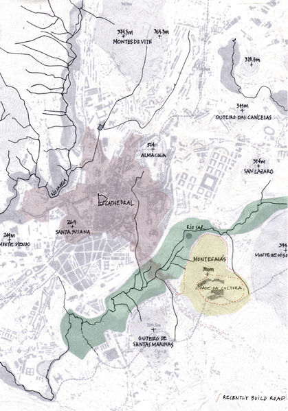
Map showing rivers and hills in relation to the historic city center of Santiago de Compostela. The drawing marks in yellow tone the Monte Gaiás and in blue tone the river side land. Dotted in red are indicated a newly built road that has cut the traditional water flow from the shrub land to pastures and the Cidade da Cultura building site.
File history
Click on a date/time to view the file as it appeared at that time.
| Date/Time | Thumbnail | Dimensions | User | Comment | |
|---|---|---|---|---|---|
| current | 12:16, 29 November 2013 |  | 688 × 984 (599 KB) | Aurora (talk | contribs) | Map showing rivers and hills in relation to the historic city center of Santiago de Compostela. The drawing marks in yellow tone the Monte Gaiás and in blue tone the river side land. Dotted in red are indicated a newly built road that has cut the traditi |
You cannot overwrite this file.
File usage
The following 2 pages use this file: