Uploads by Oana Baloi
Jump to navigation
Jump to search
This special page shows all uploaded files.
| Date | Name | Thumbnail | Size | Description | Versions |
|---|---|---|---|---|---|
| 10:50, 24 January 2012 | Communication2 4.jpg (file) |  |
136 KB | 1 | |
| 10:01, 24 January 2012 | Communication2 3.jpg (file) |  |
146 KB | 1 | |
| 08:38, 24 January 2012 | Communication1 2.jpg (file) |  |
135 KB | 1 | |
| 23:58, 23 January 2012 | Communication2 scene.jpg (file) |  |
160 KB | 1 | |
| 22:58, 23 January 2012 | Communication1 tent.jpg (file) |  |
149 KB | 1 | |
| 20:29, 23 January 2012 | Appearance2.jpg (file) |  |
132 KB | 1 | |
| 20:14, 23 January 2012 | Appearance1.jpg (file) |  |
141 KB | 1 | |
| 20:04, 23 January 2012 | Function w.jpg (file) |  |
147 KB | 1 | |
| 17:48, 23 January 2012 | Tower blocks.jpg (file) |  |
138 KB | 1 | |
| 16:11, 22 January 2012 | Containers correct.jpg (file) |  |
148 KB | 1 | |
| 14:38, 22 January 2012 | Containers.jpg (file) |  |
147 KB | 1 | |
| 14:18, 22 January 2012 | Imag water.jpg (file) |  |
140 KB | 1 | |
| 21:03, 19 January 2012 | DSC1005.JPG (file) |  |
1.64 MB | 1 | |
| 21:00, 19 January 2012 | Wageningen 13 floor.jpg (file) |  |
229 KB | 2 | |
| 17:01, 19 January 2012 | Water-system.jpg (file) |  |
108 KB | 1 | |
| 16:59, 19 January 2012 | Traffic.jpg (file) |  |
146 KB | 1 | |
| 16:58, 19 January 2012 | Vegetation-2.jpg (file) |  |
148 KB | 1 | |
| 16:56, 19 January 2012 | Vegetation.jpg (file) |  |
148 KB | 2 | |
| 16:54, 19 January 2012 | Build-fund-m.jpg (file) |  |
97 KB | 1 | |
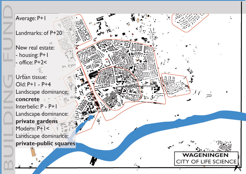
| 16:26, 19 January 2012 | Built fund.jpg (file) |  |
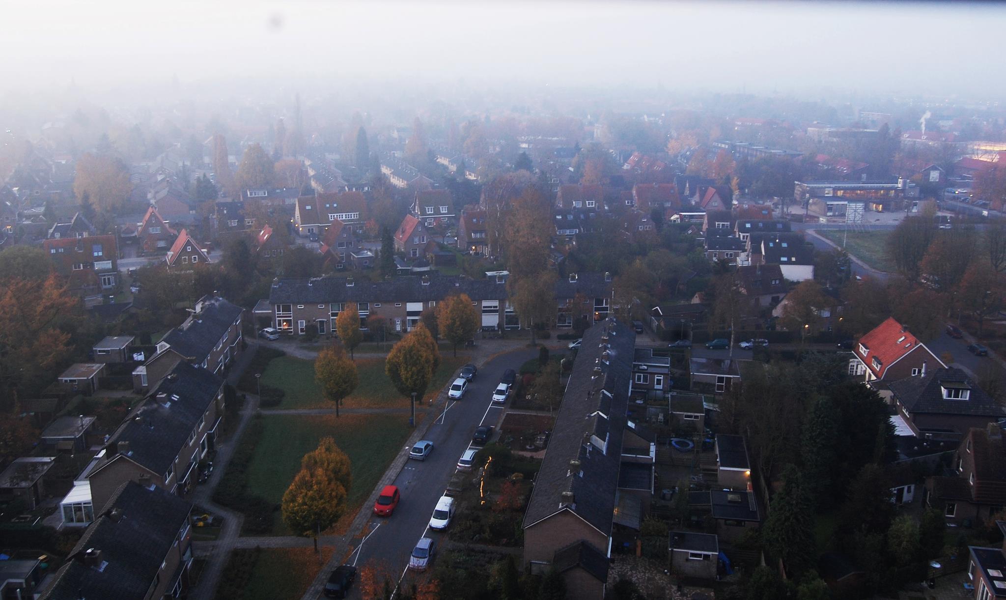
143 KB | The city centre has a urban layer dominated by P+3 heights, with public spaces covered mostly by concrete. Public space consume is realized through a shopping street, cafes and bars, and an open market two times per week. In the areas surrounding the city | 1 |
| 14:55, 13 December 2011 | Presentation-OK.jpg (file) |  |
149 KB | 1 | |
| 14:52, 13 December 2011 | Topography-OK.jpg (file) |  |
144 KB | 1 | |
| 14:48, 13 December 2011 | Geomorphology-OK.jpg (file) |  |
142 KB | 1 | |
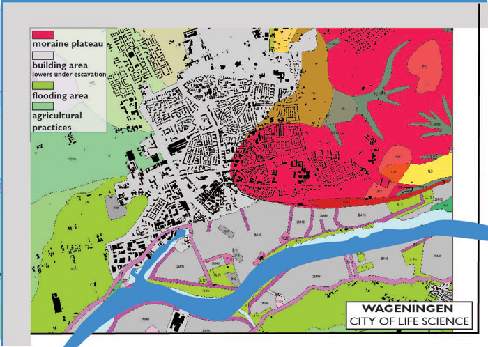
| 14:39, 13 December 2011 | Geomorphology-wageningen-150K.jpg (file) |  |
151 KB | The city is continuously expanding leading to a decreasing number of permeable surfaces. From West to East, the soil layers are less fertile, therefore less used for agriculture and urban agriculture practices. Within the city the permeability reached 0 i | 1 |
| 14:37, 13 December 2011 | Topography-wageningen 150K.jpg (file) |  |
148 KB | The city is continuously expanding leading to a decreasing number of permeable surfaces. From West to East, the soil layers are less fertile, therefore less used for agriculture and urban agriculture practices. Within the city the permeability reached 0 i | 1 |
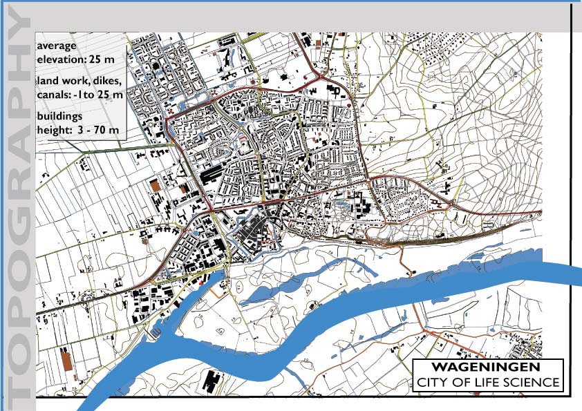
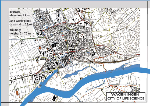
| 04:35, 13 December 2011 | Topography-wageningen.jpg (file) |  |
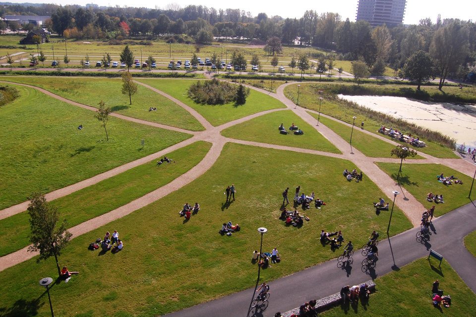
133 KB | The topography of the area represents the specific flat land of The Netherlands. The average elevation is 25 meters above sea level, with the minimum represented by the Rhine River level and the maximum by the winder dyke. In the surroundings, to the west | 2 |
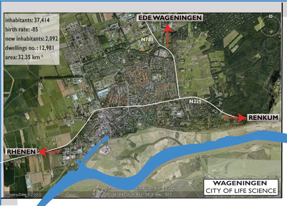
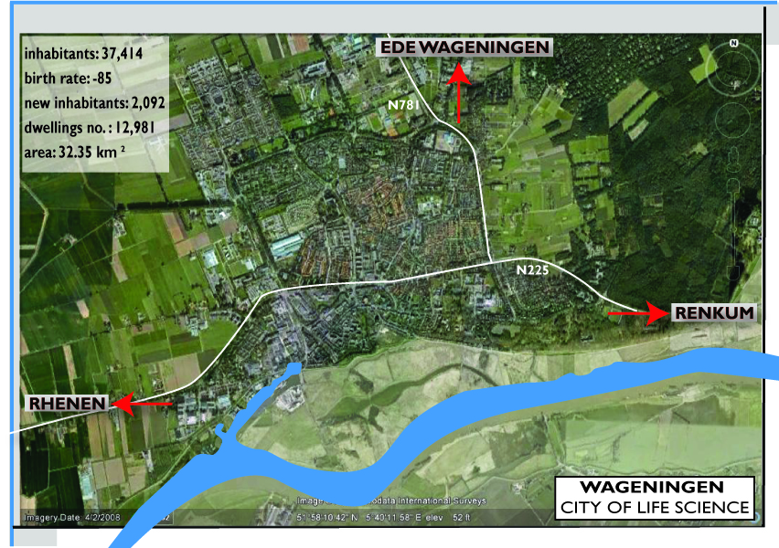
| 03:09, 13 December 2011 | Presentation Wageningen - map.jpg (file) |  |
1.63 MB | Reverted to version as of 02:59, 13 December 2011 | 3 |
| 17:59, 14 November 2011 | Katia-wageningen.jpg (file) |  |
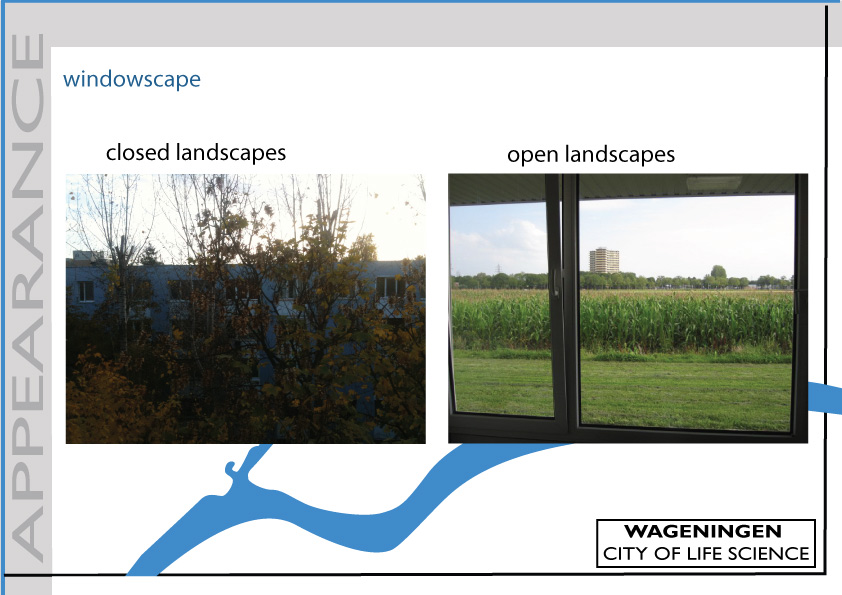
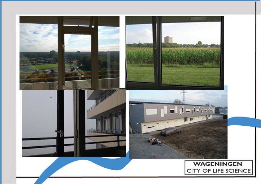
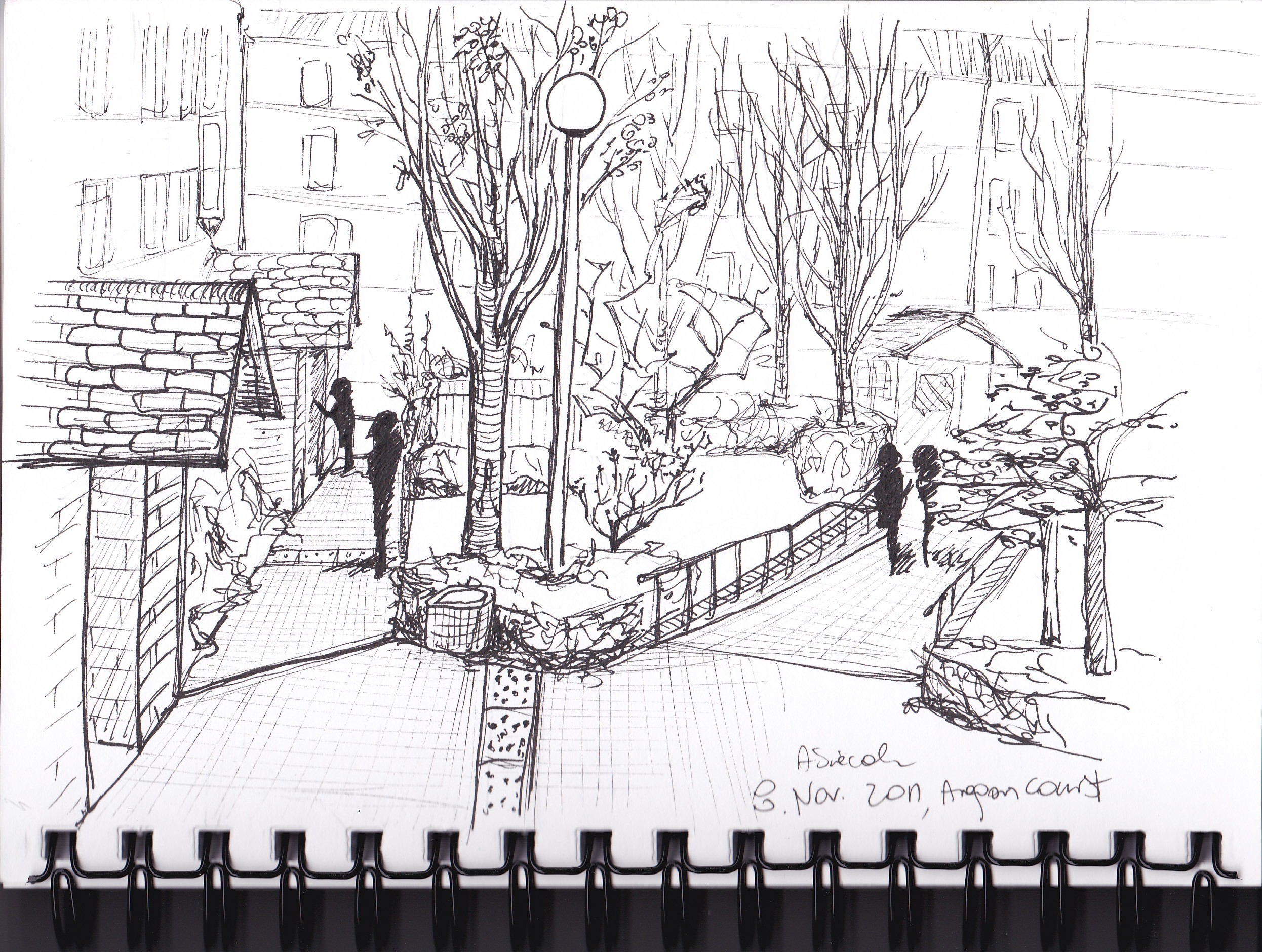
294 KB | windowscape | 1 |
| 11:18, 14 November 2011 | Wageningen proximity space.jpg (file) |  |
121 KB | Windowscape | 1 |
| 11:17, 14 November 2011 | Wageningen infrastructure 2.jpg (file) |  |
171 KB | Windowscape | 1 |
| 11:17, 14 November 2011 | Wageningen infrastructure.jpg (file) |  |
56 KB | Windowscape | 1 |
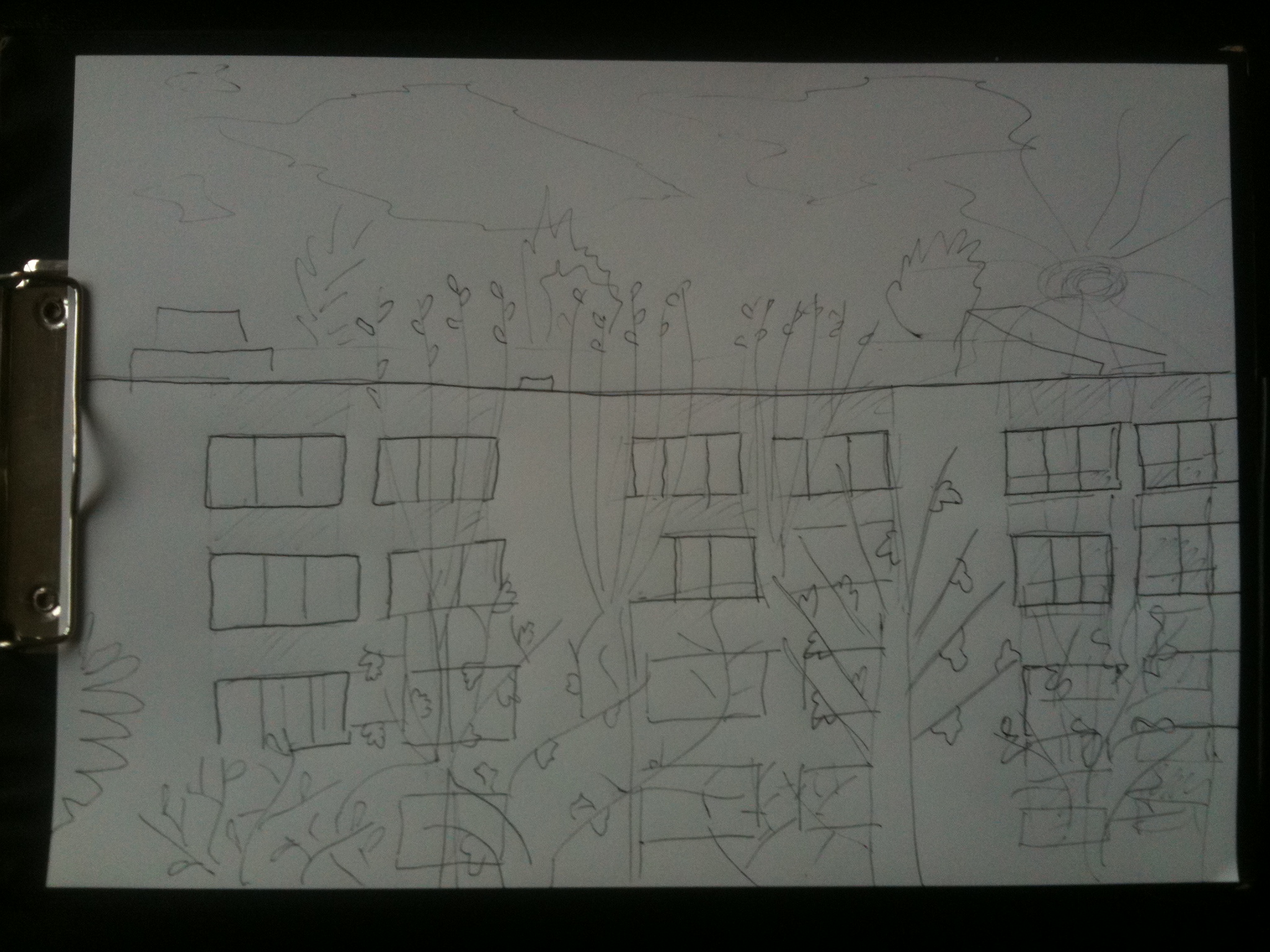
| 11:07, 14 November 2011 | Schita 4 wageningen Ioana.jpg (file) |  |
963 KB | Windowscape | 1 |
| 11:06, 14 November 2011 | Schita 3 london Anna.jpg (file) |  |
1.46 MB | Windowscape | 1 |
| 11:05, 14 November 2011 | Schita 2 buc Octav.jpg (file) |  |
2.27 MB | Windowscape | 1 |
| 11:04, 14 November 2011 | Schita 1 buc Mihai Toader.JPG (file) |  |
956 KB | Windowscape | 1 |
| 12:33, 7 November 2011 | Windowscape.JPG (file) |  |
468 KB | 2 |