Planting Design 2013 Working Group 30 - Case Study B
---> back to group page working group 30
Estuary of Miño River
| Name | Estuary of Miño river | |||||||||||
| Location | Galicia | |||||||||||
| Country | Spain | |||||||||||
| Authors | Natalia Vicente | |||||||||||

| ||||||||||||
| {{#widget:GoogleMaps | width=300 | height=200 | lat=41.872469 | lng=-8.866678 | zoom=8 | centermarker=yes | maptypecontrol=yes | overviewmapcontrol=yes | largemapcontrol=yes | scalecontrol=yes
}} | ||
Rationale: Why is this case interesting?
This area framed by two countries Spain and Portugal is where River Miño reaches the Atlantic. Delta of Miño is valuable wetland that brings refuge a huge amount of migratory water birds in its trip from north Europe to Africa in Autumn and its back-trip in Spring. By the other hand, its nice beaches and its trees full riversides provide open air spaces for the nearby communities such as A Guardia, Caminha. I will focus in a piece of that area, which people use more intensively. My goal is analyzing how to preserve a very important ecosystem allowing ,at the same time, this place to be a leisure space. I grew up in A Guarda. We do many sports in the river and it is an space exchange in between people from two countries.
Author's perspective
As urban planner i consider this landscape could be a good example of how to develop protected nature areas that always took part in life of the communities, I think is important to study what kind of interventions ensures their protection and conservation.
Landscape and/or urban context of your case
- Biogeography, cultural features, overall character, history and dynamics
- Illustration: Map; sketches; short descriptive analyses
Analytical drawings
Please add four analytical sketches/drawings (or montages/schemes) of your case and take the following aspects into account:
- natural dynamic versus cultural framework - in how far do these two forces come together in your case?
- dynamic through the year (you may imagine how the site looks in spring and summer, maybe you also remember it)
- highlight potentials and problems
- Analytical Drawings
-
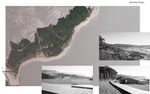
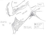 analytical drawing 1
 -
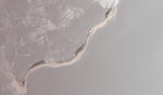
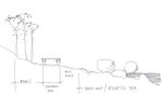 analytical drawing 2
 -
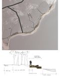
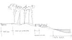 analytical drawing 3
 -
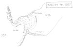 analytical drawing 4


Projective drawings
- Please add four projective sketches/drawings (or montages/schemes) for your case and take the following aspects into account:
- How would you like this case to change in the near future? (in 1-2 years)
- And how could it look like in 10-15 years?
- Projective Drawings
-
 projective drawing 1
 -
 projective drawing 2
 -
 projective drawing 3
 -
projective drawing 4


Summary and conclusion
Stabilizing dunes involves multiple actions. Planting vegetation reduces the impact of wind and water. Fences catch sand and other material. Footpaths protect dunes from damage from foot traffic.
Image Gallery
You may add a series of images/photos in addition to the sketches/drawings
- Image Gallery
-
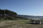 image 1
 -
image 2
-
image 3
-
image 4

References
* Please make sure that you give proper references of all external resources used.
* Do not use images of which you do not hold the copyright.
* Please add internet links to other resources if necessary.
About categories: You can add more categories with this tag: "", add your categories