Green Infrastructure 2014 Working Group K - Case Study 1
---> back to group page working group K
Salman Shahr( Motelghoo), Mazandaran, Iran
| Name | Salman Shahr(Motelghoo) | |
| Country | Iran | |
| City | Salman Shahr(Motelghoo) | |
| Authors | Kimia Kiani | |
| ||
|
| ||
Rationale: Why is this case interesting?
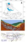
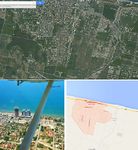
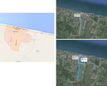
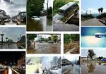
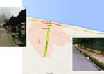
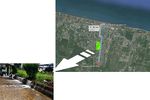
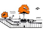
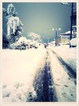
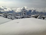
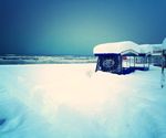
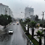
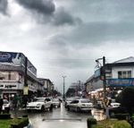
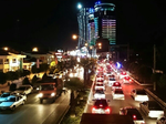
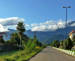
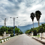
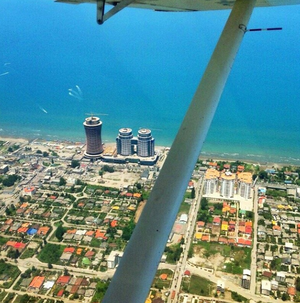
Salman Shahr(Motelghoo) is a small city where is located in the north of Iran, between Alborz mountains and Caspian sea. It is a beautiful city with a fabulous scene from mountains to sea although uploaded pictures illustrate only the problems in urban structures in the city.Also the city is chosen by local and foreign tourists as a destination for travelling. Because of its geographical location, the city has a humid and wet weather. So,I have chosen this area as my case study due to its potential for becoming an element for green infrastructure method.As the picture indicates, the city and its urban structure has not been designed for rain storms or heavy snow.For instance, pathways, roads and pavements should be redesigned in the green infrastructure method.
Author's perspective
I studied Master of Architecture and Bachelor of Architecture engineering in Iran. I have several years work experiences in designing and researching. Currently I am working in a research office voluntarily. I have done some projects about energy saving in architecture and I am going to continue my studying in a field of sustainability development, specially in design and planning. I have known Motelghoo since childhood. I and my family have been vacationing in this city most of the time.
New constructions in this city have been bringing considerable population for travelling and living to this but the structure of city, roads and pavements has remained unchanging.
Landscape and/or urban context of your case
- Biogeography, cultural features, overall character, history and dynamics
Introduction: MAZANDARAN is a Caspian province in the north of Iran, located on the southern coast of the Caspian sea, it is bordered clockwise by the provinces of Golestan to the east, Semnan to the south east, Tehran to the south, Qazvin south west and Gilan by the west. Mazandaran is one of the most densely populated provinces in Iran and has diverse natural resources, especially large reservoirs of oil and natural gas. The province covers an area of 23756 Km, equal to 1.46 percent of the country and has a population of 3,000,000 equal to 4 percent of the population of the country. The province also consists of 52 cities, 3600 villages and 45 sections. There are 18 counties in the province including Sari, Behshahr, Babol, Amol, Qaemshahr, Ramsar, Tonekabon, Chaloos, Noshahr, Noor, Mahmoodabad, Savadkooh, Babolsar, Jooybar, Neka, Behshahr, Galoogah, Fereidoonkenar and Abbas Abad
The province's five largest counties are Sari, Behshahr, Babol, Amol and Qaemshahr. Founded as province in 1937, Mazandaran was declared the second modern province after neighboring Gilan. The diverse nature of the province features plains, prairies, forests and jungles stretching from the sandy beaches of the Caspian Sea to the rugged and snowcapped Elburz sierra, including Mount Damavand, the highest peak and volcano in the Middle East and Western Asia, which at the narrowest point (Nowshahr County) narrows to 5 miles. Mazandaran is a major producer of farmed fish and aquaculture provides an important economic addition to traditional dominance of agriculture. Another important contributor to the economy is the tourism industry, as people from all of Iran enjoy visiting the area. Mazandaran is also a fast-growing centre for biotechnology and civil engineering. Human habitation in the area dates back at least 75,000 years. Recent excavations in Goher Tippe provide proof that the area has been urbanized for more than 5,000 years, and the area is considered one of the most important historical sites of Iran. It has played an important role in cultural and urban development of the region. Indigenous peoples of the region include the ethnic Mazanderanis speaking an Iranian language which most resembles Gilaki and Sangiseri Mazandaran province central coordination locates in 36.5656°N 53.0588°E. The population of the province has been steadily growing during the last 50 years. The population is of Caucasian Iranian stock with a minority of non-native neighboring Turkic tribes (esp. the Turkomen), a sizable Armenian minority and Russian immigrants, mainly from former Soviet republics of Georgia (country), Turkmenistan and Azerbaijan. The Mazandaran Sea provides a beautiful coastline in north of Sari; northeast of the city is Neka. Qa'emshahr (Formerly known as Shahi) is to its southwest, Juybar is to its northwest, and Kiyasar, Damghan, and Semnan are in the south part of Sari. Sari is the provincial capital of Mazandaran, located in the north of Iran, between the northern slopes of the Alborz Mountains and southern coast of Caspian (Mazandaran) Sea. Its population is estimated to be 261,293, as of 2006. It has a land area of 5,089 square kilometers. Sari is one of the entertainment and sports centers of Iran.
Geography and Climate: Mazandaran province is geographically divided into two parts: the coastal plains, and the mountainous areas. The Alborz Mountain Range surrounds the coastal strip and plains of the Caspian Sea like a huge barrier. There is often snowfall during most of the seasons in the Alborz regions, which run parallel to the Caspian Sea's southern coast, dividing the province into many isolated valleys. The province enjoys a moderate, subtropical climate with an average temperature of 25 °C in summer and about 8 °C in winter. Although snow may fall heavily in the mountains in winter, it rarely falls around sea lines. There is often snowfall during most of the seasons in the Alborz regions, which run parallel to the Caspian Sea's southern coast, dividing the province into many isolated valleys. The province enjoys a moderate, subtropical climate with an average temperature of 25 °C in summer and about 8 °C in winter. Although snow may fall heavily in the mountains in winter, it rarely falls around sea lines.
About Salman Shahr (Motelghoo):
Salman Shahr (formerly, Motel Qū (Persian: متل قو/ سلمان شهر) and Saqikelayeh (Persian: ساقيكِلايِه) is a city in and capital of Salman Shahr, Abbasabad District, Mazandaran Province, Iran. At the 2006 census, its population was 9,592, in 2,605 families. Salman Shahr is located 30 kilometres (19 mi) east of Tonekabon en route to the city of Chaloos.
Salman Shar is the new name for this city after the Islamic revolution. In the past, the city was called Saghi Kelaye and was also named after its famous hotel Motel Ghoo or Motel Qu (Swan Motel). Salman Shar city is a new settlement that was established in 1961 which was incorporated as a municipality in 1962.
In the late 2000s the major development and construction projects called "Ghoo" or "Diamond of the Middle East" were kicked off. The core of this project is built in the same place as where motel Ghoo was located.
History Pre Islamic History: The region is known to have been populated from early antiquity, and Mazandaran has changed hands among various dynasties from early in its history. There are several fortresses remaining from Parthian and Sassanid times, and many older cemeteries scattered throughout the province. During this era, Mazandaran was part of Hyrcania Province which was one of important provinces. With the advent of the Sassanid dynasty, the King of Mazandaran (Tabaristan andPadashkhwargar) was Gushnasp, whose ancestors had reigned in the area (under the Parthian empire) since the time of Alexandar. In 529-536 Mazandarn was ruled by Sassanid prince Kawus son of Kawadh. Anushirawan, the Sassanid king, put in his place Zarmihr, who claimed his ancestry from the legendary blacksmith Kaveh. This dynasty ruled till 645 A.D., when Gil Gilanshah (a descendant of the Sassanid king Jamasp and a son of Piruz) joined Mazandaran to Gilan. These families had descendants who ruled during the Islamic period.
Mazandaran Today,
General:
The culture of Mazandaran is closely related to that of neighboring Gilan (or Guilan) and similarities between the two are abundant. The cuisine of the province is very rich in seafood due to its location by the Caspian Sea, and rice is present in virtually every meal. Indeed, the rest of Iran was introduced to rice through Gilan and Mazandaran. Before the 1800s, Persians, Kurds, and other Iranian ethnic groups used bread rather than rice as an accompaniment to their meals, though bread remains a prominent staple among them. While bread remains very popular among those groups, in Gilan and Mazandaran, rice remains the choice staple of the indigenous inhabitants.
Mazanderani or Tabarian is a Northwestern Iranian language. Various Mazandarani's dialects exist which are spoken in Mazandaran province and the neighbour province Golestan such as Mazanderani, and Gorgani. Also, Qadikolahi (Ghadikolahi) and Palani may be dialects. Mazandarani mostly resemble Gilaki. Today, Mazandaranis also use Persian (Western Persian). The educated can communicate and read Persian well.
A dialect of Azeri is spoken in the town of Galoogah
In Persian epic, Shahnameh, Mazandaran is mentioned in two different sections. First time implicitly, when Fereydun sets its capital in a city called Tamishe near Amol:
Under the title, and when Manuchehr is returning to Fereydun's capital, Tamisheh in Mazandaran (known as Tabarestan), after victory over Salm and Tur:
In the second section, a region called Mazandaran is mentioned at Kai Kavoos era frequently, it is an area which is mostly inhabited by Div (demons). The legendary Iranian Shah Kaykavoos as well as the Iranian hero Rostam each take turn to go to Mazandaran in order to battle the demons.
A famous verse from Shahnameh is when Zal tells Kai Kavoos:
"I heard troubling news that the king is planning to go to Mazandaran"
However, this Mazandaran is not considered identical to the modern province of Mazandaran, and is instead a land to the west of Iran. The current province was simply considered a part of Tabaristan; the name Mazandaran is a later development, perhaps based upon local terminology.
Economy:
Having sea, jungle and tourism all together has made the province one of the 5 wealthiest in Iran in terms of GDP and net worth. The recent explored oil resources will make the status even better by attracting new investment in the field. Rice, grain, fruits, cotton, tea, tobacco, sugarcane, and silk are produced in the lowland strip along the Caspian shore. Oil wealth has stimulated industries in food processing, cement, textiles, cotton, and fishing (caviar).
Suitable environmental conditions, pleasant and moderate climate, beautiful natural landscapes, and proximity to Tehran, have led the province to be one of the main recreational and tourism areas of Iran.
Iran's Cultural Heritage Organization lists close to 630 sites of historical and cultural significance, hence a wealth of tourist attractions.
- Illustrations: maps; sketches; short descriptive analyses
- Illustrations
Analytical drawings
- Please use analytical drawing for visualising the conflicts/potentials of your site
- Analytical Drawings
- Your drawing.jpg
your drawing
- Your drawing.jpg
your drawing
Green Infrastructure benefits for this site
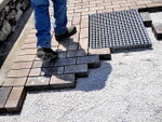
Using Permeable pavements,
Benefits for this site:
Reduces Storm water Runoff:
• Permeable pavement reduces surface runoff volumes and rates by allowing storm water to infiltrate underlying soils.
• By reducing runoff volumes and rates, permeable pavement can lower water treatment costs and reduce flooding and erosion.
Increases Groundwater Recharge:
• By allowing rainfall to infiltrate, permeable pavement can help increase groundwater recharge.
Reduces Energy Use:
• The use of permeable pavements also has the potential to reduce energy use by lowering surrounding air temperatures, which in turn reduces demand on cooling systems within buildings.
Improves Air Quality:
• Because permeable pavement captures rainfall onsite, communities can reduce the amount of water treatment needed, in turn reducing air pollution from power plants.
• By reducing the urban heat island effect, permeable pavement decreases ground level ozone formation, which directly impacts air quality.
Reduces Urban Heat Island:
• Permeable pavement absorbs less heat than conventional pavement, which helps to reduce the surrounding air temperature and decrease the amount of energy needed for cooling.
Using Green Roofs,
Benefits for this site:
Reduces Storm water Runoff:
• Green roofs can store significant amounts of water in their growing media. This water is eventually evaporated from the soil or transpired by the plants on the roof, thus reducing the runoff entering sewer systems and waterways, which can help alleviate the risk of combined sewer overflows (CSO).
Reduces Energy Use:
• Additional insulation provided by the growing media of a green roof can reduce a building’s energy consumption by providing superior insulation compared to conventional roofing materials.
• Evaporative cooling from water retained in the growing media reduces roof surface temperatures during hot days.
Reduces Urban Heat Island:
• The local evaporative cooling provided by green roofs can reduce elevated temperatures present in urban areas as a result of heat-absorbing surfaces such as streets and conventional roofs.
Improves Community Livability:
• Green roofs improve the local aesthetics of a community.
• Green roofs can increase recreational opportunities by providing outdoor areas for people to use and enjoy. They also have the potential to foster improved community interactions that help build social capital.
• Green roofs may also provide opportunities for urban agriculture.
Cultivates Public Education Opportunities:
• Green roofs and permeable pavements increase community interest in green infrastructure through their aesthetic appeal, which provides a great opportunity for public education.
• The installation of permeable pavement and green roofs can provide an opportunity to further educate the public about the benefits of green infrastructure in Iran. Using Green infrastructure method in this site provides an opportunity to develop community awareness and understanding around the importance of sustainable water resource management.
Potential for multifunctionality
- By using green infrastructure techniques such as green roofs, rain gardens, tree planting, and permeable pavement, they are managing storm water problems at a lower cost and realizing a wide range of other benefits from reduced air pollution, energy use, and urban heat island effect to improved wildlife habitat and aesthetics.
- Local water management and storm water control benefits.
- Green infrastructure in this site is a powerful tool for managing existing problems and preparing for the future and also readiness for supervenient events.
- Improving quality of life.
- raising awareness on the importance of integrating green infrastructure into its urban landscape, also this case study can be used as a sample for developing Green infrastructure methods in Iran.
Projective drawings
- How would you like this case to change in the near future? (in 1-2 years)
- you may add a short explanation here
- And how could it look like in 10-15 years?
- you may add a short explanation here
- Projective Drawings
Summary and conclusion
- The aim of GI practices in this site in Iran is due to delivering multiple ecological, economic and social benefits or services. In addition, to reducing polluted storm water runoff, GI practices can also positively impact on energy consumption, air quality, carbon reduction and sequestration, property prices, recreation and other elements of community health and vitality that have monetary or other social value. Moreover, green infrastructure practices in this site can be defined as managing storm waters effectively. For instance, almost all pavements and streams in this site should be redesigned in GI method and water harvesting would be used in this site as the redirection and productive use of rainwater by capturing and storing it onsite for irrigation, toilet flushing and other potential uses. Using Permeable pavements and Rain gardens are two samples that would be effective for this meaning.
Image Gallery
Please add further images/photos here
- Image Gallery
References
About categories: You can add more categories with this tag: "", add your categories
