Green Infrastructure 2014 Group I - Case Study 3
---> back to group page working group I
please add your title here
| Name | Alshati Neighborhood | |||||||||||
| Country | Saudi Arabia | |||||||||||
| City | Dammam City | |||||||||||
| Authors | Fayez Almasmoom | |||||||||||

| ||||||||||||
| {{#widget:GoogleMaps | width=300 | height=250 | lat= 26°28'1.67"N | lng= 50° 7'40.50"E | zoom=10 | centermarker=yes | maptypecontrol=yes | overviewmapcontrol=yes | largemapcontrol=yes | scalecontrol=yes
}} | ||
Rationale: Why is this case interesting?
Please explain in short why this site has green infrastructure potential and what makes it special (150 words approx)
Author's perspective
what is your professional/educational background and your relation to the site?
Landscape and/or urban context of your case
Ad Dammam, town lies in eastern Saudi Arabia, in Ash Sharqiyah (Al Hasa) Province, on the Persian Gulf. It is one of the nation's chief ports, serving as a major exporting point for petroleum and natural gas. King Faisal University (1975) is here. Ad Dammam was a small coastal community until the late 1930s, when it began to be developed as a port. Several large-scale residential and commercial building projects were undertaken here in the 1970s and early 1980s.
The port city is well connected by road, rail, and air with the rest of Saudi Arabia, as well as with its neighboring countries.
Apart from housing the main seat of the Easter Province administration, Dammam is a major residential and commercial center. An important section of King Faisal University is located here.
Dammam is about 400 km away from Riyadh. It is the capital of the Eastern region and a very important port. It was a separate small town but now it has become one big town, linking Al-Khobar and Al-Dhahran. Dammam is now a major commercial center.
Historians believe that Dammam was initially called DAMDAMA, which means the sound of drums that announce the beginning or the end of the hunting season. Near Dammam lies a very important center for refining petroleum. The population of Dammam is about one million.
Antiquities
Dammam retains the spirit of its past heritage, for which its local population is very proud. The Trading Port is reflective of a map of olden days. One well-maintained watch tower stands guard on King Saud Road as you pass from the City Center to Jubail highway. A typical conical structure, representing a glimpse of the past, is situated on the right corner of the bifurcating road leading to Saihat.
- Biogeography, cultural features, overall character, history and dynamics
- Illustrations: maps; sketches; short descriptive analyses
- Illustrations
-
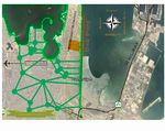
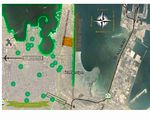 City Context
 -
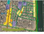
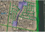
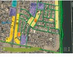 Green way & Vacant lands future uses
 -
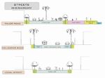
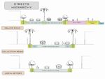 Streets Hierarchy


Analytical drawings
- Please use analytical drawing for visualising the conflicts/potentials of your site
- Analytical Drawings
-
Connectivity?!
-
 your drawing
 -
Streets Hierarchy Analysis

Green Infrastructure benefits for this site
Look again at the multiple benefits of green infrastructure - what could be achieved in your site and which are most relevant?
Potential for multifunctionality
Green infrastructure has typically multiple functions. What could be achieved for your site in this respect?
Projective drawings
- How would you like this case to change in the near future? (in 1-2 years)
- you may add a short explanation here
- And how could it look like in 10-15 years?
- you may add a short explanation here
- Projective Drawings
-
 projective drawing
 -
 projective drawing
 -
 Streets Hierarchy Vision


Summary and conclusion
- 100 words approx.
Image Gallery
Please add further images/photos here
- Image Gallery
-
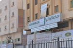
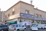 Commercial Center
 -
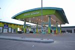 Gas Station
 -
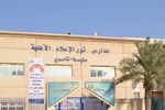 Intermediate and Secondary School
 -
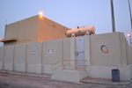 Electricity Generators
 -
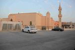 The Mosque
 -
 Dermatology Clinic
 -
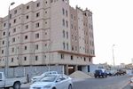 Apartments Building
 -
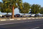 Waterfront


References
- please add your references here
1. http://www.the-saudi.net/saudi-arabia/dammam/Dammam%20City%20-%20Saudi%20Arabia.htm
About categories: You can add more categories with this tag: "", add your categories