File:Uso de suelo 200.jpg
Original file (4,488 × 2,067 pixels, file size: 1.21 MB, MIME type: image/jpeg)
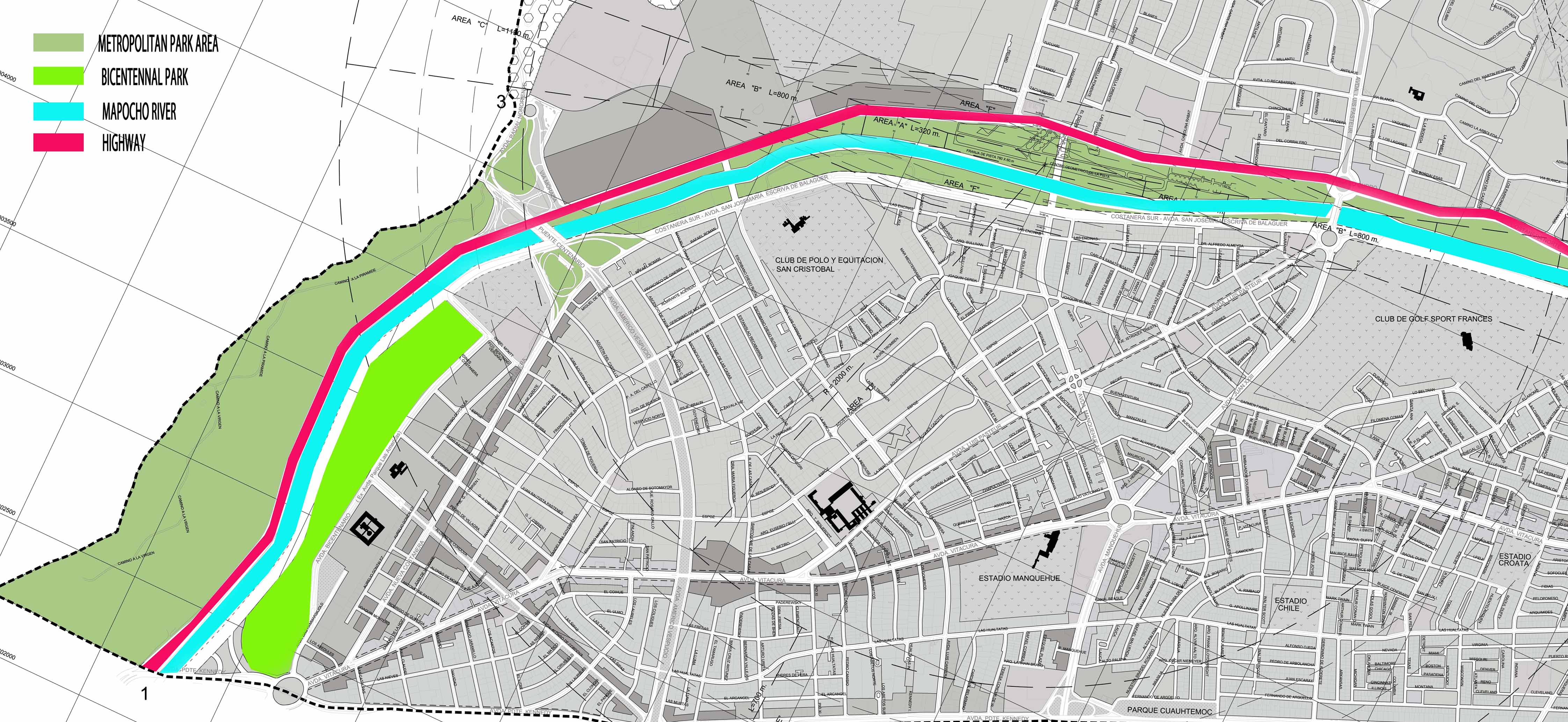
This picture shows the current zoning of the area, this park is part of a metropolitan system, which involves the whole city, this kind of zones, just can be used as green areas, but you can build 5% maximum of the land, provided it is building to satisfy the basic need of the city or complementary for the use of green area, however in several areas is a nonuse land. As you can appreciate here the most of the green zone is a remainder area between the river and the highway. that is one of the reason in my opinion, that makes more difficult an intervention.
File history
Click on a date/time to view the file as it appeared at that time.
| Date/Time | Thumbnail | Dimensions | User | Comment | |
|---|---|---|---|---|---|
| current | 23:14, 26 November 2013 | | 4,488 × 2,067 (1.21 MB) | Leslieiturra (talk | contribs) |
You cannot overwrite this file.
File usage
The following 2 pages use this file: