Green Infrastructure 2014 Group E - Case Study 3
---> back to group page working group E
Rehabilitation of the urban center "Coeur de ville" in Montreuil-sous-bois, France:
Potential of Green Infrastructures for social benefits in suburban areas.
| Name | Urban center "Coeur de ville" | |
| Country | France | |
| City | Montreuil-sous-bois | |
| Authors | Lola de Vathaire | |

| ||

| ||
|
| ||
Rationale: Why is this case interesting?
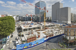
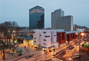
The rehabilitation of this large urban square surrounded by administrative buildings of the city of Montreuil in the periphery of Paris, should help improve social cohesion around the city center. In fact, Montreuil is a dormitory town, which had known an important development of low-cost residential areas to create accommodations very quickly for migrant workers from the French regions or from abroad during the twentieth century. In this kind of suburbs ran by communist majors, there were few economical and commercial activities. Urban planning were mostly answering questions regarding habitation and transportation, disregarding recreation and environmental protection. The good connections to Paris, the capital city caused a slowdown of social and cultural developments. The poor connections to other parts of Montreuil and to other suburbs impeded the increasing of property values.
In the past years, the destruction or renewing of buildings of the 50s-70s free some places in the city like on this quarter "coeur de ville" (heart of the city). Places with a lot of potential to create a local life for communities, improving quality of life and restoring some natural functions of nature.
Author's perspective
As a student of landscape architecture, working in Germany a land ahead in matter of sustainability and green infrastructure, I often though about the possibilities for this square and the waste of resources that anterior designs caused, as I was visiting my family in Montreuil.
After a new rehabilitation, two years ago, I was disappointed to see that important structures of the urban landscape were not integrated in the planning, wasting again a lot of potential to improve quality of life and landscape in this area.
I would like to use this exercise, to point out which methods and patterns contribute to urban heat island, greenhouse effect, etc and propose green infrastructure solutions in an integrative and adaptive design.
Landscape and/or urban context of your case
- Biogeography:Montreuil can be dissociated in two parts because of the geological formation of the area it was built on. The nether city belongs to the Paris basin, a formal wetland in the valley of the Seine, characterized by impermeable clay soil. The upper city is built on three hills and benefits of drinking water sources and gypsum resources in a calcareous soil.
- Illustrations
- Yourimage.jpg
your visual
- Historical urban development:
- Illustrations
- Yourimage.jpg
your visual
- Culture and cityscape:
- Illustrations
- Yourimage.jpg
your visual
- Current plannings and developments:
- Illustrations
- Yourimage.jpg
your visual
- Illustrations
- Yourimage.jpg
your visual
- Yourimage.jpg
your visual
- Yourimage.jpg
your visual
Analytical drawings
- Please use analytical drawing for visualising the conflicts/potentials of your site
- Analytical Drawings
- Your drawing.jpg
your drawing
- Your drawing.jpg
your drawing
- Your drawing.jpg
your drawing
- Your drawing.jpg
your drawing
Green Infrastructure benefits for this site
Look again at the multiple benefits of green infrastructure - what could be achieved in your site and which are most relevant?
Potential for multifunctionality
Green infrastructure has typically multiple functions. What could be achieved for your site in this respect?
Projective drawings
- How would you like this case to change in the near future? (in 1-2 years)
- you may add a short explanation here
- And how could it look like in 10-15 years?
- you may add a short explanation here
- Projective Drawings
- Yourdrawing.jpg
projective drawing
- Yourdrawing.jpg
projective drawing
- Yourdrawing.jpg
projective drawing
- Yourdrawing.jpg
projective drawing
Summary and conclusion
- 100 words approx.
Image Gallery
Please add further images/photos here
- Image Gallery
- Yourimage.jpg
your image text
- Yourimage.jpg
your image text
- Yourimage.jpg
your image text
- Yourimage.jpg
your image text
- Yourimage.jpg
your image text
- Yourimage.jpg
your image text
- Yourimage.jpg
your image text
- Yourimage.jpg
your image text
References
- please add your references here
About categories: You can add more categories with this tag: "", add your categories