Group V - Collaborative Climate Adaption Project
| Area | Tehran Province | |
| Place | Tehran | |
| Country | Iran | |
| Topic | please enter the topic here | |
| Author(s) | Ana Cecilia Martinez Marletta; Negar Mehryar; Sandra Streipert; Tina Vetter | |

| ||
|
| ||
Rationale: Why have you selected this case study area?
- Please summarise:- e.g. previous experience, is it your everyday environment?, specific vulnerability, previous research being done etc.
Tehran is the hometown of one of the group members and it is her everyday environment. Tehran is the mega city in the north of Iran and has a good climate which is suffering most from air pollution and crowded population. Other issues that become relevant in this city and regional level are related With The climate as dust storms and floods. Precipitation tend to increase in the wettest areas while in the drier areas decrease. This fact influence the agronomy. Other changes in the weather is snowy winter which starts earlier than expected
Authors' perspectives
- What theoretical or professional perspective do you bring to the case study?
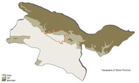
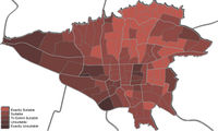
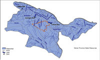
Tehran is situated on a plain at the foot of the Alborz Mountains Presents diversity of climate and terrain. In the relief find a fault beneath the Alborz chain and several smaller faults located in the plains of the south of the city. For this reason the city is exposed to earthquakes. The city does not have major water resources. It is located at an equal distance from two major river basins that collect water coming from the mountains located upstream. Suffers the problems of the big cities of the world: air pollution and hearing, traffic congestion, social class difference. The northern suburbs of the city, located in height on the slopes of Alborz, are the suburbs of the population of the upper middle class of the capital. To the south, toward the desert, are the most popular neighborhoods and industrial. Currently air pollution and rapid population growth are major issue and vulnerability. The environmental capacity for the proper development of quality of life, is insufficient.
Landscape and/or urban context
- Biogeography, land use patterns, cultural features, overall character, history and dynamics
Tehran province is located in the north of the central plateau of Iran. It has common borders from north with Mazandaran, from east with Semnan, from west with Qazvin and from south with Qom. the area of this province is about 18,909 square kilometers and includes Tehran, Damavand, Ray , Shemiranat, Shahriyar, Varamin and Islam Shahr; Savoj Bolaq and Karaj were also 2 parts of this province which has been seperated since 2 years ago and now have become independent provinces. The highest point of the province is Damavand peak, 5,678 m. and the lower parts are the plains of Varamin, 790 m. above sea level. Mountain ranges such as the Alborz in the north; the Savad Kooh and Firooz Kooh are located in the north east; Lavasanat, Qarah Daq, Shemiranat, Hassan Abad and Namak Mountains are in the southern territory; Bibi Shahr Banoo and Alqadr are situated in the south east and the heights of Qasr-e-Firoozeh being located to the east of the province. There are many ancient areas dating back to 6000 years ago have been found in the surrounding regions of Tehran such as Cheshme-Ali, Gheytariyeh, Darrous and Chizer. According to historical documents, until the Moghul Invasion, Tehran was a small village and one of the four parts of Ray. It was selected as the Capital of Iran in 1200 AH. and since then has been the political, cultural, economical part of the country.
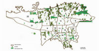
- ratio of green/blue and sealed/built-up areas
- urban green space 79154757 m2
- public parks 17422904 m2
- urban green belt 37000 hectares
- per capita urban green space 6.5 m2
Illustration:
Map; sketches; short descriptive analyses


Cultural/social/political context
- Brief explanation of culture, political economy, legal framework
Illustration: Bullet points, image, background notes
Culture The are many interesting buildings in Tehran. Most from the Qajar time, including the Golestan Palace (till 1979 the seat of the Shah) and the Shah mosque. The largest theater is the Vahdat Concert Hall with about 1000 seats. Other theaters are the Rudaki Hall (home of the Rudaki Orchestra) and the Nasr (oldest theater in the city). Improtant museums are based in the capital city: the Archaelogical Museum, the Abgineh Museum with an exhibition of Iranian pottery, the Rhea Abbasi Museum with a collection of Iranian calligraphy and paintings and the Carpet Rassam Cultural with a carpet weaving school. Finally mentioning is the Saad abad-Palace.
Tehran has about 800 parks. Known parks are the Daneshju-Park, Sa’ei-Park and the Navaran-Park in the South of the palace.
Economy and Transportation Industrial firms are producing in the province cotton textiles, food, cement and bricks. The National Oil Company, based in the capital city, manages the oil industry in the country. The economy is largely controlled by the government. In private hands are only small firms. The educational and media center of Iran is in the capital city. Major universities are the University of Tehran and the Sharif University of Technology. 3 airports offer the province an international aviation. Overland buses connect the province to Europe. Tehran has an excellent motorway network. The province also has rail links to all parts of the country.
Local Climate
- What are the climatic conditions at present? Have there been extreme weather events in the near past?
- Which changes are expected? Is there any evidence?
The Iranian capital has a continental climate. It varies greatly depending on the altitude. The elevated north Tehran enjoys cooler temperatures than the southern part of the city, situated on the fringes of the central Iranian desert regions. The summers are dry and hot. The average values for July are in the south of the city at about 30 ° C (in the north to 25 ° C). Winters are cold (in the North in January 2 ° C, 5 ° C in the south). It often snows in the north and west of Tehran, while in the south of the city, the sun is shining. There is a total of little rainfall. The mean average temperature is 16.5 ° C. In the region on average 230 mm of precipitation falling. In summer, temperatures reach 40 ° C. But the summer nights are cool. The coldest month is January. The temperatures fall to an average value of 2.2 ° C, which corresponds approximately to the statistically average January temperature of Cologne. [6] The warmest month is July, with an average of 29.7 C ° Most precipitation falls from December to April with 28 to 37 millimeters on average, the least from June to September with one to three millimeters on average.
Air pollution is one problem in Tehran. Another problem are the earthquakes, registered measures between 3-5.
Illustration: Table or time line: http://atlas.tehran.ir/Default.aspx?tabid=242
Analysis of vulnerability
- If you consider these potential changes - which aspects/functions of your case study would be affected?
Illustration: Map/diagram/sketches/photos/background notes
In several aspects Tehran province is vulnerable. Climate change if it follows its course until today can be the following predictions for this site.Tehran suffers from an inadequate and insufficient supply of water.The city received large amount of immigration and is expanded without any kind of planning which result in poor infrastructure to meet the demand of its inhabitants.This overflow of unsatisfied needs took human waste which is not treated properly and again be placed in the water than will again be used.Half of Iran water supply comes from the mountains and melted glaciers The prediction of a future with temperatures more high puts at risk the supply of water in this region.Climate change is predicted to bring waves of heat, cold and winter periods decreased more early.Precipitation will be more intense in areas wet causing many times damage in Agronomy and therefore decreasing the supply of food for the supply of the population.In the cities, this increase in rainfall could cause flooding if the systems of drain water were not properly prepared for so much contain of water in a short time.In areas adds more you arid drought due to the decrease of rainfall in these areas and again impact the culture and the food available for the inhabitants.The air pollution is an issue that is currently already affecting and influencing the quality of life of its inhabitants.none standard vehicles with poor quality fuel are the main and the most important reasons of air pollution in Tehran which are causing blindness and abortion in addition to serious illnesses like Cancer and health problems. Many days the sky, due to contamination particles suspended in the air, has a gray color.The activity of the inhabitants is interrupted by periods of time by the level of pollution which reached the air, and may not leave their homes.Due to its location, located at foot of mountain chain bathrobe and about faults, it may suffer from strong earthquakes.These last usually 7.0 magnitude although in some events it has passed this measure.
Proposals for Climate Change Adaption
- How could your case study area become more resilient to climate change?
- Which measures would need to be taken to adapt to the new situation?
- How could you assure sustainability of these measures?
- Please describe 2-3 measures
Implementation of Public green space development has the initial priority to decrease the air pollution of Tehran Province. The other measures and suggestions which could be considered (as ignorance of sanctions) are: 1.Public transportation expansion Metro and Bus lines expansion, also wide spreading the use of electric cars 2.General changes in urban planning and design pedestrian and bicycle ways 3.Making public transportation tax-free and available in all parts of this mega city could encourage the society not to use their own private vehicles and to supply financial sources, receiving poll taxes can be considered. 4.Increasing time table schedule of public transportation would help this matter. The other fact which has an important role on utilization of public transportation is the sense of security and being safe for people especially for women and the children. 5.Technical examination certificate issuance Increase the technical examination centers / vehicle technical examination obligation 6.Education and acculturate The press and media have important and grand role, they can aware society of environment conservation and risks and hazards of its damage and deconstruction 7.Air pollution measurement 8.Getting pollutant Motorcycles out of order which produce 8 times of standard limit pollution 9.Making away pollutant factories located in 120 radius of Tehran 10.Prohibition of construction in prevailing winds direction 11.Controlling Air, Soil and Water pollutions -Promotion and Correction of vehicles and fuel quality Utilization of solar resources -Management and urban traffic engineering improvement -Thoroughfares engineering -Producing vehicles which use clean fuel
Proposals for Climate Change Mitigation
- Which measures would need to be taken to reduce greenhouse gas emissions and other drivers of climate change within your case study area?
- How could you assure sustainability of these measures?
- Please describe 2-3 measures
Your scenario
- How will this area look like in 2060?
- Please forecast one potential future development taking climate change into account
Illustration: Map/diagram/sketches photos and background notes
What can be generalized from this case study?
- Are there any important theoretical insights?
- Which research questions does it generate?
- Short statement plus background notes
Presentation Slides
- Addnewimagename.jpg
Slide One
- Addnewimagename.jpg
Slide Two
- Addnewimagename.jpg
Slide Three
Image Gallery
- Yourimage.jpg
your image text
- Yourimage.jpg
your image text
- Yourimage.jpg
your image text
- Yourimage.jpg
your image text
- Yourimage.jpg
your image text
- Yourimage.jpg
your image text
- Yourimage.jpg
your image text
- Yourimage.jpg
your image text
References
Please add literature, documentations and weblinks http://www.atlas.tehran.ir http://www.tebyan.net http://www.ictcsociety.org http://www.doe.ir
About categories: You can add more categories with this tag: "", add your categories