Karanfil Street and Yüksel Street: Difference between revisions
| Line 71: | Line 71: | ||
<gallery caption=" " widths="150px" heights="150px" perrow="5"> | <gallery caption=" " widths="150px" heights="150px" perrow="5"> | ||
Image:Graphic1.jpg | Image:Graphic1.jpg | ||
Image:Bb.jpg | |||
</gallery> | </gallery> | ||
Revision as of 18:52, 11 December 2011
---> back to overview of Case Study List
add long title of your theme
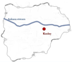
| Name | Karanfil and Yüksel Streets | |
| Location | Ankara | |
| Country | Turkey | |
| Authors | Gülin Özdemir, Gülçin Özdemir, İrem Erbaş, Cansu Saraç, Gönül Çelik | |

| ||
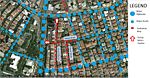
| <googlemap version="0.9" lat="39.9192" lon="32.85544" type="satellite" zoom="17" width="300" height="250">
</googlemap> | ||
Short Introduction to the Area of Study
Yüksel, Karanfil and Konur Streets are the most popular streets which reflect the identity of Ankara. They are very commercial and popular streets, being also a place where many manifestations occur, where one can cool down and/or do shopping, also the central point of the city transportation. There are 35% cafes and restaurants, 24% stores, 8% institution of education and bookstores. In the middle of the Yüksel Street, there is a human statue. In front of this statue made press statements and do remonstrances mostly. Because of this feature, this area is always undercontrol of the Police. And this quarter is the most vibrant pedestrian part of the city, in which residents openly express their problems and responses, serving numerous functions and reflecting the characteristics of Ankara at the same time. The problems that can arise from the quarter are likely to affect all the residents of the city and are currently waiting to be solved.
Exercise 1: Sketching the Landscape
Time frame: October 25 - November 15, 2011
Student activities:
- Creation of analytical drawings and sketches
- Presentation of results
Please upload a selection of your drawings/sketches/mental maps and add them to the image gallery
-
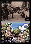
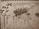 Karanfil Street
 -
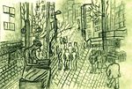 Konur Street
 -
 your image text
 -
your image text
-
your image text


Exercise 2: Landscape Layers
Time frame: November 15 - 29, 2011
- time based changes and 'landscape biography', and/or:
- topography, open spaces, built, green, traffic and water structures on different layers. *Definition of zones with coherent character
- Description of this character.
-
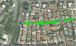
 transportation layer
 -
 your image text
 -
 your image text
 -
 your image text
 -
-


Please publish your findings here
Exercise 3: Behaviour Patterns
Time frame: December 6 - 20, 2011


- How do people behave in this area? How do they use the space? What is important for them?
- Observation of study area, interviews with local people and mapping of use patterns.
- Preparation of short presentation
Please publish your findings here
Exercise 4: Communication Concepts
Time frame: December 19, 2011 - January 17, 2012
- Based on the different landscape assessment approaches students will develop a communication concept for their area of study
- Which measures would be necessary for enhancing the awareness for the area?
- Students are free to choose their method.
Please publish your findings here
Image Gallery
-
your image text
-
your image text
-
your image text
-
your image text
-
your image text
References
* Please make sure that you give proper references of all external resources used.
* Do not use images of which you do not hold the copyright.
* Please add internet links to other resources if necessary.
About categories: You can add more categories with this tag: "", add your categories