Uploads by Stefanoficm
Jump to navigation
Jump to search
This special page shows all uploaded files.
| Date | Name | Thumbnail | Size | Description | Versions |
|---|---|---|---|---|---|
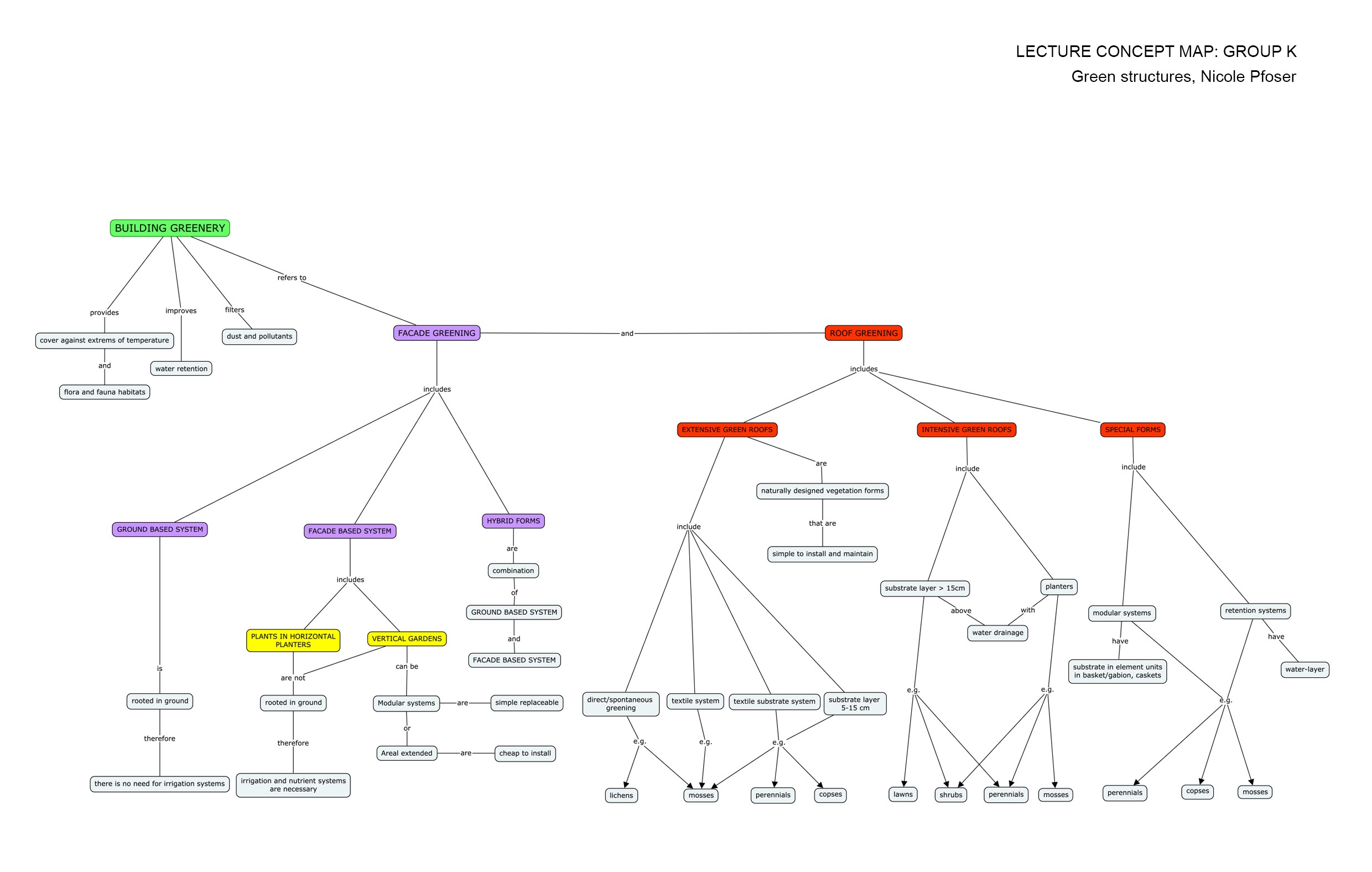
| 11:11, 25 January 2015 | Green Structures Concept map Group K.jpg (file) |  |
646 KB | 1 | |
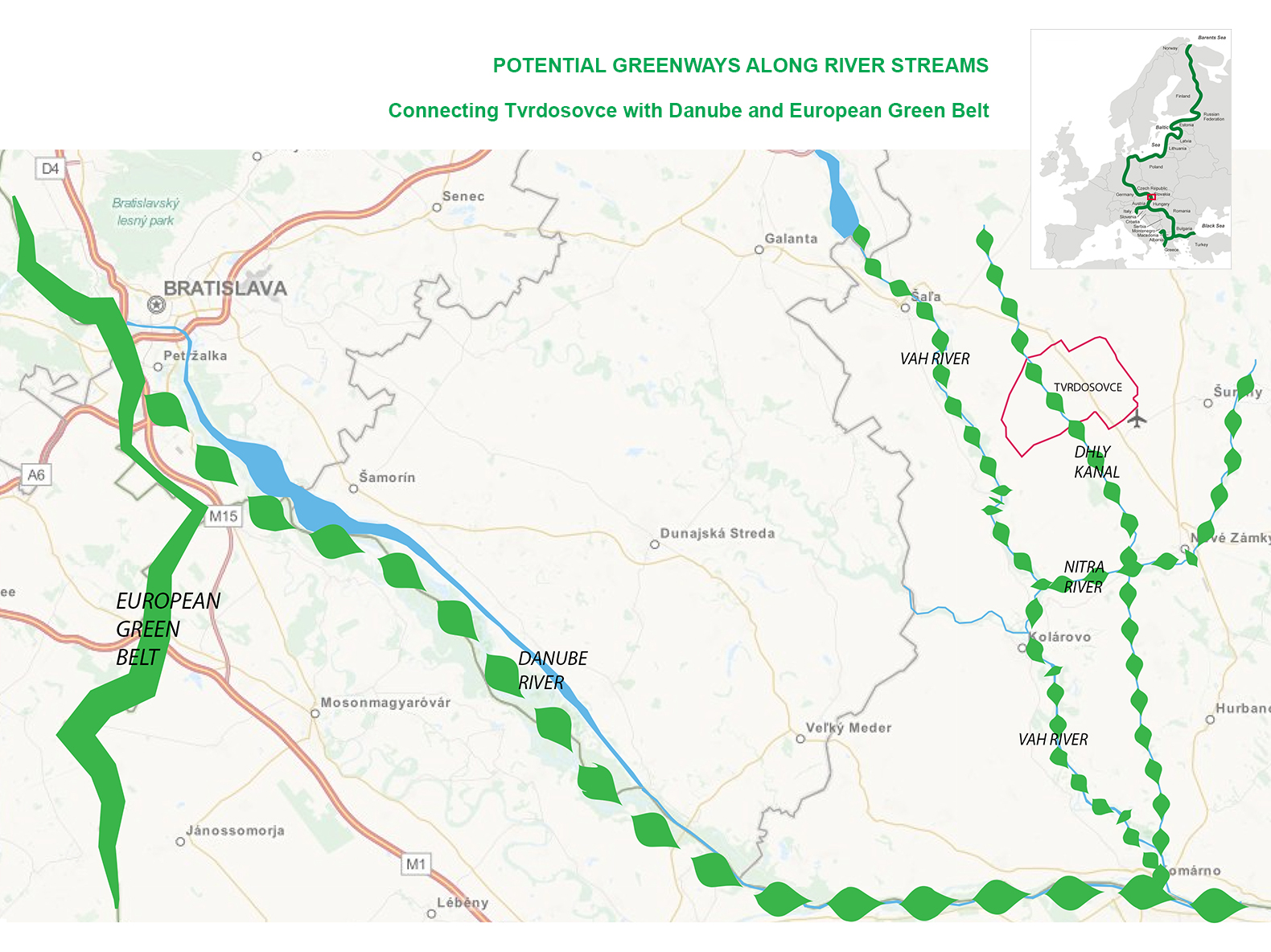
| 10:54, 25 January 2015 | Projective drawing Milena.png (file) |  |
1.41 MB | On this drawing are presented potential green corridors along water streams. Green corridor along Dlhý kanál would connect Tvrdosovce landscape with corridors along rivers Nitra and Váh, and finnaly Danube. | 1 |
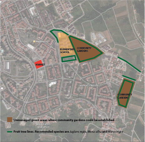
| 19:26, 30 November 2014 | Projective drawings Ispravka.png (file) |  |
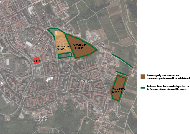
455 KB | On this drawing, areas that have potential to become community gardens are marked. These areas are covered with grasses and shrubs, and they are not very well managed. On drawing are also marked places where fruit species could be planted in lines. I w... | 1 |
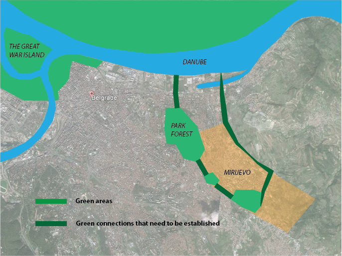
| 15:56, 30 November 2014 | Connectivity Milena 2.png (file) |  |
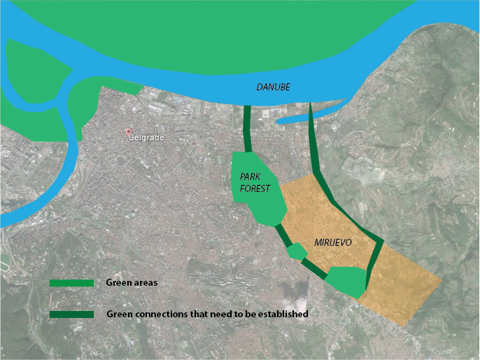
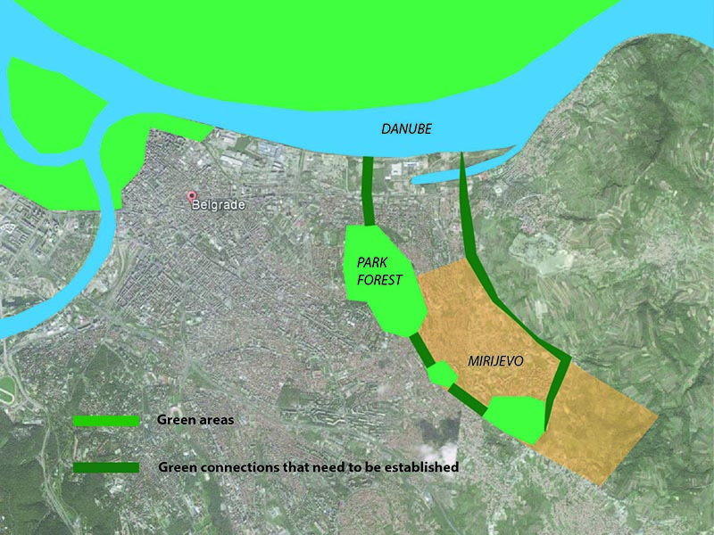
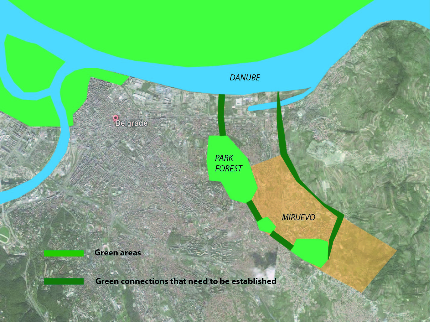
571 KB | This image shows green and blue areas in the vicinity of study site. Green corridors need to be established to connect green areas within Mirijevo with nearby Park Forest, river Danube and the Great War Island (a nature preserve for great number of bi... | 1 |
| 12:09, 29 November 2014 | Connectivity Milena png.png (file) |  |
0 bytes | This image shows green and blue areas in the vicinity of study site. It is important to connect them with green corridors, so they can make functional system. For wildlife protection, such corridors should be 20 m wide (Austin, 2014), although further... | 1 |
| 12:03, 29 November 2014 | Connectivity wider context png.png (file) |  |
569 KB | This image shows green and blue areas in the vicinity of study site. It is important to connect them with green corridors, so they can make functional system. For wildlife protection, such corridors should be 20 m wide (Austin, 2014), although further... | 2 |
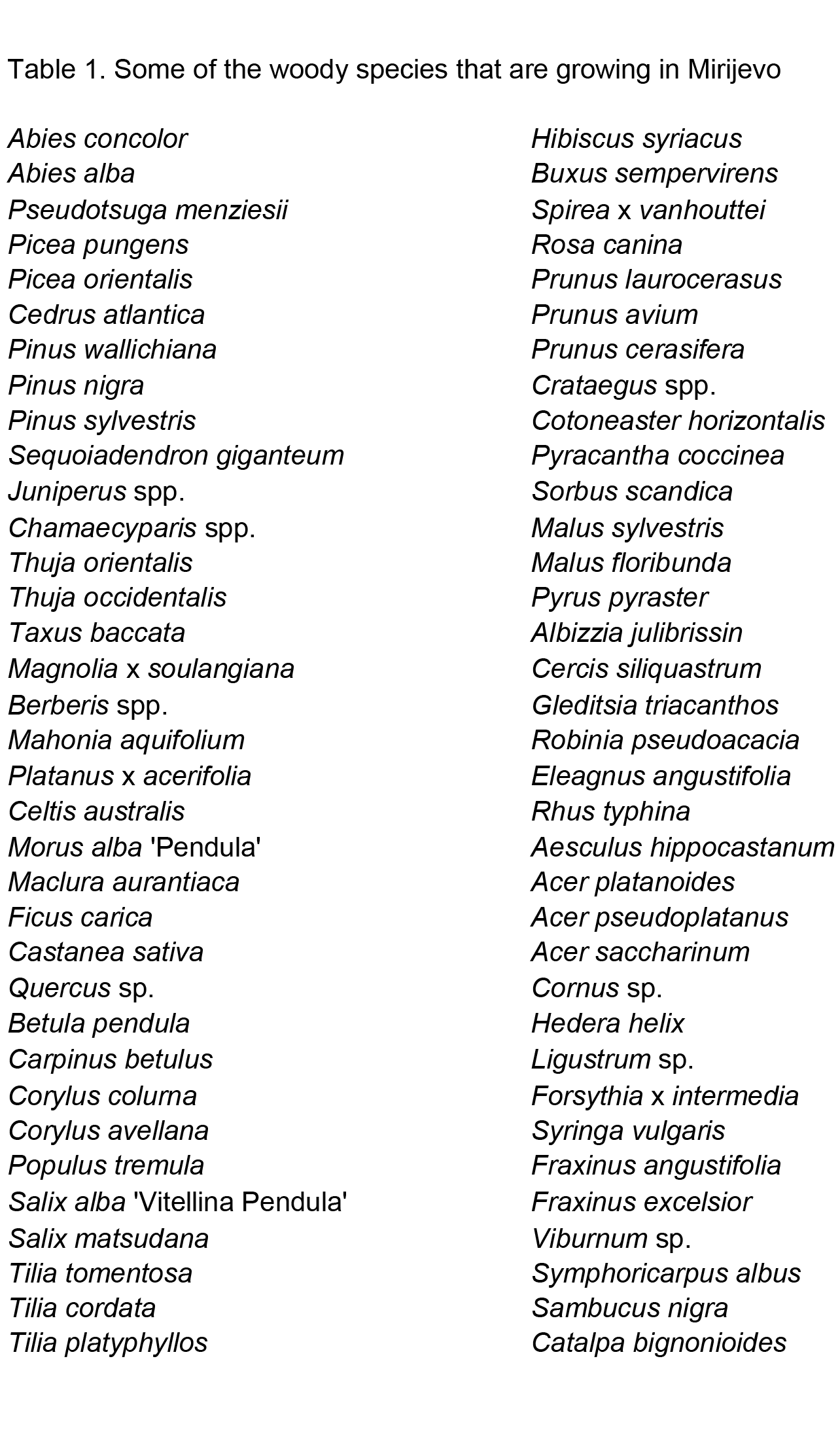
| 11:35, 29 November 2014 | Drvenaste vrste u Mirijevu.png (file) |  |
199 KB | This list of woody species in Mirijevo is incomplite. Besides, wide variety of grasses, crops and ornamental plants are growing in Mirijevo. | 1 |
| 16:04, 28 November 2014 | Mirijevo study site.png (file) |  |
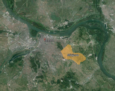
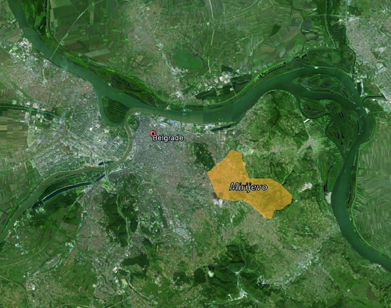
219 KB | This map is representing position of the study site in relation to Belgrade. Mirijevo is located around 7 km from city center on the eastern outskirts of Belgrade's urban zone. The neighborhood is developed in the valley of Mirijevski potok (creek whic... | 1 |
| 15:56, 28 November 2014 | Projective drawings Milena.png (file) |  |
469 KB | On this drawing, areas that have potential to become community gardens are marked. These areas are covered with grasses and shrubs, and they are not very well managed. Also, on drawing are marked places where fruit species could be planted. I would rec... | 1 |
| 13:29, 28 November 2014 | Garage rooftops.jpg (file) |  |
428 KB | Garage rooftops – one of many surfaces in Mirijevo that could be better managed. | 1 |
| 13:27, 28 November 2014 | WP 20141111 009.jpg (file) |  |
1.7 MB | Garage rooftops – one of many surfaces in Mirijevo that could be better managed. | 3 |
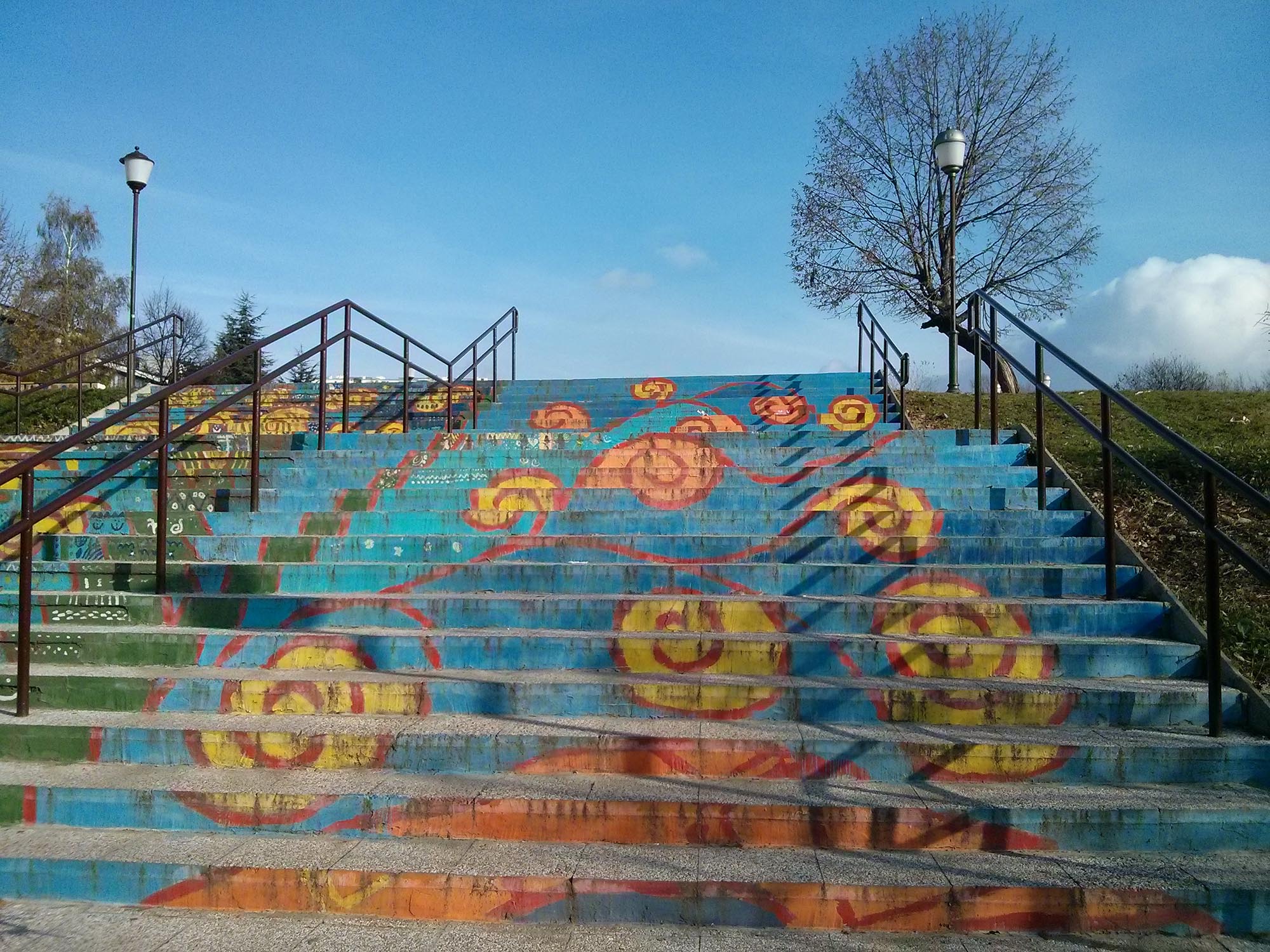
| 11:12, 28 November 2014 | Schol yard Preview.jpg (file) |  |
46 KB | 1 | |
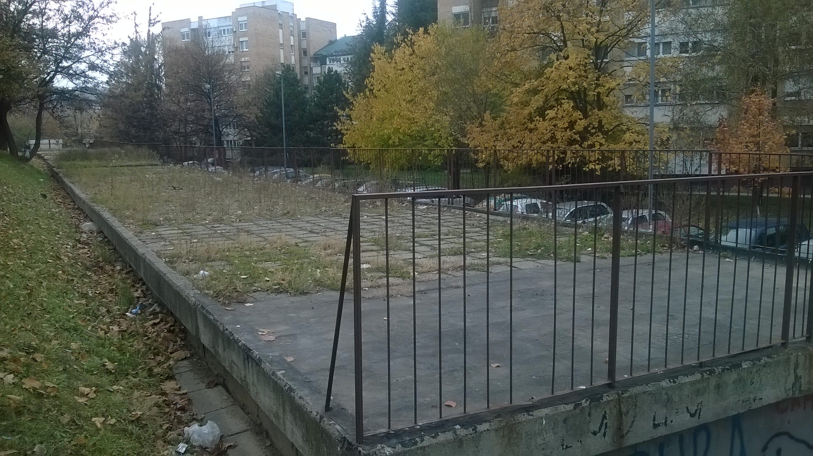
| 10:54, 28 November 2014 | Schol yard stairs.jpg (file) |  |
552 KB | 1 | |
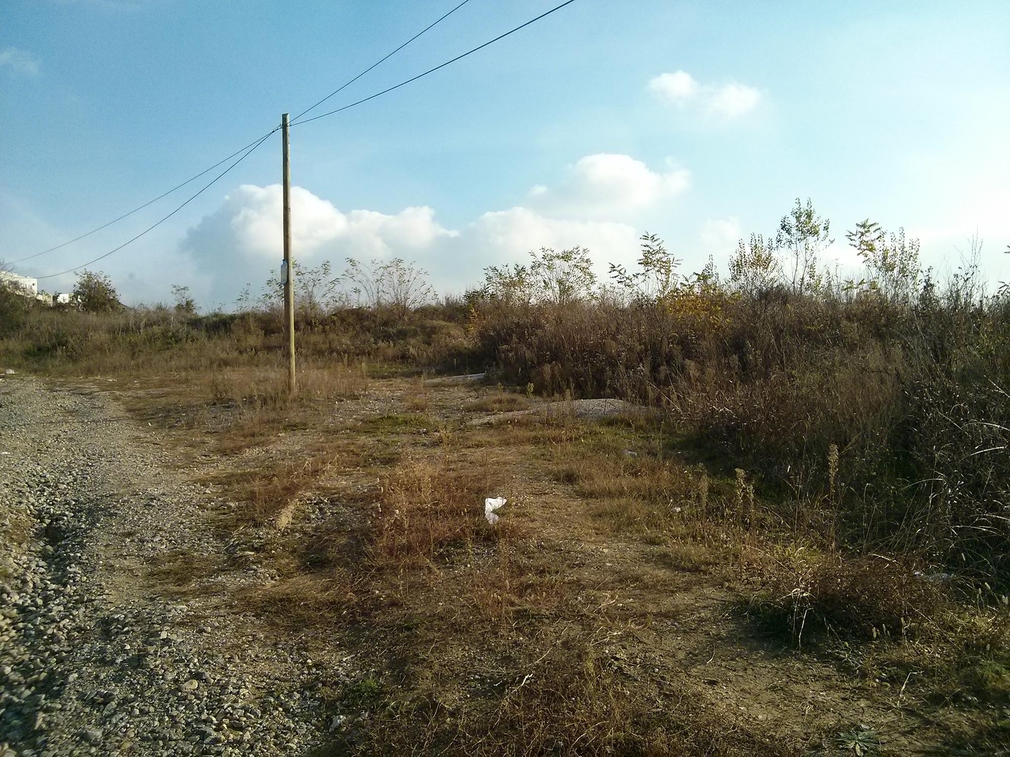
| 10:44, 28 November 2014 | Grassland ecosystem 2.jpg (file) |  |
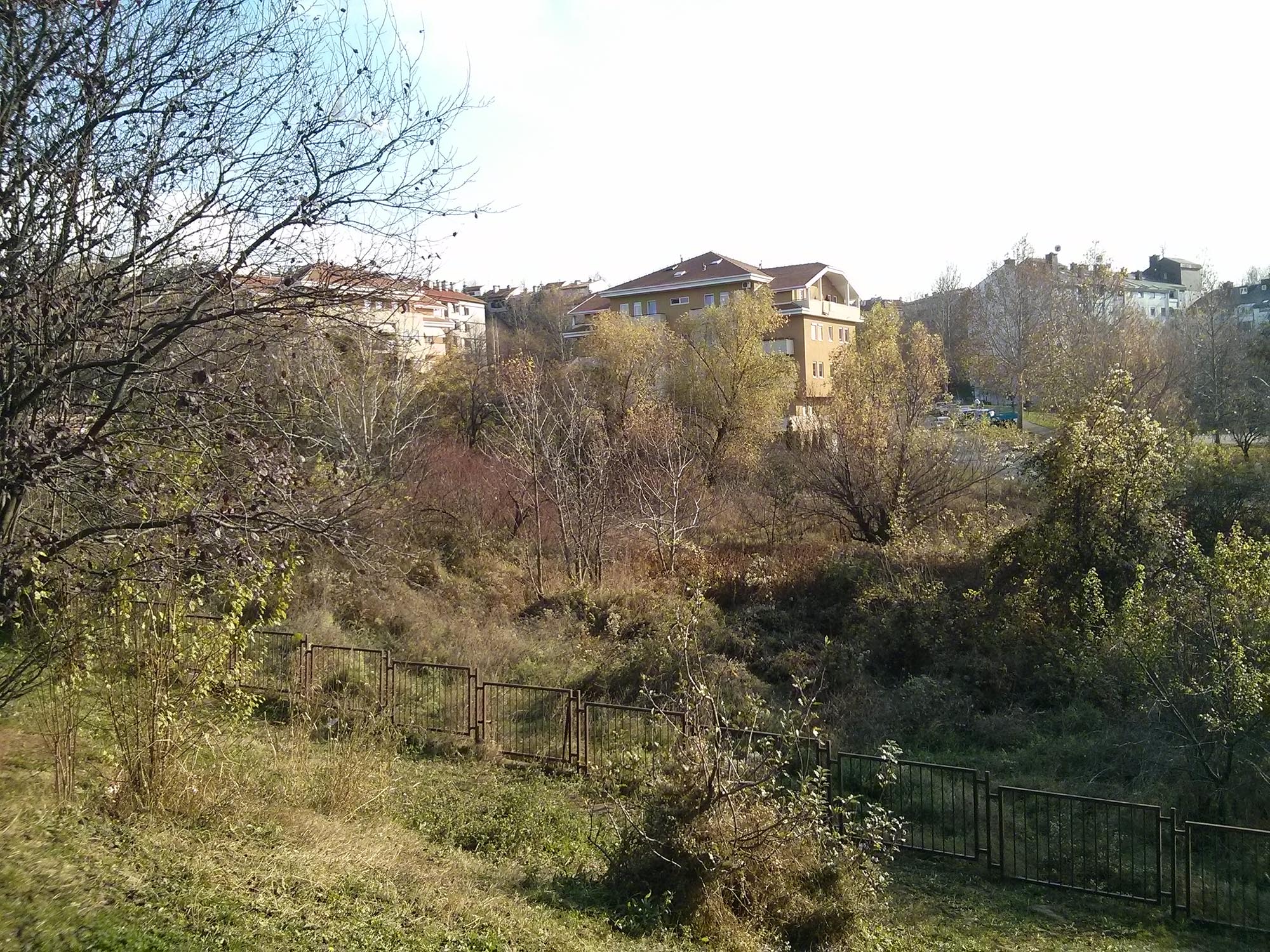
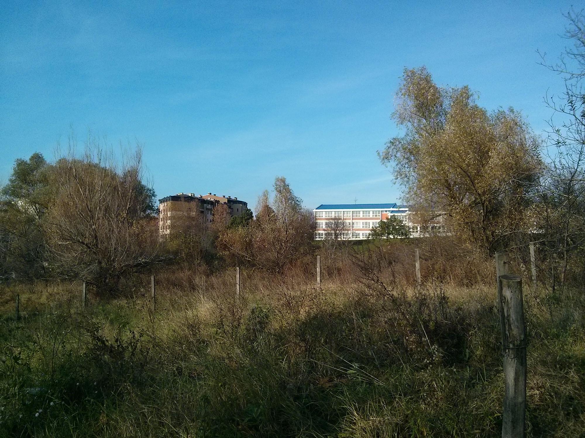
617 KB | On this picture is shown part of the area in Mirijevo when community gardens could be established. | 1 |
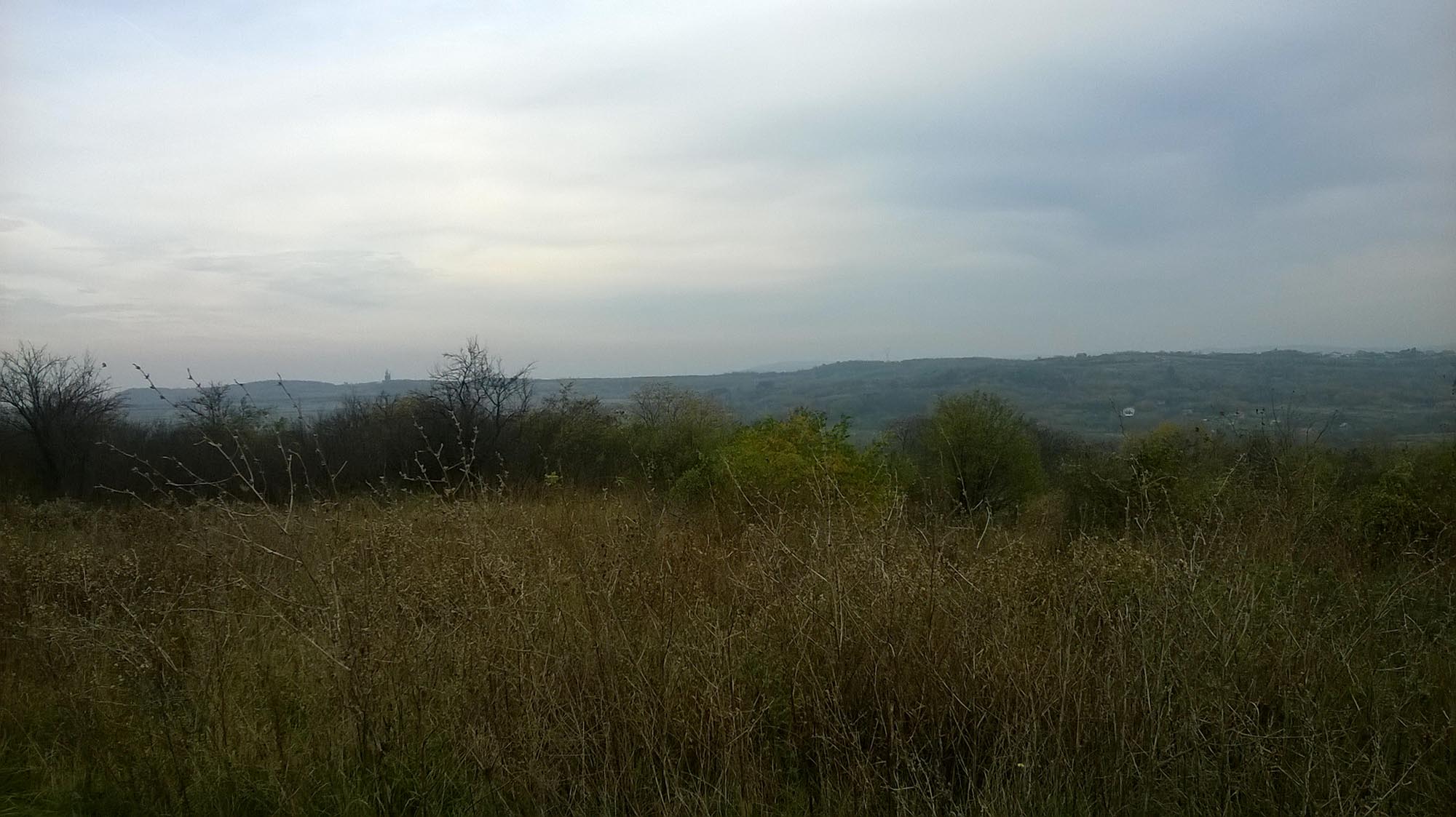
| 10:32, 28 November 2014 | Grassland ecosystem.jpg (file) |  |
269 KB | This picture presents a grassland ecosystem in Mirijevo. | 1 |
| 10:21, 28 November 2014 | Mirijevo study site 2.jpg (file) |  |
757 KB | This map is representing position of the study site in relation to Belgrade. Mirijevo is located around 7 km from city center on the eastern outskirts of Belgrade's urban zone. The neighborhood is developed in the valley of Mirijevski potok (creek whic... | 1 |
| 10:05, 28 November 2014 | Mirijevo Wider Context.jpg (file) |  |
723 KB | This image shows green and blue areas in the vicinity of study site. It is important to connect them with green corridors, so they can make functional system. For wildlife protection, such corridors should be 20 m wide (Austin, 2014), although further... | 5 |
| 16:14, 27 November 2014 | Private garden.jpg (file) |  |
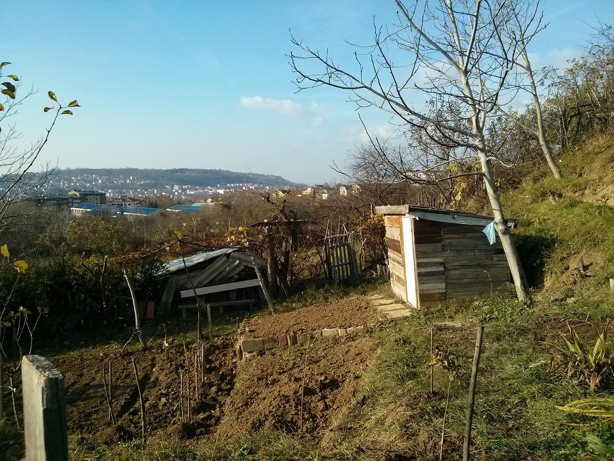
731 KB | This picture presents one of few existing private gardens in Mirijevo. This area has potential for community agriculture. | 1 |
| 15:57, 27 November 2014 | Green area near elementary school 3.jpg (file) |  |
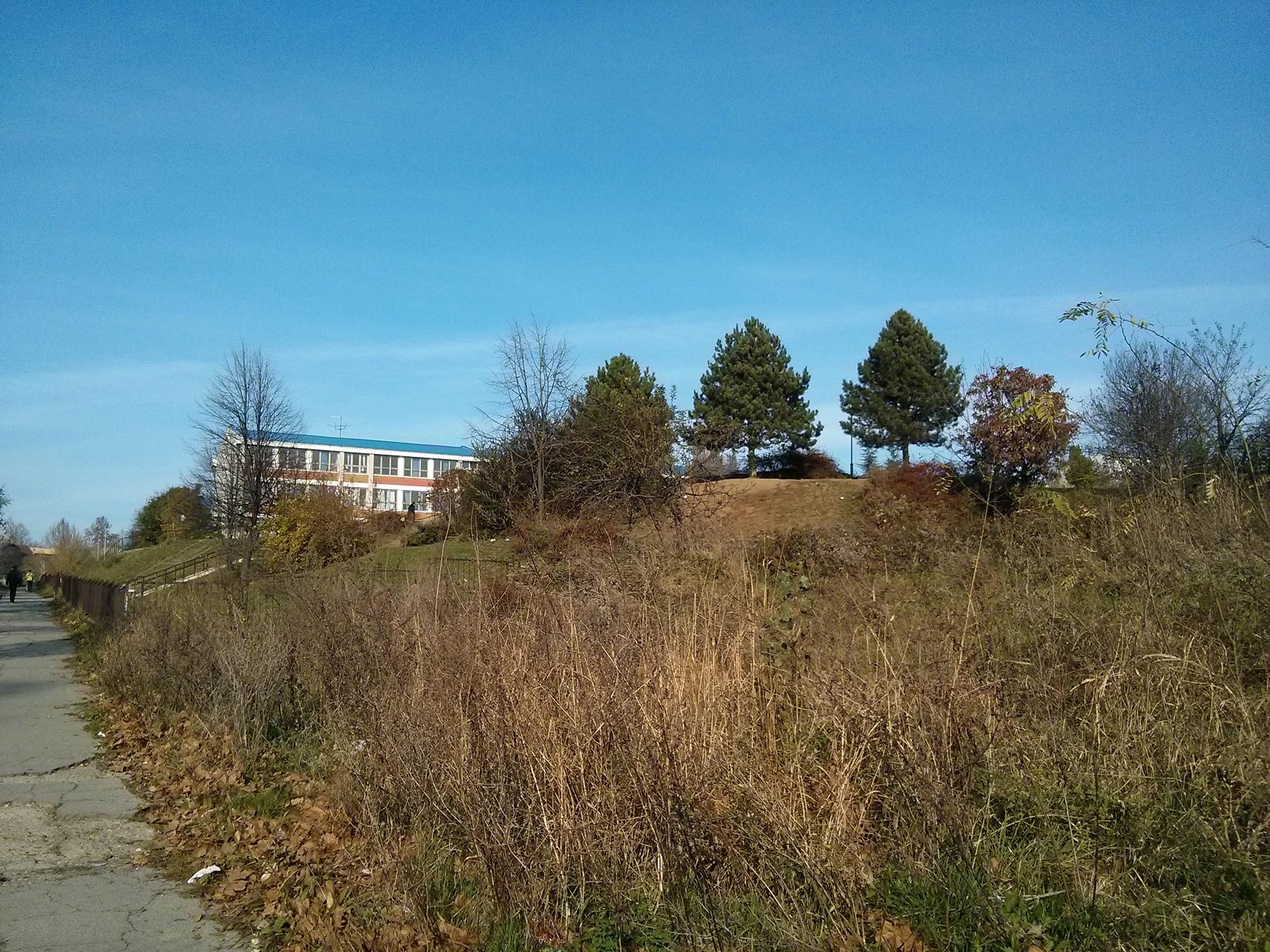
813 KB | This picture presents green area near “Pavle Savić” elementary school that is not very well managed. | 1 |
| 15:52, 27 November 2014 | Drenage cannal in school yard.jpg (file) |  |
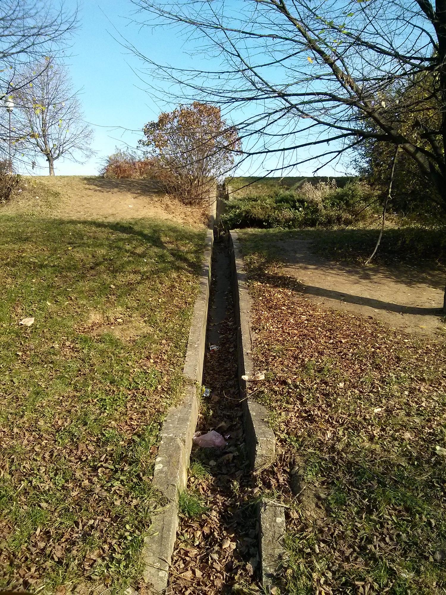
1.01 MB | This picture presents drainage canal in school yard. Not so safe solution. | 1 |
| 15:46, 27 November 2014 | Green area near elementary school 2.jpg (file) |  |
639 KB | This image presents green area near "Pavle Savić" elementary school that is not very well managed. | 1 |
| 15:40, 27 November 2014 | Green area near elementary school.jpg (file) |  |
573 KB | This picture presents green area near “Pavle Savić” elementary school that is not very well managed. | 1 |
| 14:56, 27 November 2014 | Connectivity wider context.jpg (file) |  |
1,006 KB | This image shows green and blue areas in the vicinity of study site. It is important to connect them with green corridors, so they can make functional system. For wildlife protection, such corridors should be 20 m wide (Austin, 2014), although further... | 1 |