Help
Uploads by EdCasFer
Jump to navigation
Jump to search
This special page shows all uploaded files.
File list
Items per page:
20
50
100
250
500
Username:
Include old versions of files
Show file list
First page
Previous page
Next page
Last page
Date
Name
Thumbnail
Size
Description
Versions
02:45, 17 January 2013
Road adjacent to Jardin del Principe 03.jpg
(
file
)
452 KB
2
02:31, 17 January 2013
Roundabout adjacent to Puente Largo.jpg
(
file
)
977 KB
1
02:28, 17 January 2013
Brige over the Tagus river.jpg
(
file
)
312 KB
1
02:28, 17 January 2013
From the bridge over the Tagus river.jpg
(
file
)
321 KB
1
02:27, 17 January 2013
Glorieta Santiago Rusinol 01.jpg
(
file
)
1.52 MB
1
02:15, 17 January 2013
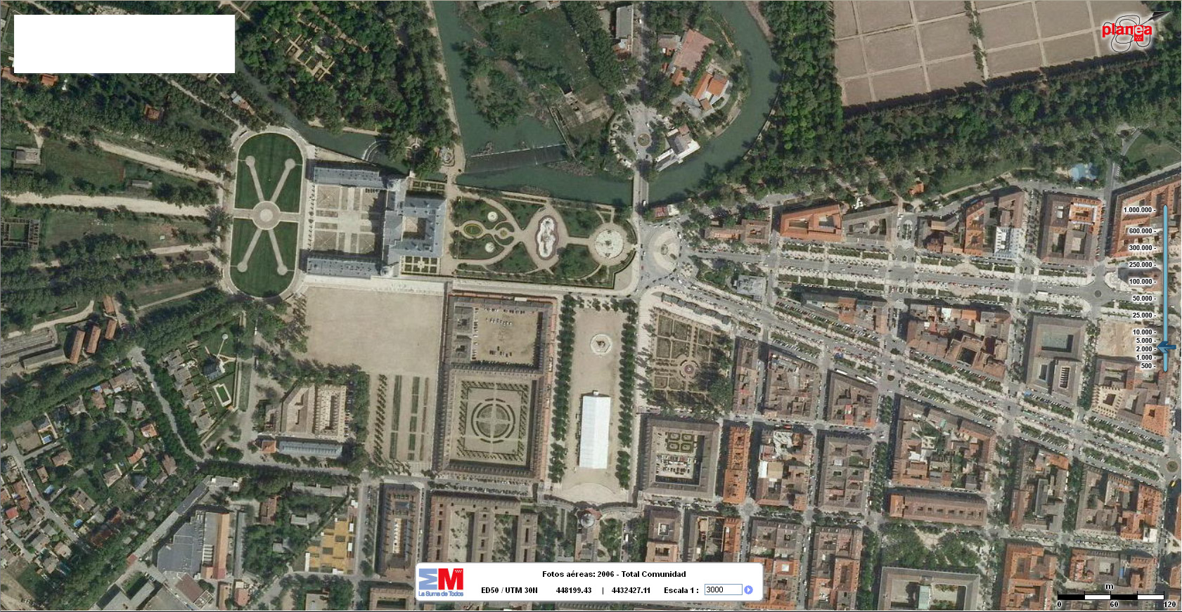
Aranjuez gate 2006.jpg
(
file
)
633 KB
2
02:13, 17 January 2013
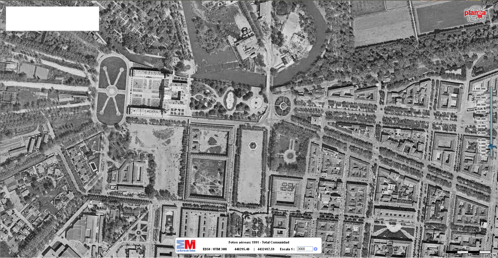
Aranjuez gate 1991.jpg
(
file
)
649 KB
2
02:07, 17 January 2013
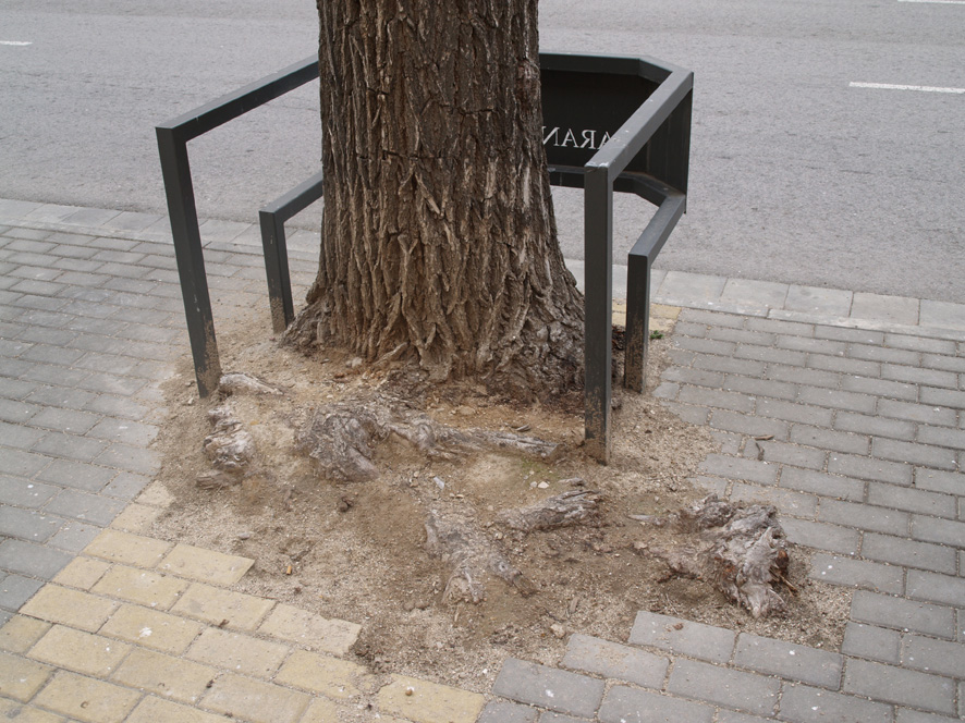
Trees need enough room to grow 03.jpg
(
file
)
288 KB
1
02:02, 17 January 2013
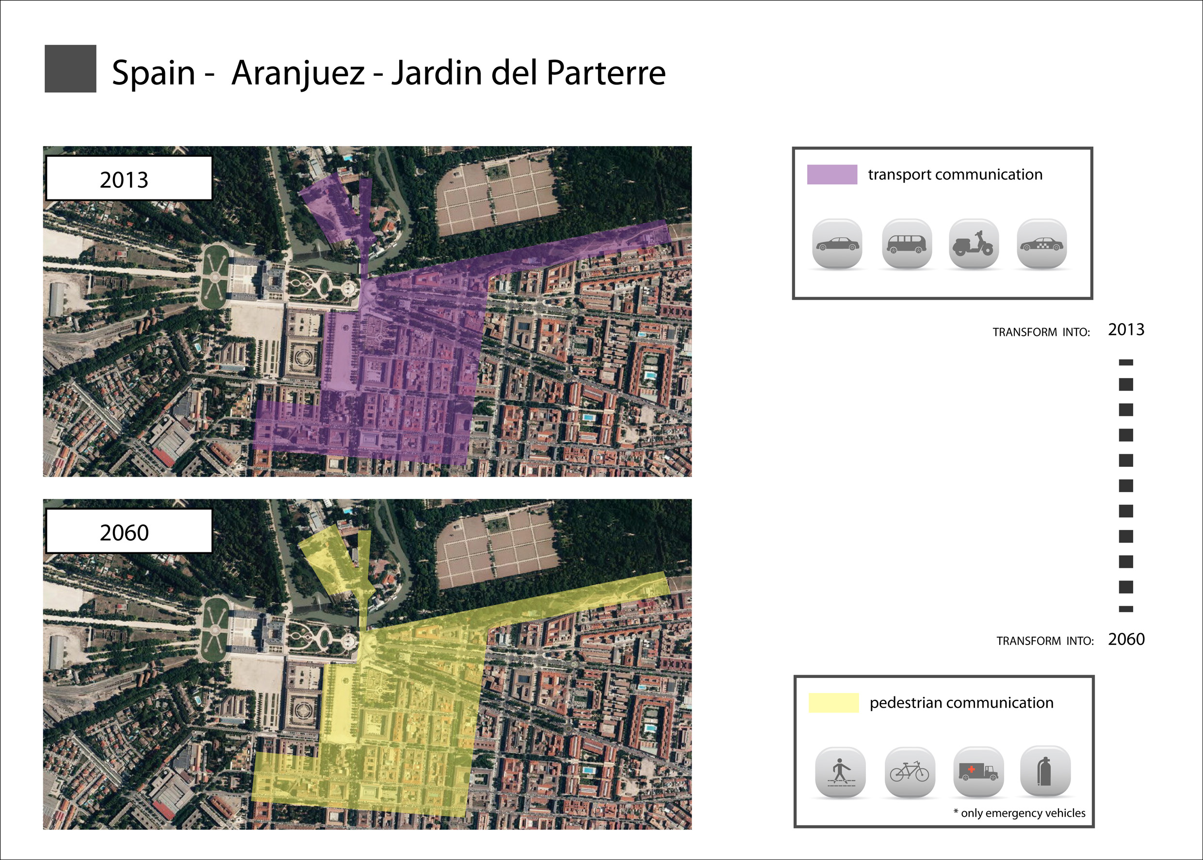
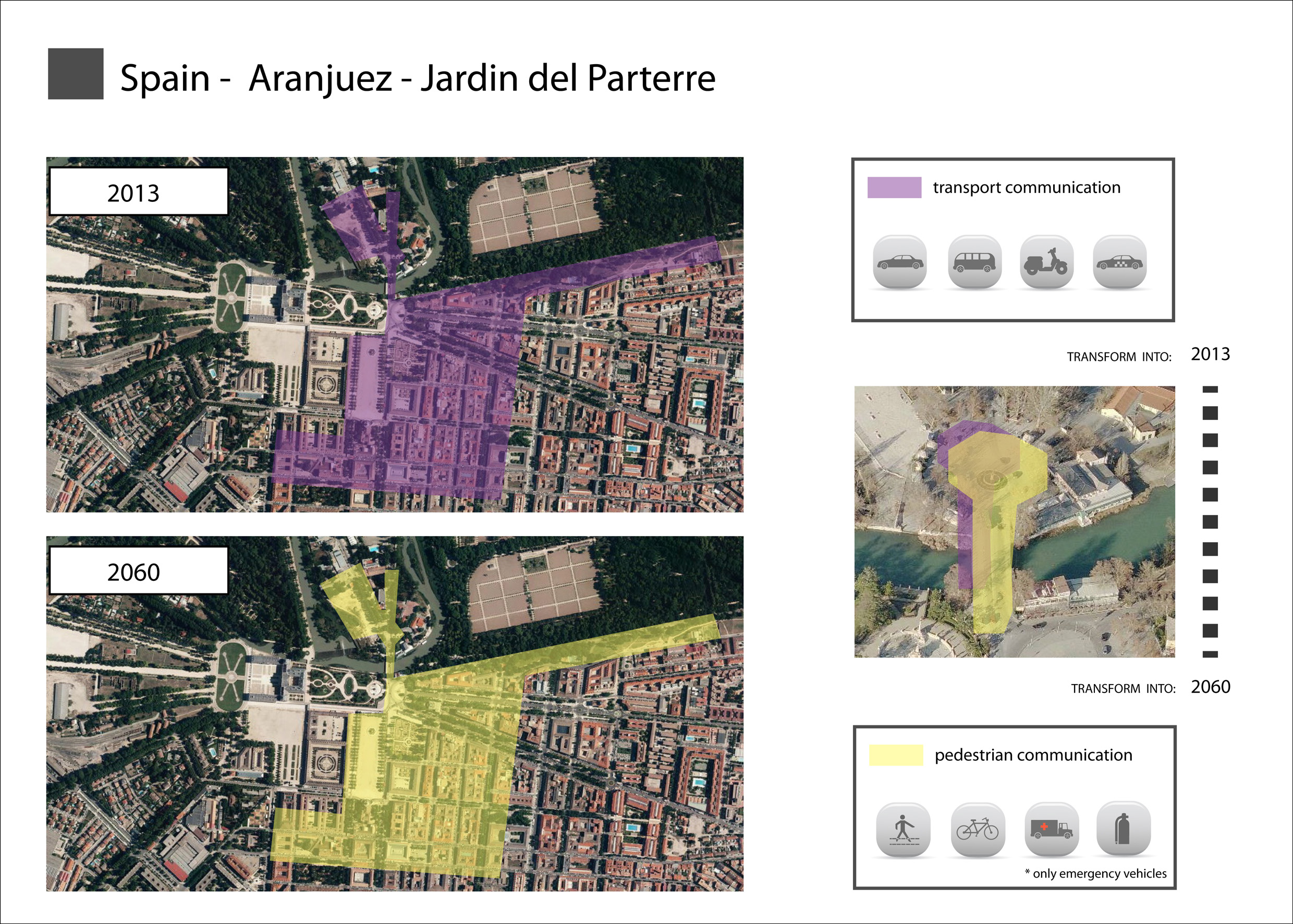
1.scheme 02.jpg
(
file
)
996 KB
1
01:55, 17 January 2013
2.scheme slides.jpg
(
file
)
335 KB
1
17:16, 15 January 2013
Aranjuez Case Study Presentation Slide 3.jpg
(
file
)
1.3 MB
1
17:15, 15 January 2013
Aranjuez Case Study Presentation Slide 2.jpg
(
file
)
1.42 MB
1
17:14, 15 January 2013
Aranjuez Case Study Presentation Slide 1.jpg
(
file
)
1.47 MB
1
23:45, 14 January 2013
Aranjuez gate 2011.jpg
(
file
)
761 KB
1
23:42, 14 January 2013
Decaying trees.jpg
(
file
)
840 KB
1
23:27, 14 January 2013
Trees need enough room to grow 05.jpg
(
file
)
266 KB
1
23:26, 14 January 2013
Trees need enough room to grow 04.jpg
(
file
)
316 KB
1
23:25, 14 January 2013
Trees were before this two lane tarmac road.jpg
(
file
)
381 KB
1
23:24, 14 January 2013
Trees in the road to El Cortijo de San Isidro.jpg
(
file
)
346 KB
1
23:24, 14 January 2013
Ill and poorly maintained Ulmus pumilla in a road of Aranjuez.jpg
(
file
)
421 KB
1
23:19, 14 January 2013
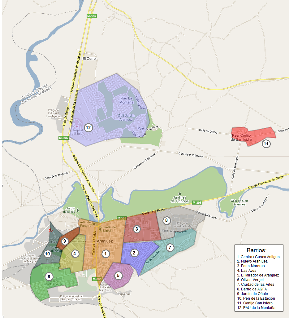
Barrios aranjuez.png
(
file
)
264 KB
1
23:10, 14 January 2013
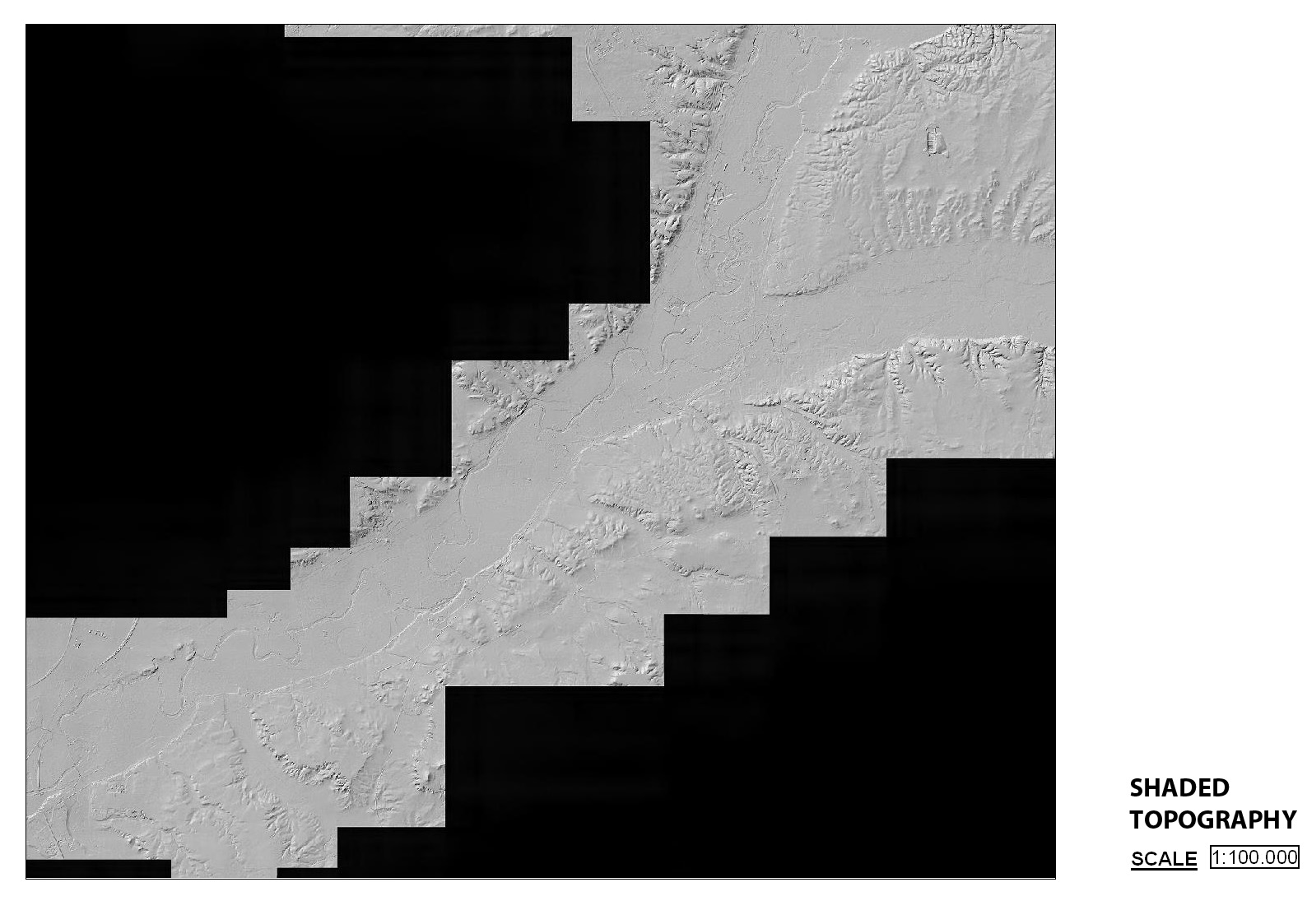
Shaded topography map 1 100000.jpg
(
file
)
291 KB
1
23:10, 14 January 2013
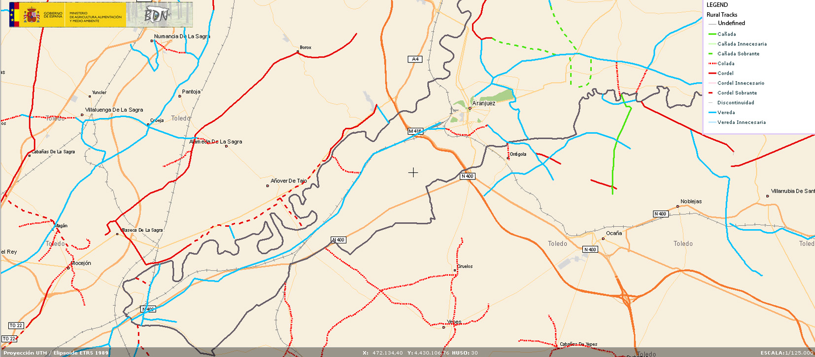
Rural tracks map.jpg
(
file
)
407 KB
1
23:09, 14 January 2013
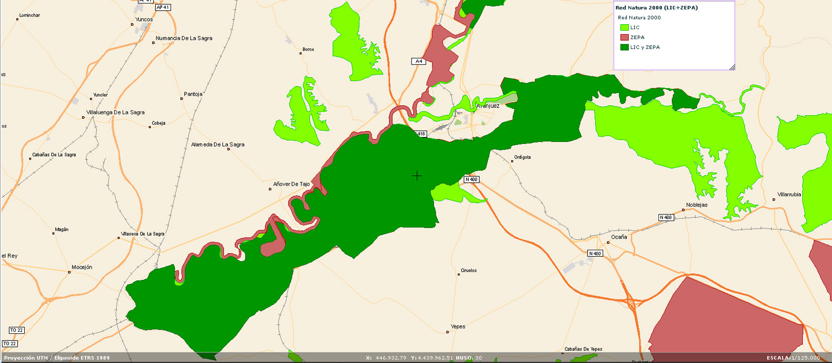
Red Natura 2000.jpg
(
file
)
314 KB
1
23:09, 14 January 2013
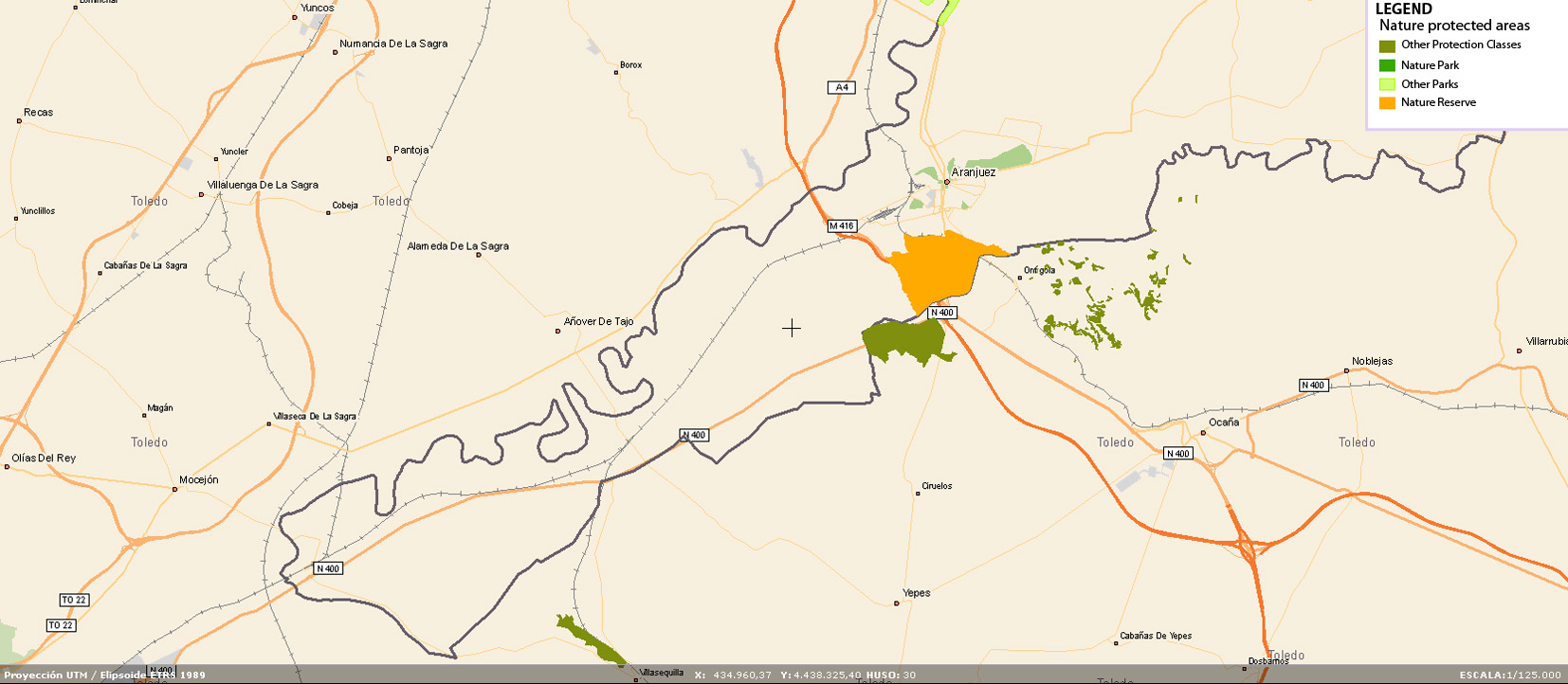
Nature Protected Areas map.jpg
(
file
)
271 KB
1
23:09, 14 January 2013
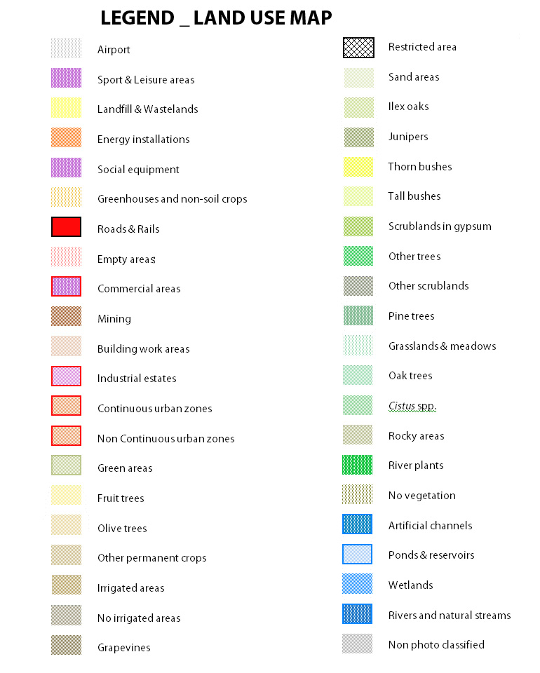
Legend Land Use Map.jpg
(
file
)
183 KB
1
23:08, 14 January 2013
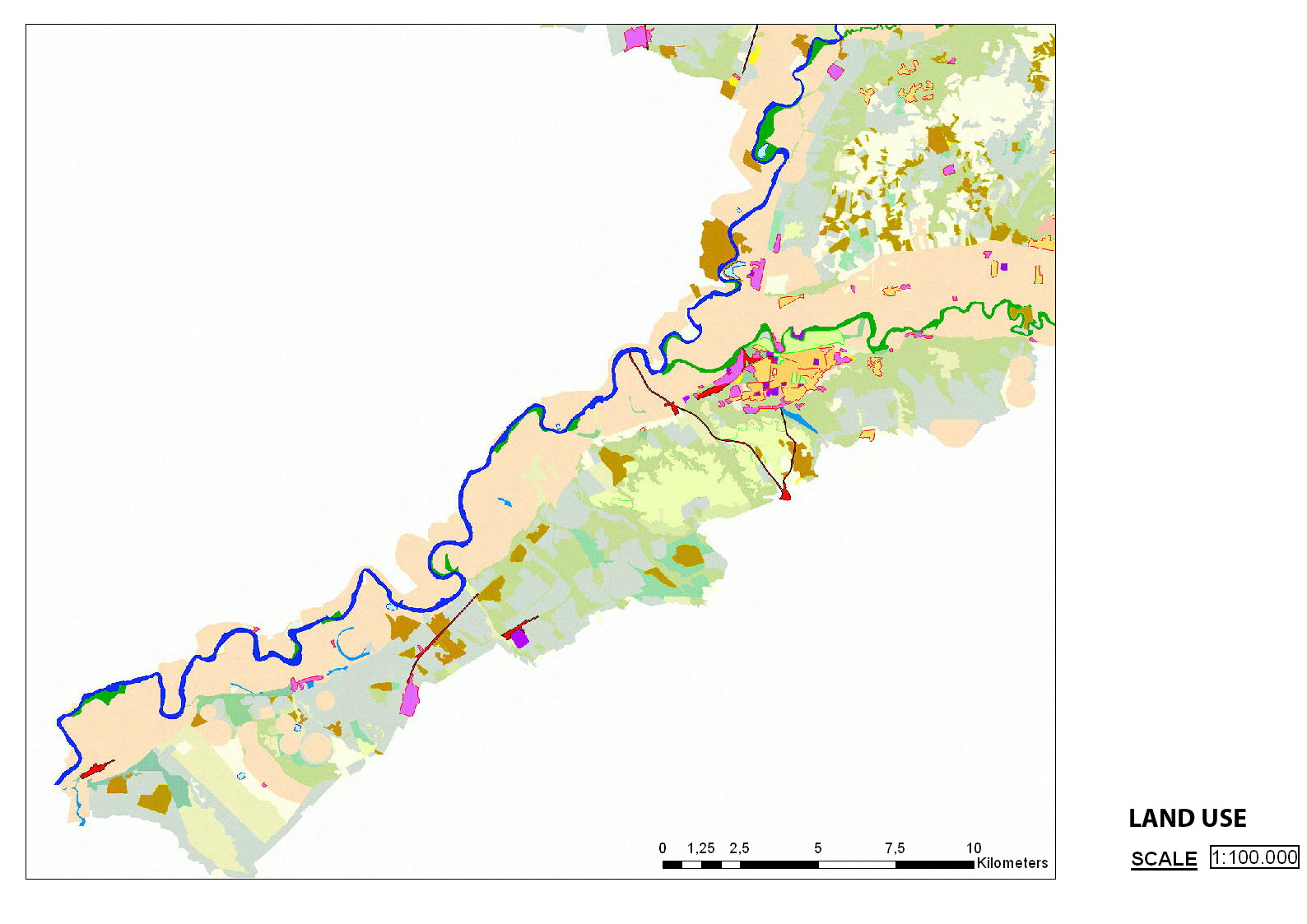
Land Use map 1 100000.jpg
(
file
)
349 KB
1
23:08, 14 January 2013
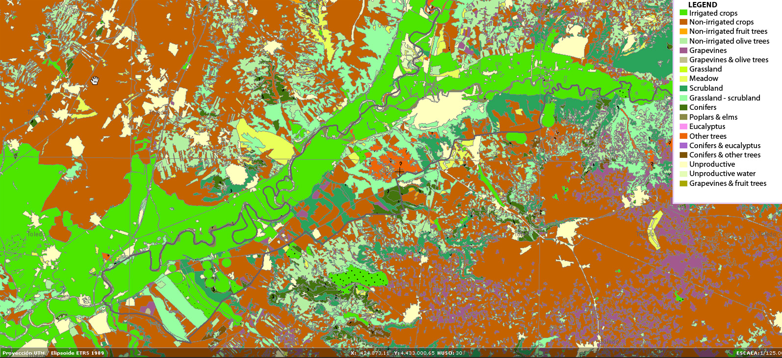
Crops map.jpg
(
file
)
1.01 MB
1
23:07, 14 January 2013
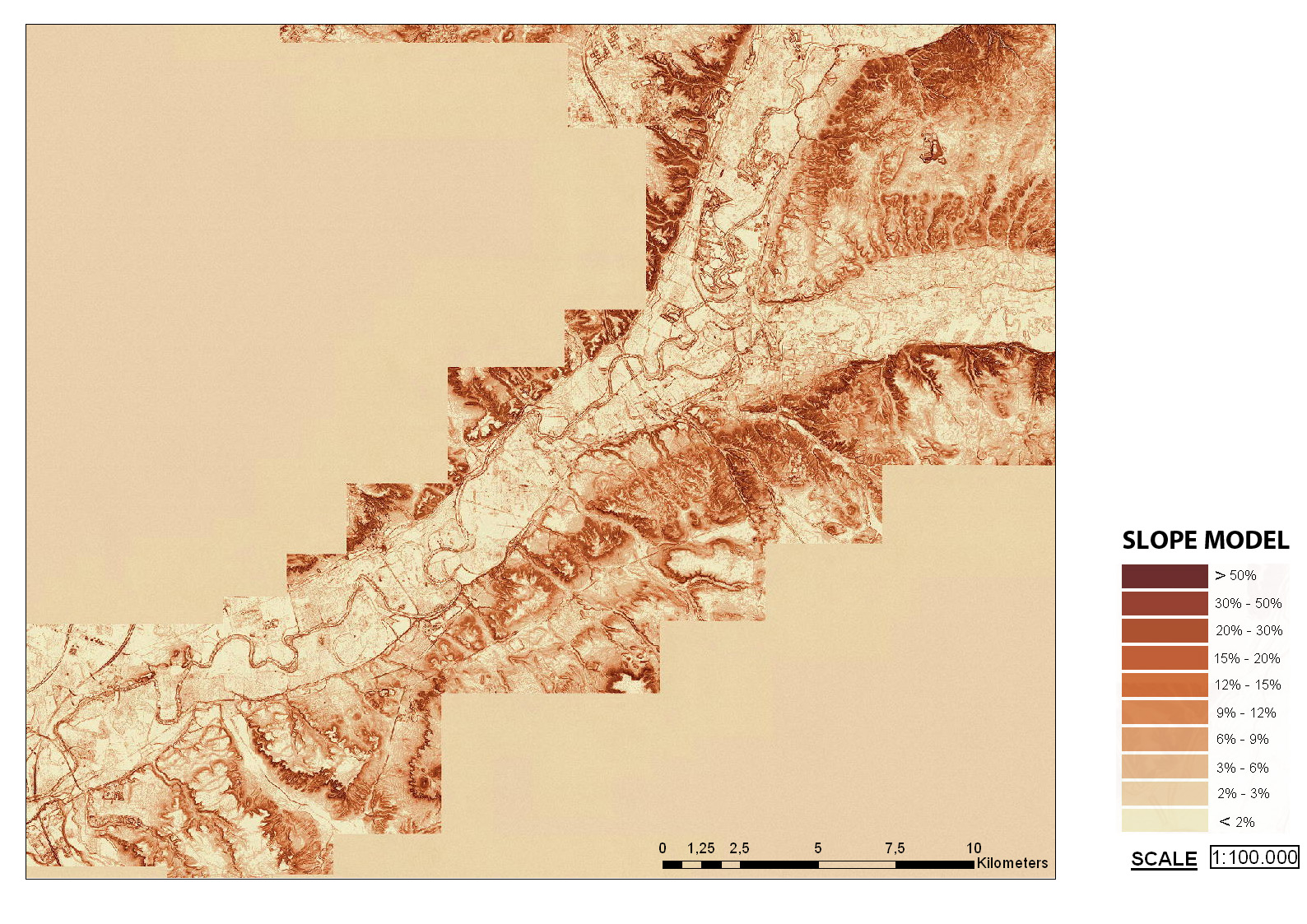
Clinometric model map 1 100000.jpg
(
file
)
643 KB
1
23:06, 14 January 2013
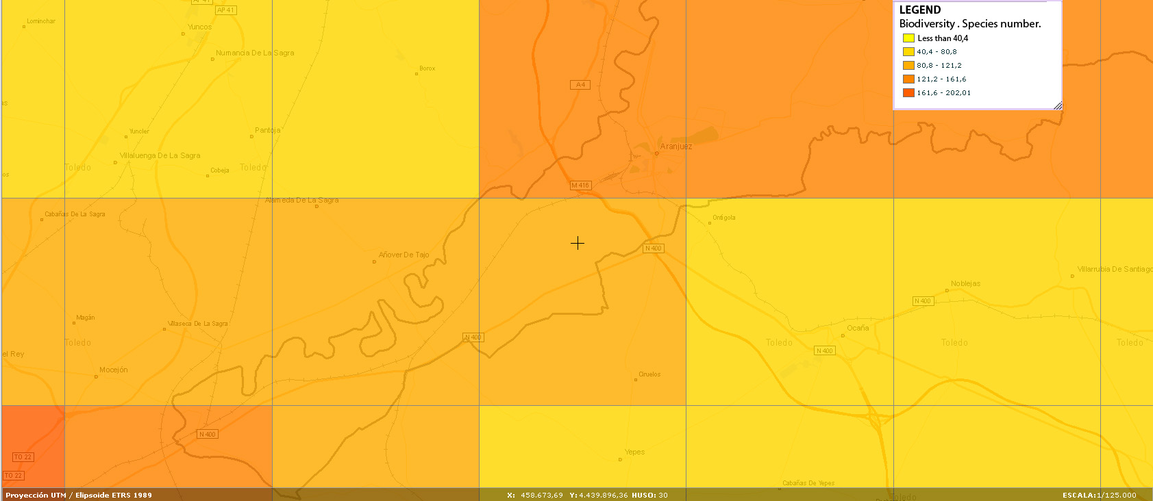
Biodiversity map species number.jpg
(
file
)
181 KB
1
23:06, 14 January 2013
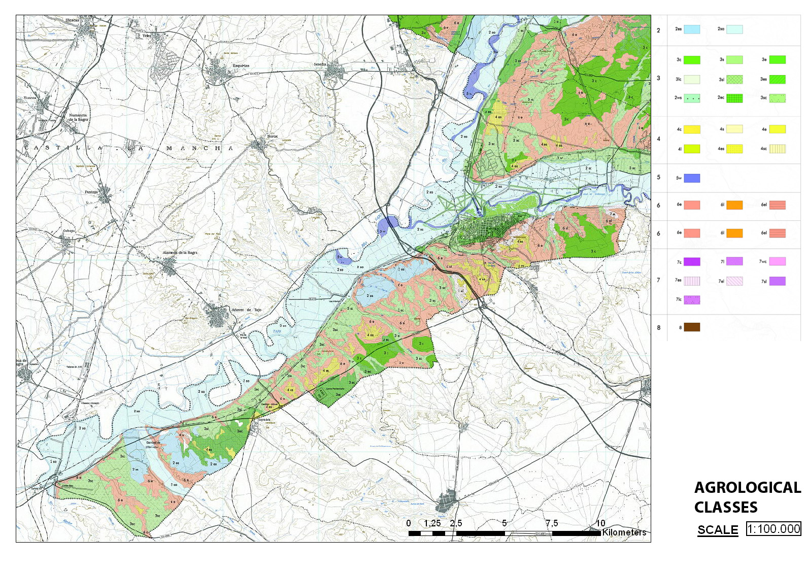
Agrologic classes map 1 100000.jpg
(
file
)
854 KB
1
23:01, 14 January 2013
4.scheme 04.jpg
(
file
)
1 MB
1
23:00, 14 January 2013
3.scheme 03.jpg
(
file
)
1.03 MB
1
22:59, 14 January 2013
2.scheme 02.jpg
(
file
)
913 KB
1
22:56, 14 January 2013
1.scheme 01.jpg
(
file
)
1.11 MB
1
22:09, 14 January 2013
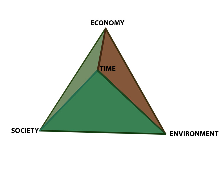
Sustainability tetrahedron 01.jpg
(
file
)
57 KB
1
01:19, 12 January 2013
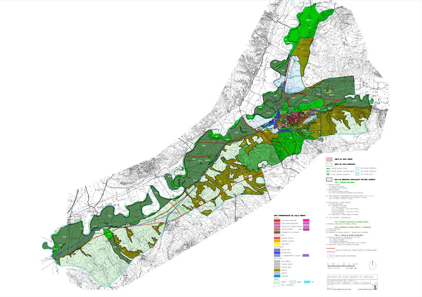
Aranjuez Land Categories.jpg
(
file
)
541 KB
1
01:11, 12 January 2013
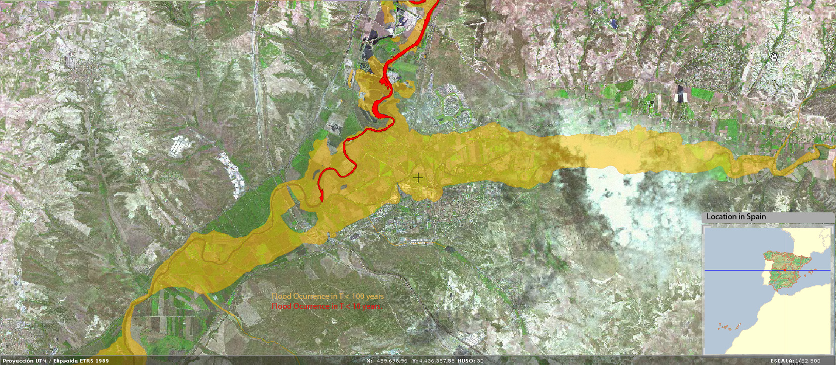
Mapa riesgo inundabilidad.jpg
(
file
)
752 KB
1
17:24, 11 January 2013
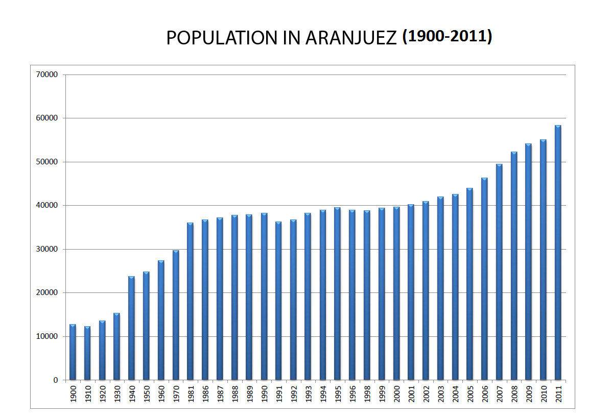
Population In Aranjuez.jpg
(
file
)
245 KB
1
17:20, 11 January 2013
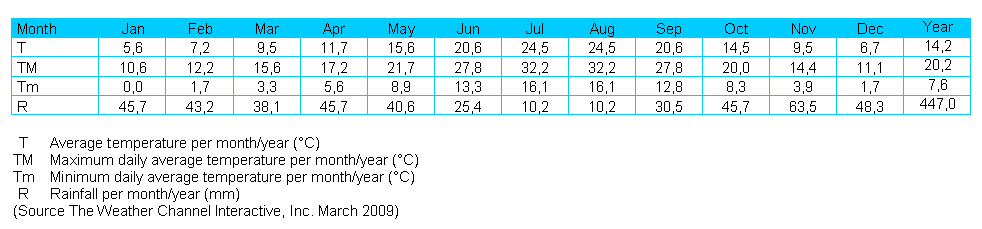
Average Local Data up to 2009.jpg
(
file
)
119 KB
1
14:00, 11 January 2013
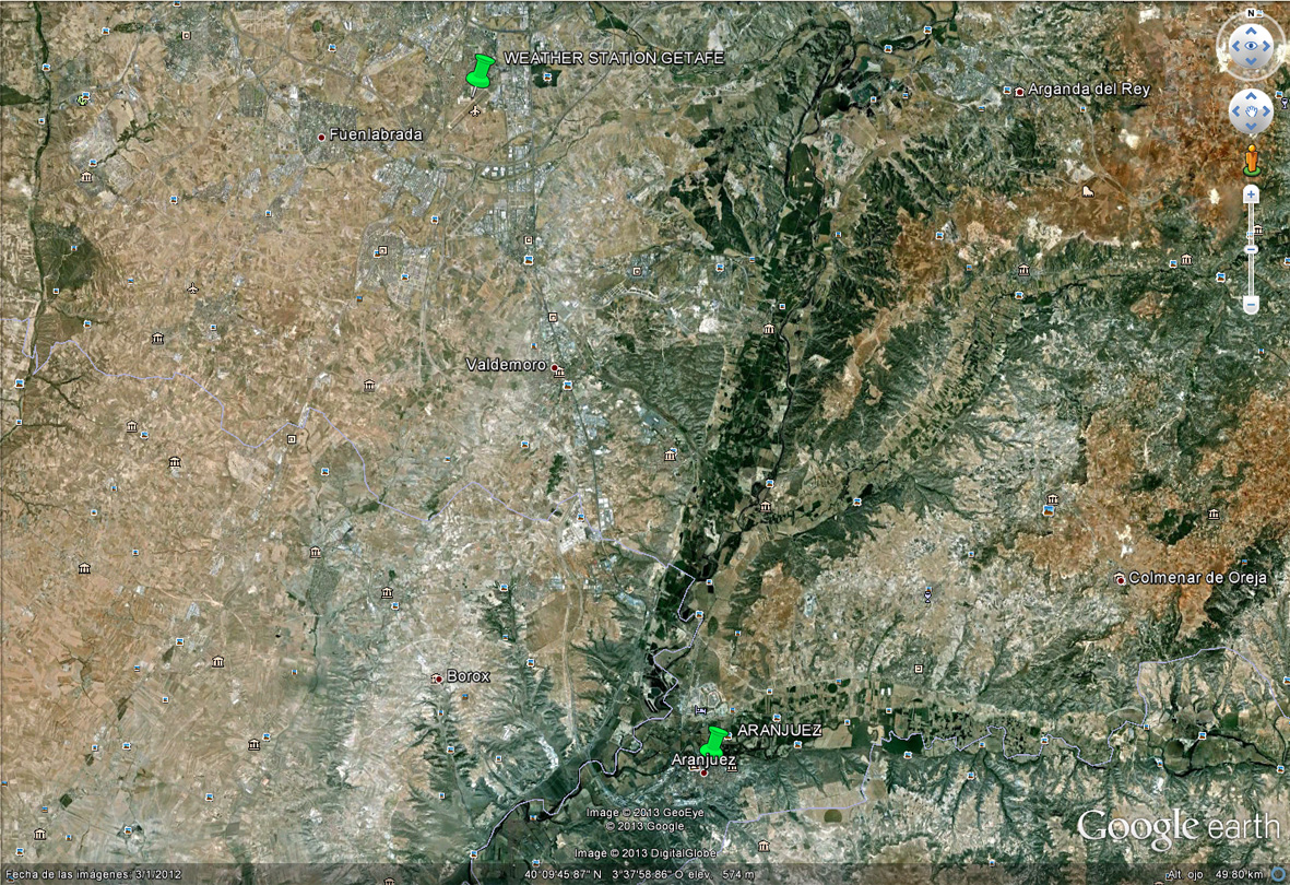
Aranjuez Getafe Location.jpg
(
file
)
681 KB
1
14:00, 11 January 2013
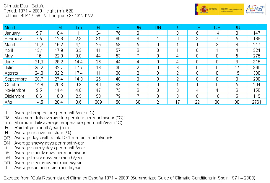
Climatic Data Getafe.jpg
(
file
)
270 KB
1
12:55, 11 January 2013
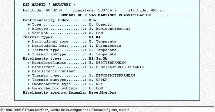
Summary of Rivas Martinez Classification 1933-1969 (37 years).jpg
(
file
)
129 KB
1
12:54, 11 January 2013
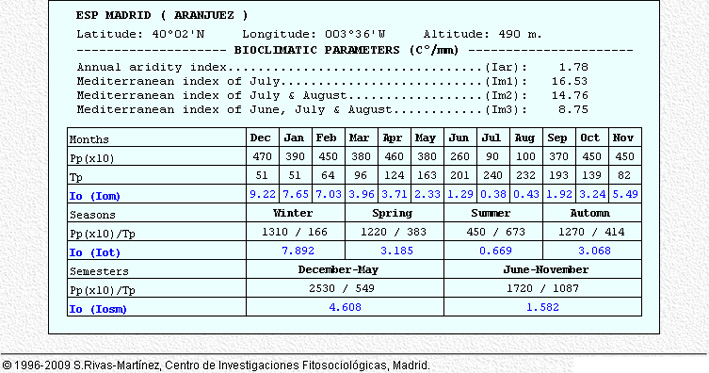
Bioclimatic Parameters 1933-1969 (37 years).jpg
(
file
)
160 KB
1
12:54, 11 January 2013
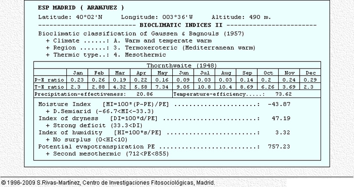
Bioclimatic Indexes 02 1933-1969 (37 years).jpg
(
file
)
153 KB
1
12:54, 11 January 2013
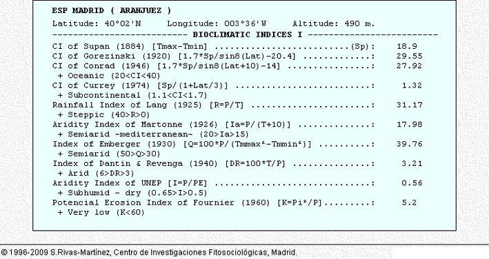
Bioclimatic Indexes 01 1933-1969 (37 years).jpg
(
file
)
145 KB
1
12:53, 11 January 2013
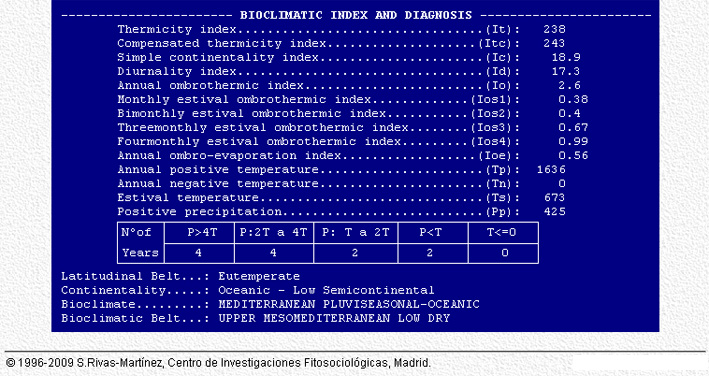
Bioclimatic Index and Diagnosis 1933-1969 (37 years).jpg
(
file
)
190 KB
1
12:53, 11 January 2013
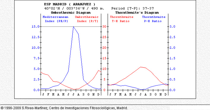
Ombrotermic Diagram 02 1933-1969 (37 years).jpg
(
file
)
114 KB
1
12:53, 11 January 2013
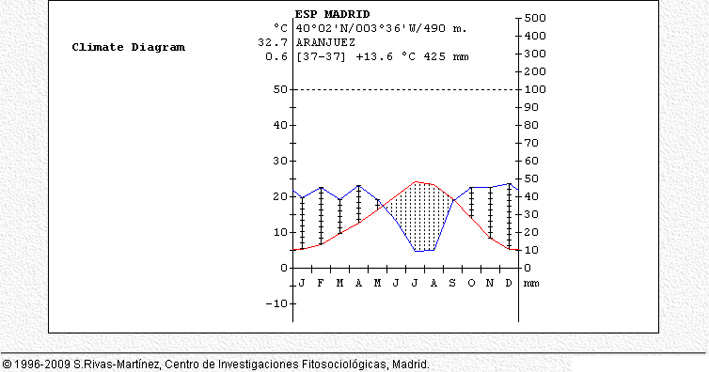
Climatic Diagram 02 1933-1969 (37 years).jpg
(
file
)
85 KB
1
12:52, 11 January 2013
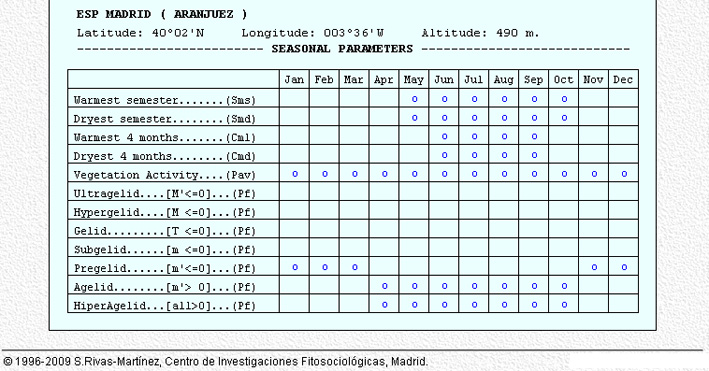
Seasonal Parameters 1933-1969 (37 years).jpg
(
file
)
147 KB
1
First page
Previous page
Next page
Last page
Navigation menu
Personal tools
Log in
Namespaces
Special page
English
Views
More
Search
General Information
Main Page
All Case Studies
All Recordings
Current Seminar
Design with Nature
Schedule
Assignment
Case Studies
Resources
Past Seminars
Urban Landscapes
Rural Landscapes
Participation
Cultural Landscapes
Landscape Concepts
Everyday Landscapes
Climate Change
Planting Design
Green Infrastructure
Landscape Democracy
Renewable Energy + Landscape Quality
Help + Tools
Recent changes
Random page
Help
Widgets+Templates
Tools
User contributions
Logs
View user groups
Special pages
Printable version


.jpg)
.jpg)
.jpg)
.jpg)
.jpg)
.jpg)
.jpg)
.jpg)