The Land of Buzau
Geopark's landscape: The Land of Buzau, Romania by Marius Dobre and Catalina Olariu
--> Back to Rural Landscapes Seminar Case Study List
Rationale: Why is this case study interesting?
- This case study is interesting because it presents an area that is going to be declared a Geopark. It is a case with many questions and also with lots of constraints because the territory is composed of economically disadvantaged areas but with a rich geological, biological and cultural potential, potential that it is not exploited. The combination of these elements leads to a specific local landscape. The geopark territory presents an almost optimum balance between natural and anthropic, balance that should be maintained.
- A geopark is a protected area, but also a tool to ensure sustainable development of the communities. This development includes also tourism, which can lead to destruction of the initial values, because of uneducated tourists and uneducated local communities.
Author's perspective
The project for The Land Of Buzau Geopark (Geoparcul Tinutul Buzaului) was and it is an interdisciplinary project, containing the contribution (intake/work) of geographers, geologists and also sociologists, botanists, anthropologists, etc. but entirely missing the landscapers. Initially, our involvement was voluntary as exhibition designers for the exhibitions to launch the project of the future geopark initiated by Buzau County council in collaboration with Geomedia Center (University of Bucharest), coordinated by Alexandru Andrasanu. In time, both the project coordinator and us, realized how important it was to involve someone that could deal with recovery and preservation of the landscape and also put it in value in the future projects of the Geopark, as a complementary axis to the strategic directions.
Landscape and/or urban context
- Biogeography and cultural features
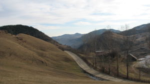
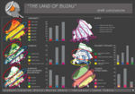
“The Land of Buzau” is located in Buzau county, being situated at the intersection of three biogeographical zones: biogeographical alpine region in north, biogeographical continental region in center and biogeographical steppe region in south. All of these regions have specific elements of flora and fauna, resulting a dynamic character of the territory.
The site of the case study presents interesting diversity of geological, biological and cultural elements.
Geodiversity: the region is known for the Muddy volcanoes, the amber from Colti, the Salt from Meledic, the Live fires, the petroleum springs, salty springs, the spectacular relief with the “Wall of the giants” or the stone fangs, the salt caves, fossils, or other geological structural elements less known.
Biodiversity: the north part of the geopark territory is situated in the mountain forest area (with species like: Fagus and Picea), while in central-southern area there are steppe elements, species like: Stipa (herb), gopher, Carpathian Scorpio, etc. Most of the territory is occupied with a mosaic of patches of forest, bushes, pastures and arable land (result of human activity).
Cultural diversity: the territory of the geopark is situated at the interference of three Romanian provinces loaning something from all, without denying its own identity: dominance of the countryside, village settlement along the river valleys, the existence of isolated hamlet with old traditions, the existence of powerful and ancient religious and monastic center, traditionally clothing, traditional architecture, cultural and arhitectural monuments, boundary stones and religious crosses, and also customs, legends, stories, festivals.
- Overall character
- History and dynamics
Cultural/social/political context
- Brief explanation of culture, political economy, legal framework
Illustration: Bullet points, image, background notes
History
- How did the area/project/plan at the focus of the case study evolve?
Illustration: Table or time line
Spatial analysis of area/project/plan
- What are the main structural features?
- How has it been shaped? Were there any critical decisions?
Illustration: Map/diagram/sketches photos and background notes
Analysis of program/function
- What are the main functional characteristics?
- How have they been expressed or incorporated?
Illustration: Map/diagram/sketches photos and background notes
Analysis of design/planning process
- How was the area/project/plan formulated and implemented?
- Were there any important consultations/collaborations?
Illustration: Map/diagram/sketches photos and background notes
Analysis of use/users
- How is the area/project/plan used and by whom?
- Is the use changing? Are there any issues?
Illustration: Map/diagram/sketches photos and background notes
Cross-cutting questions
Why is participation important?
By participation of local communities we can understand influence: over tourists and landscape, or involvement in the tourism infrastructure. When a tourist (outsider) crosses a landscape, all of his/her five senses are involved in the assessment of that specific landscape quality, resulting an own subjective perception of each tourist over that landscape (perceptions that can be positive, negative or neutral. There are certain aspects of the landscape in the Land of Buzau that, as tourist, you can not understand at the first look and so you can not say it is “nice” or “ugly”, they simply just raise questions. e.g.: the multitude of trinity/ crosses on hills and crossroads). After an interaction with the local community (assuming active participation of the local inhabitants) this perceptions can change and evolve (the tourist’s own subjective perception will combine with the subjective perception of the locals over the landscape and its elements). Therefore an active local community represents the connections between tourists and local landscape, contributing to the emotional links.
- local communities can promote local stories and legends about The Land of Buzau among the tourists; - the involvement of local communities in promoting their traditions and customs by creating cultural activities (eg: festivals, craftsmen workshops, etc.). - sustaining local communities to participate in the tourists accommodation programs: programs like: “Living with locals”, etc.
Therefore, the participation of local inhabitants in the process of conserving and adding value to the Land of Buzau landscapes is essential, also because the inhabitant of a place are the first responsible in keeping alive the local identity.
In which ways does tourism effect on the local identity?
Currently, in The Land of Buzau the tourism is not very intense (taking into account the surface of the entire geopark’s). But in some punctual areas, like Berca - Scortoasa (at the muddy volcanoes), the badly managed tourism activities are starting to have a negative impact on the local identity. This negative impact is a result of the changes that occur in the behavior of the local community: the locals begin to sell a false image/do things that in their opinion would be appreciated by tourist, to attract as many tourists as they can, earning money being their only priority. Therefore, we are dealing with uneducated local communities - they chose to build faster and cheaper, but in non-traditional ways, spoiling the whole charm of the place; - they promote “kitsch”, forgetting or not realizing that tourists come in The Land of Buzau for what it really represents: a rural area with incredible landscapes and stories (the “Land Story”, “Life Story” and “Human Story” – all of these intersected giving a unique landscape ); - they sacrifice the local landscape in order to earn money; they change or alter the resource that could give them considerable incomes, only if well managed and promoted! - from earning their existence with agriculture and handicraft they pass to a new industry which they can not master by themselves.
Which are the mutual influences for protected areas and cultural landscapes and tourism and how can they coexist?
What are the tasks of the management?
In order to ensure a good and responsible management of geological, natural, historical and cultural sites and also to value natural resources available on the Geopark’s territory, it is essential to assign areas with different type of protection, conservation and value scheme of the resources, as follows:
- strictly protected areas, having the a status of protection and preservation as a scientific reserve;
- buffer areas, having a role to ensure the protection of the above mentioned zone. In these zones certain limited activities of valuing available resources are allowed, in conformity with authorizations given by the Geopark’s administration;
- areas of sustainable use and development, that can develop economic incomes by traditional or modern practices, ecologically admitted and within the capacity of resources regeneration;
For each of these areas it is necessary to conceive different management plans.
Future development directions
- How is the area/project/plan evolving?
- Are there any future goals?
Illustration: Map/diagram/sketches photos and background notes
Peer reviews or critique
- Has the area/ project/plan been reviewed by academic or professional reviewers?
- What were their main evaluations?
Pleas add references, quotes...
Points of success and limitations
- What do you see as the main points of success and limitations of the area/project/plan?
Illustration: Summary table
What can be generalized from this case study?
- Are there any important theoretical insights?
Short statement plus background notes
Which research questions does it generate?
Short statement plus background notes
ANALYSIS PHASE - Image Gallery
- Yourimage.jpg
your image text
- Yourimage.jpg
your image text
- Yourimage.jpg
your image text
- Yourimage.jpg
your image text
- Yourimage.jpg
your image text
References
Please add literature, documentations and weblinks
About categories: You can add more categories with this tag: "", add your categories


