The Land of Buzau
Geopark's landscape: The Land of Buzau, Romania by Marius Dobre and Catalina Olariu
--> Back to Rural Landscapes Seminar Case Study List
Rationale: Why is this case study interesting?
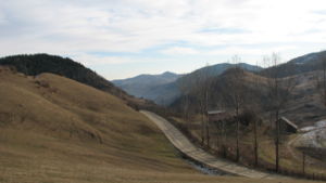
- This case study is interesting because it presents an area that is going to be declared a Geopark. It is a case with many questions and also with lots of constraints because the territory is composed of economically disadvantaged areas but with a rich geological, biological and cultural potential, potential that it is not exploited. The combination of these elements leads to a specific local landscape. The geopark territory presents an almost optimum balance between natural and anthropic, balance that should be maintained.
- A geopark is a protected area, but also a tool to ensure sustainable development of the communities. This development includes also tourism, which can lead to destruction of the initial values, because of uneducated tourists and uneducated local communities.
Author's perspective
- What theoretical or professional perspective do you bring to the case study? Please answer from your personal perspective.
Landscape and/or urban context
- Biogeography and cultural features
- Overall character
- History and dynamics
Cultural/social/political context
- Brief explanation of culture, political economy, legal framework
Illustration: Bullet points, image, background notes
History
- How did the area/project/plan at the focus of the case study evolve?
Illustration: Table or time line
Spatial analysis of area/project/plan
- What are the main structural features?
- How has it been shaped? Were there any critical decisions?
Illustration: Map/diagram/sketches photos and background notes
Analysis of program/function
- What are the main functional characteristics?
- How have they been expressed or incorporated?
Illustration: Map/diagram/sketches photos and background notes
Analysis of design/planning process
- How was the area/project/plan formulated and implemented?
- Were there any important consultations/collaborations?
Illustration: Map/diagram/sketches photos and background notes
Analysis of use/users
- How is the area/project/plan used and by whom?
- Is the use changing? Are there any issues?
Illustration: Map/diagram/sketches photos and background notes
Future development directions
- How is the area/project/plan evolving?
- Are there any future goals?
Illustration: Map/diagram/sketches photos and background notes
Peer reviews or critique
- Has the area/ project/plan been reviewed by academic or professional reviewers?
- What were their main evaluations?
Pleas add references, quotes...
Points of success and limitations
- What do you see as the main points of success and limitations of the area/project/plan?
Illustration: Summary table
What can be generalized from this case study?
- Are there any important theoretical insights?
Short statement plus background notes
Which research questions does it generate?
Short statement plus background notes
Image Gallery
- Yourimage.jpg
your image text
- Yourimage.jpg
your image text
- Yourimage.jpg
your image text
- Yourimage.jpg
your image text
- Yourimage.jpg
your image text
References
Please add literature, documentations and weblinks
About categories: You can add more categories with this tag: "", add your categories


