Green Infrastructure 2014 Group B - Case Study 4
---> back to group page working group B
please add your title here
| Name | Evin River Valley | |||||||||||
| Country | Iran | |||||||||||
| City | Tehran | |||||||||||
| Authors | Sanaz Emamverdi | |||||||||||

| ||||||||||||
| {{#widget:GoogleMaps | width=300 | height=240 | lat=35.753166 | lng=51.385061 | zoom=13 | centermarker=yes | maptypecontrol=yes | overviewmapcontrol=yes | largemapcontrol=yes | scalecontrol=yes
}} | ||
Rationale: Why is this case interesting?
When we move from East to West of Tehran,seven major river valleys can be seen. One of the main valleys is Evin- Darakeh river valley. River valleys in the north of the city are as deep valleys, but when they flow through the city, for the lower depth and older history of urban texture, are almost as cored cement canals. From ecological viewpoint, river-valley ecosystem is a part of the space on the ground that meets a specific arrangement of topography, land cover, hydrography, and built environment. The slopes of Alborz Mountain Range as a main origin for establishment of Tehran City provide the citizens with tourist resorts. Unsustainable development regardless of environmental considerations in Tehran in the last three decades has led to degradation of mountain ecosystem in the northern Tehran and its surrounding plains. Considering that mountains and river valleys are natural heritage and a vital source of water supply, their conservation must be the responsibility of all society members. Tehran Master Plan highly emphasis on the importance and necessity of maintaining and developing river-valleys in Tehran as a respiratory lung of the city. They are fertile habitats that support a variety of flora and fauna and play significant roles as catchments and as places for energy and wind flows to remove air pollution from the city environment, providing opportunity for connection with the natural upland–lowland context. Therefore, the advantages of protection and using potential of ecological systems of this river-valley, providing extensive for public recreational within the urban and rural areas, providing economic benefits and protection of cultural values and heritage.
Author's perspective
I have graduated with a bachelor’s degree and I have been working in a consulting firm. I have been interested in landscape and urban design. This site is located in the capital city of Iran which I have spent most of my life there. 7 river-valleys of Tehran always were the landmarks of this city which nowadays they have been lost among the buildings and pollution. As a matter of fact, this area has the range of potentials for green infrastructure.
Landscape and/or urban context of your case
- Biogeography, cultural features, overall character, history and dynamics
- Illustrations: maps; sketches; short descriptive analyses
Biogeography
The seven north–south river valleys are characteristic of natural corridors of Tehran’s landscape structure. They are fertile habitats that support a variety of flora and fauna and play significant roles as catchments and as places for energy and wind flows to remove air pollutions from the city environment, providing opportunity for connection with the natural upland–lowland context. Upland areas benefit from much better conditions than lowlands due to less environmental destruction caused by urban development. The natural hydrological corridors along the river valleys face more destructive factors and have less ecological functions from north to south because of their structural modifications. Natural corridors connect many natural and built patches scattered along them. These corridors are mostly oriented in a north–south direction. The east–west ecological connections are restricted due to the morphological structure of city.
Climate
Tehran features a semi-arid, continental climate. Tehran's climate is largely defined by its geographic location, with the towering Alborz Mountains to its north and the central desert to the south. It can be generally described as mild in the spring, hot and dry in the summer, pleasant in the autumn, and cold in the winter. As a large city with significant differences in elevation among various districts, the weather is often cooler in the hilly north as compared to the flat southern part of Tehran. Summer is usually hot and dry with very little rain, but relative humidity is generally low and the nights are cool. The majority of the light annual precipitation occurs from late-autumn to mid-spring, but no one month is particularly wet. The hottest month is July (min. temp. 26°C, max. temp. 36°C) and the coldest is January (min. temp. -1°C, max. temp. 8°C). From the south toward the north, the altitude increases, from 900 meters in low areas to 1800 meters. This difference in height results in differences in weather.
Overall character
Tehran consists of three sections: mountainous, piedmont and desert. The mountainous section includes peaks over 1800 meters. The Alborz mountain chain in the north of the City, the river valleys of the Darabad, Golab Dare, Farahzad, Kan, Evin and the low hills and urban forest parks (e.g., Lavizan, Sorkhe hesar, chitgar, Quchak) are examples of primary landscape elements which are intrinsically linked with Tehran ecological network, and provide an essential sense of place which can be appreciated from many vantage points within the city. There are other more local landscape elements that can help give areas a sense of place and which can be referred to as secondary landscape elements. Among other landscape features are natural and manmade patches, which give Tehran its unique characteristics and residential and touristic values. One of its most important natural patches is northern heights which endow the city with a special natural characteristic. From the south toward the north, the altitude increases, from 900 meters in low areas to 1800 meters. This difference in height results in differences in weather, better vegetation and beautiful countryside in the north. As one move from the south to the north, where are many changes in the natural environmental conditions, property value, access to services and social conditions.
History
Tochal peak is 3900 meters in altitude. Its main ridges overlook the southern slopes and Tehran plain, and forms small drainage basins. The rivers flowing in these basins are the life veins of the city. Water constantly flows in these basins and probably the main reason why Tehran developed is its hydro morphological conditions influenced by its northern heights. The most important basin, which covers the southern slopes of the northern heights of the city, include: Kan, Farahzad, Darakeh and Darband basins.
- Illustrations
-
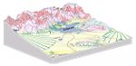 Morphology of Tehran
 -
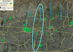 Tehran's landscape network
 -
your visual
-
your visual


Analytical drawings
- Please use analytical drawing for visualising the conflicts/potentials of your site
- Analytical Drawings
-
your drawing
-
your drawing
-
your drawing
-
your drawing
Green Infrastructure benefits for this site
Look again at the multiple benefits of green infrastructure - what could be achieved in your site and which are most relevant?
First, by revival of this river valley and beside greenery, they can act as air filters and city lungs. They play the role efficiency in order to reduce the air pollution. Moreover, by preparing a proper foundation for flowing water, there would be no more threatening for the water contamination. Second, fewer prices would be spent on transportation system and also less time would be wasted to arrive the recreational areas in north of Tehran, especially for near neighborhood and residential areas. Besides we would not be charged for the conservation of plants and green spaces when we put them on their natural structure and for planting because we have appropriate soil, water and plants. Third, by this revitalization, river-valleys as the only natural heritages in Alborz foothill would return to people’s life, like what Tehran has been before. It can also be the revival of people’s collective memory, original historical views and increasing the city legibility. Therefore, by revitalizing of the river-valley as a linear green infrastructure from north to south of the city, we have ecological benefits, economic benefits and social and cultural benefits together, which they are the main aspects of sustainable development.
Potential for multifunctionality
Green infrastructure has typically multiple functions. What could be achieved for your site in this respect?
River valleys and green urban spaces by providing the multi-functional spaces such as recreational, aesthetical, infrastructural, social and cultural …, have the potential to be used as one of the most efficient tools to reduce the environmental issues. This site has the opportunity to integrate river-valleys and green spaces in a network of multi-functional areas. Then, in order to maintain the idea of reviving this river-valley and green spaces we can establish parallel linear park based on river-valley, planning and allocating appropriate situation for streets, sidewalks, bicycle trail and other necessary facilities, assigning clean and public transportation into the river-valleys to achieve a proper connectivity and using vernacular plants of Tehran in valley to maintain the original nature and many other strategies. Therefore, it could result in reducing and improving a lot of problems such as water and sewage contamination, air pollution, sonic pollution and insecurity ….
Projective drawings
- How would you like this case to change in the near future? (in 1-2 years)
In the near future I hope to see:
- Preventing contamination of water along the river and maintaining the water quality by designing waste water pathways and preventing it from entering the river
- Improving the river status and coping with flood risk especially in rainy seasons by: creating protective green space on the body of deep slopes - modification reconstruction of the river wall by natural elements
- And how could it look like in 10-15 years?
In 10-15 years I would like to see:
- Maintaining and enhancing natural and recreational attractions by: protection of natural landscapes in the study area – identification and organization of elements with recreational values
- Recreational use of river potentials by: increasing the quality of land cover by maintenance management – protection of the gardens existing alongside the river path
- Projective Drawings
-
projective drawing
-
projective drawing
-
projective drawing
-
projective drawing
Summary and conclusion
During recent years, the municipality of Tehran began to work on rehabilitation of river valleys. Three projects now are completed or near completion. This great movement can improve and develop the quality and quantity of Tehran environment, which is in a dangerous and catastrophic condition, but only if planners, designers and other decision makers pay attention to all aspects of rehabilitation, especially ecological and environmental principles like connectivity, coherent hydrology, compatible plantation, controlled interfering, considering buffer zones and so on. The river valleys often are a neglected part of Tehran’s urban landscape and most of them have tragic stories and inelegant features. Planning for their conservation and restoration should start for the remaining and unprotected rivers quickly because Tehran is the city of river valleys!
To sum up, southern slope of Alborz Mountain is one of the valuable natural heritage areas in Tehran. It is a traditional promenade for Tehran citizens and prevent sprawl of the city towards north direction. River-valleys upstream of Tehran have a determining role in ecotourism development in the city. Sustainable design of corridors and patches in the site provides the possibility of sustainable development of tourism activities of the river-valley.
Image Gallery
Please add further images/photos here
- Image Gallery
-
your image text
-
your image text
-
your image text
-
your image text
-
your image text
-
your image text
-
your image text
-
your image text
References
- please add your references here
About categories: You can add more categories with this tag: "", add your categories