File:Geomorphology-wageningen-150K.jpg
No higher resolution available.
Geomorphology-wageningen-150K.jpg (700 × 498 pixels, file size: 151 KB, MIME type: image/jpeg)
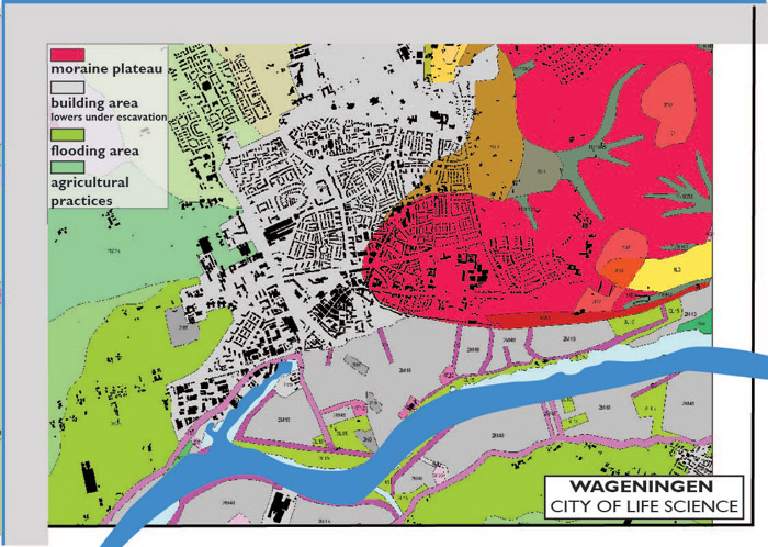
The city is continuously expanding leading to a decreasing number of permeable surfaces. From West to East, the soil layers are less fertile, therefore less used for agriculture and urban agriculture practices. Within the city the permeability reached 0 in certain places and squares or proximity spaces.
File history
Click on a date/time to view the file as it appeared at that time.
| Date/Time | Thumbnail | Dimensions | User | Comment | |
|---|---|---|---|---|---|
| current | 14:39, 13 December 2011 | | 700 × 498 (151 KB) | Oana Baloi (talk | contribs) | The city is continuously expanding leading to a decreasing number of permeable surfaces. From West to East, the soil layers are less fertile, therefore less used for agriculture and urban agriculture practices. Within the city the permeability reached 0 i |
You cannot overwrite this file.
File usage
There are no pages that use this file.