Uploads by Totha
Jump to navigation
Jump to search
This special page shows all uploaded files.
| Date | Name | Thumbnail | Size | Description | Versions |
|---|---|---|---|---|---|
| 10:22, 25 November 2014 | LandscapeContextAndStructure1950.jpeg (file) | 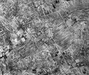 |
0 bytes | This image shows the landscape context and structure of the site in 1950, just before collectivization of agriculture. © Attila Tóth 2014 | 1 |
| 14:02, 24 November 2014 | GreenInfrastructureStreetscapeII.jpeg (file) | 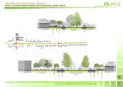 |
0 bytes | 1 | |
| 14:01, 24 November 2014 | GreenInfrastructureStreetscape.jpeg (file) | 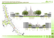 |
0 bytes | 1 | |
| 13:57, 24 November 2014 | GreenInfrastructureCore.jpg (file) | 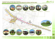 |
1.47 MB | 1 | |
| 13:40, 24 November 2014 | LandscapeHistory19.jpeg (file) | 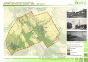 |
0 bytes | 1 | |
| 13:37, 24 November 2014 | LandscapeHistory18thCentury.jpg (file) | 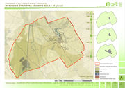 |
1.23 MB | 1 | |
| 13:24, 24 November 2014 | LinkageSettlementLandscape.jpeg (file) | 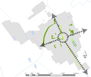 |
0 bytes | This analytical scheme defines the linear green space situated in the village centre as the core element of the local urban green infrastructure. The arrows symbolise the linking function of local green infrastructure (linking the settlement with the s... | 1 |
| 13:06, 24 November 2014 | GreenSpaceConnectivitySettlementLandscapeTardoskedd.jpeg (file) | 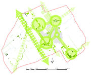 |
0 bytes | This analytical scheme emphasises the core elements of the local green infrastructure (green spaces of a higher ecological stability or spatially/areally most extensive sites - in green circles). These are situated around the settlement. The linkages b... | 1 |
| 12:43, 24 November 2014 | PotentialsGreenInfrastructureTardoskedd.jpeg (file) | 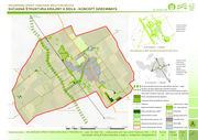 |
0 bytes | This analysis defines the main components of the green infrastructure which are predominantly of linear character due to the agricultural landscape that they are embedded into. There is a huge potential of local tourism or agritourism improvement and d... | 1 |
| 15:38, 18 November 2014 | Current Landscape Structure - Layer Maps.jpeg (file) | 1.32 MB | These thematic layer maps extract different landscape features from the current landscape structure © Attila Tóth 2012 | 3 | |
| 15:24, 18 November 2014 | Changes in the Landscape Structure 18th-21st Century.jpeg (file) |  |
0 bytes | Changes in the landscape and settlements structure from the 18th till the 21st century depicted by a timeline. © Attila Tóth 2014 | 1 |
| 15:20, 18 November 2014 | Green Infrastructure of Tvrdošovce in the Micro-Regional Context.jpeg (file) | 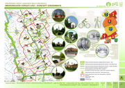 |
0 bytes | Green Infrastructure of the site embeded in the context of the micro-region Cergát Váh which consists of 7 rural settlements of the Nitra Region (administrative context) and the Danube Lowland (geographic context) © Attila Tóth 2012 | 1 |
| 15:27, 14 November 2014 | Town Centre as the Green Infrastructure Core.jpeg (file) | 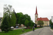 |
0 bytes | The core of the local urban green infrastructure is represented by a linear green space in the central part of the historic streetscape in the town centre. This site has a unique spatial quality & historic legacy as it relates to urban design of the Hi... | 1 |