Unused files
Jump to navigation
Jump to search
The following files exist but are not embedded in any page. Please note that other web sites may link to a file with a direct URL, and so may still be listed here despite being in active use.
Showing below up to 50 results in range #1,501 to #1,550.
- The Relationship - post sem.png 3,149 × 1,277; 607 KB
- Manfredi Anzalone 07.02.2014.jpg 3,545 × 2,278; 598 KB
- Concept map Giuseppe Mineo.jpg 2,738 × 1,708; 424 KB
- ِAmman Districts.jpg 1,181 × 886; 0 bytes
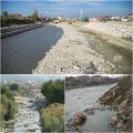
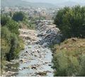
- River of North Tirana, Albania.jpg 960 × 960; 211 KB
- River of North Tirana, Albania 1.jpg 953 × 529; 110 KB
- River of North Tirana, Albania 2.jpg 466 × 422; 60 KB
- Site.jpg 555 × 374; 54 KB
- 2013-01-16 let03.jpg 400 × 266; 0 bytes
- Darsena2.png 897 × 649; 1.05 MB
- Landuse Tirana River.jpg 700 × 273; 31 KB
- Topography of Tirana Riverside.jpg 705 × 292; 66 KB
- Shahar chay.jpg 448 × 336; 0 bytes
- Atunrase Estate Site location.png 960 × 720; 919 KB
- Atunrase Estate Site location 1.jpg 768 × 480; 106 KB
- Atunrase Estate Site location 2.png 768 × 480; 610 KB
- A coruña mapa.jpg 1,996 × 1,256; 496 KB
- Atunrase Site 4.jpg 881 × 570; 15 KB
- Atunrase Site 5.jpg 960 × 720; 104 KB
- Atunrase 7.jpg 788 × 524; 21 KB
- Main River Valleys.jpg 1,930 × 1,404; 1.29 MB
- Connection of Open Spaces by the River.jpg 1,930 × 1,404; 1.25 MB
- Main Roads Crossing The River.jpg 1,930 × 1,404; 1.31 MB
- Current Landscape Structure - Layer Maps.jpeg 0 × 0; 1.32 MB
- Riu Girona Description2.jpg 4,961 × 3,508; 1.97 MB
- Ohrid area.jpg 4,650 × 2,788; 1.18 MB
- Portada.jpg 390 × 264; 81 KB
- IMG 0177.JPG 3,264 × 2,448; 1.85 MB
- Vistaplazavenezuela.JPG 3,264 × 2,448; 0 bytes
- Darband River Valley-Map.jpg 965 × 702; 158 KB
- Effects of Covering the Bed of the River on Environment.jpg 992 × 1,403; 244 KB
- Hashemie Map.jpg 884 × 610; 211 KB
- Most.jpeg 1,760 × 1,179; 0 bytes
- ZellcharacteristiciMage.jpg 640 × 480; 150 KB
- Atzenbach1.jpg 2,592 × 1,936; 1.79 MB
- Tirana river land use.jpg 706 × 292; 93 KB
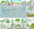
- Green spaces and types of trees.jpg 1,266 × 1,058; 896 KB
- Zlotuptaka.jpg 980 × 590; 288 KB
- City river.jpeg 912 × 588; 191 KB
- Shahar chay 1.jpeg 1,024 × 861; 0 bytes
- Work Group C concept map.jpg 4,961 × 3,425; 861 KB
- Green spaces Tirana North.jpg 1,266 × 1,058; 824 KB
- Green spaces Tirana North plan.jpg 2,000 × 907; 497 KB
- Masterplan of Tirana river proposal.jpg 711 × 537; 49 KB
- Figure 8 Photos of the polluted river area, 2012..jpg 710 × 127; 0 bytes
- Swot river of Tirana.jpg 1,150 × 531; 205 KB
- Reg04 1.png 284 × 191; 43 KB
- Map.png 1,203 × 571; 478 KB
- Marklenh.jpg 1,366 × 1,033; 1.47 MB
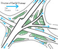
- Abdali Rain Drainage.jpg 799 × 669; 209 KB


