The Land of Buzau: Difference between revisions
| Line 40: | Line 40: | ||
=== Landscape and/or urban context=== | === Landscape and/or urban context=== | ||
*Biogeography and cultural features | *Biogeography and cultural features | ||
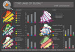
“The Land of Buzau” is located in Buzau county, being situated at the intersection of three biogeographical zones: biogeographical alpine region in north, biogeographical continental region in center and biogeographical steppe region in south. All of these regions have specific elements of flora and fauna, resulting a dynamic character of the territory. | “The Land of Buzau” is located in Buzau county, being situated at the intersection of three biogeographical zones: biogeographical alpine region in north, biogeographical continental region in center and biogeographical steppe region in south. All of these regions have specific elements of flora and fauna, resulting a dynamic character of the territory. | ||
Geodiversity: the region is known for the Muddy volcanoes, the amber from Colti, the Salt from Meledic, the Live fires, the petroleum springs, salty springs, the spectacular relief with the “Wall of the giants” or the stone fangs, the salt caves, fossils, or other geological structural elements less known. | The site of the case study presents interesting diversity of geological, biological and cultural elements. | ||
''Geodiversity'': the region is known for the Muddy volcanoes, the amber from Colti, the Salt from Meledic, the Live fires, the petroleum springs, salty springs, the spectacular relief with the “Wall of the giants” or the stone fangs, the salt caves, fossils, or other geological structural elements less known. | |||
''Biodiversity'': the north part of the geopark territory is situated in the mountain forest area (with species like: Fagus and Picea), while in central-southern area there are steppe elements, species like: Stipa (herb), gopher, Carpathian Scorpio, etc. Most of the territory is occupied with a mosaic of patches of forest, bushes, pastures and arable land (result of human activity). | |||
''Cultural diversity'': the territory of the geopark is situated at the interference of three Romanian provinces loaning something from all, without denying its own identity: dominance of the countryside, village settlement along the river valleys, the existence of isolated hamlet with old traditions, the existence of powerful and ancient religious and monastic center, traditionally clothing, traditional architecture, cultural and arhitectural monuments, boundary stones and religious crosses, and also customs, legends, stories, festivals. | |||
*Overall character | *Overall character | ||
Revision as of 13:28, 27 May 2009
Geopark's landscape: The Land of Buzau, Romania by Marius Dobre and Catalina Olariu
--> Back to Rural Landscapes Seminar Case Study List
| Name | The Land of Buzau | |
| Location | Buzau County | |
| Country | Romania | |
| Topic | Landscape planning and Rural developement | |
| Office | University of Agricultural Science, departament of Landscape Architecture | |
| Case study author(s) | Catalina Olariu and Marius Dobre | |

| ||
| <googlemap version="0.9" lat="45.338633" lon="26.732483" type="terrain" zoom="9" width="300" height="200" scale="yes" overview="yes">
45.3917, 26.533356, The center of the Geopark "The Land of Buzau" </googlemap> http:// 64.947899, -19.196045 </googlemap> | ||
Rationale: Why is this case study interesting?
- This case study is interesting because it presents an area that is going to be declared a Geopark. It is a case with many questions and also with lots of constraints because the territory is composed of economically disadvantaged areas but with a rich geological, biological and cultural potential, potential that it is not exploited. The combination of these elements leads to a specific local landscape. The geopark territory presents an almost optimum balance between natural and anthropic, balance that should be maintained.
- A geopark is a protected area, but also a tool to ensure sustainable development of the communities. This development includes also tourism, which can lead to destruction of the initial values, because of uneducated tourists and uneducated local communities.
Author's perspective
- What theoretical or professional perspective do you bring to the case study? Please answer from your personal perspective.
Landscape and/or urban context
- Biogeography and cultural features
“The Land of Buzau” is located in Buzau county, being situated at the intersection of three biogeographical zones: biogeographical alpine region in north, biogeographical continental region in center and biogeographical steppe region in south. All of these regions have specific elements of flora and fauna, resulting a dynamic character of the territory.

The site of the case study presents interesting diversity of geological, biological and cultural elements.
Geodiversity: the region is known for the Muddy volcanoes,  the amber from Colti,  the Salt from Meledic, the Live fires, the petroleum springs, salty springs, the spectacular relief with the “Wall of the giants” or the stone fangs, the salt caves, fossils, or other geological structural elements less known.

Biodiversity: the north part of the geopark territory is situated in the mountain forest area (with species like: Fagus and Picea), while in central-southern area there are steppe elements, species like: Stipa (herb), gopher, Carpathian Scorpio, etc. Most of the territory is occupied with a mosaic of patches of forest, bushes, pastures and arable land (result of human activity).

Cultural diversity: the territory of the geopark is situated at the interference of three Romanian provinces loaning something from all, without denying  its own identity: dominance of the countryside, village settlement along the river valleys, the existence of isolated hamlet with old traditions, the existence of powerful and ancient religious and monastic center, traditionally clothing, traditional architecture, cultural and arhitectural monuments, boundary stones and religious crosses, and also customs, legends, stories, festivals.
- Overall character
- History and dynamics
Cultural/social/political context
- Brief explanation of culture, political economy, legal framework
Illustration: Bullet points, image, background notes
History
- How did the area/project/plan at the focus of the case study evolve?
Illustration: Table or time line
Spatial analysis of area/project/plan
- What are the main structural features?
- How has it been shaped? Were there any critical decisions?
Illustration: Map/diagram/sketches photos and background notes
Analysis of program/function
- What are the main functional characteristics?
- How have they been expressed or incorporated?
Illustration: Map/diagram/sketches photos and background notes
Analysis of design/planning process
- How was the area/project/plan formulated and implemented?
- Were there any important consultations/collaborations?
Illustration: Map/diagram/sketches photos and background notes
Analysis of use/users
- How is the area/project/plan used and by whom?
- Is the use changing? Are there any issues?
Illustration: Map/diagram/sketches photos and background notes
Future development directions
- How is the area/project/plan evolving?
- Are there any future goals?
Illustration: Map/diagram/sketches photos and background notes
Peer reviews or critique
- Has the area/ project/plan been reviewed by academic or professional reviewers?
- What were their main evaluations?
Pleas add references, quotes...
Points of success and limitations
- What do you see as the main points of success and limitations of the area/project/plan?
Illustration: Summary table
What can be generalized from this case study?
- Are there any important theoretical insights?
Short statement plus background notes
Which research questions does it generate?
Short statement plus background notes
Image Gallery
-
 The location of the site in Europe and European Geoparks Network context
 -
 Why here...? because there is geodiversity
 -
 Why here...? because there is biodiversity
 -
 Why here...? because there is cultural diversity 1
 -
 Why here...? because there is cultural diversity 2
 -
 The rivers
 -
 The forest's vegetation
 -
 The hayfields and pasture vegetation
 -
 Economical surfaces
 -
 Salty soils and Rockery vegetation
 -
 Tourist objectives
 -
 Landscape anatomy - linear villages
 -
 Landscape anatomy - predominates natural
 -
 Conclusions
 -
your image text
-
your image text
-
your image text
-
your image text
-
your image text


2.jpg)


References
Please add literature, documentations and weblinks
About categories: You can add more categories with this tag: "", add your categories