File:Mirijevo Wider Context.jpg: Difference between revisions
Jump to navigation
Jump to search
Stefanoficm (talk | contribs) This map is representing position of the study site in relation to Belgrade. Mirijevo is located around 7 km from city center on the eastern outskirts of Belgrade's urban zone. The neighborhood is developed in the valley of Mirijevski potok (creek whic... |
Stefanoficm (talk | contribs) Stefanoficm uploaded a new version of "File:Mirijevo Wider Context.jpg" |
(No difference)
| |
Revision as of 14:19, 27 November 2014
This map is representing position of the study site in relation to Belgrade. Mirijevo is located around 7 km from city center on the eastern outskirts of Belgrade's urban zone. The neighborhood is developed in the valley of Mirijevski potok (creek which is a right tributary to the Danube). Terrain has valley shape, with highest countour of 200 m above see level. Lowest contour is at 100 m above see level, where the Mirijevo stream is situated. West-facing slopes and east-facing slopes are predominant.
File history
Click on a date/time to view the file as it appeared at that time.
| Date/Time | Thumbnail | Dimensions | User | Comment | |
|---|---|---|---|---|---|
| current | 10:05, 28 November 2014 | 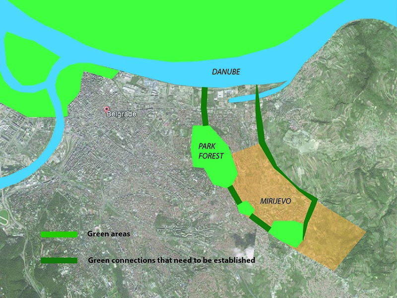 | 800 × 600 (723 KB) | Stefanoficm (talk | contribs) | This image shows green and blue areas in the vicinity of study site. It is important to connect them with green corridors, so they can make functional system. For wildlife protection, such corridors should be 20 m wide (Austin, 2014), although further... |
| 14:24, 27 November 2014 |  | 800 × 631 (779 KB) | Stefanoficm (talk | contribs) | This map is representing position of the study site in relation to Belgrade. Mirijevo is located around 7 km from city center on the eastern outskirts of Belgrade's urban zone. The neighborhood is developed in the valley of Mirijevski potok (creek whic... | |
| 14:22, 27 November 2014 |  | 1,068 × 842 (890 KB) | Stefanoficm (talk | contribs) | Reverted to version as of 14:11, 27 November 2014 | |
| 14:19, 27 November 2014 | 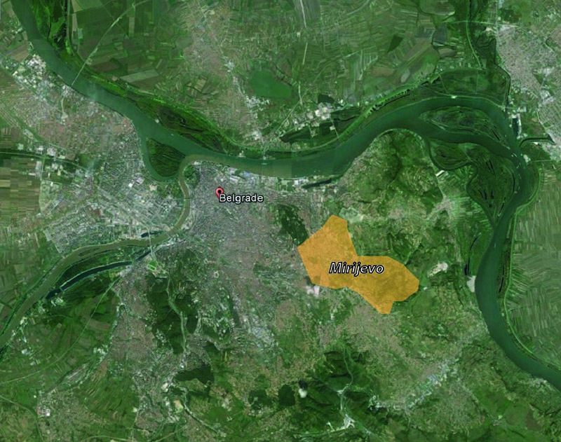 | 800 × 631 (779 KB) | Stefanoficm (talk | contribs) | ||
| 14:11, 27 November 2014 |  | 1,068 × 842 (890 KB) | Stefanoficm (talk | contribs) | This map is representing position of the study site in relation to Belgrade. Mirijevo is located around 7 km from city center on the eastern outskirts of Belgrade's urban zone. The neighborhood is developed in the valley of Mirijevski potok (creek whic... |
You cannot overwrite this file.
File usage
There are no pages that use this file.