Collaborative Design Planting Design Working Group 16: Difference between revisions
| Line 60: | Line 60: | ||
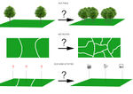
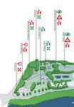
Image:Ideas.jpg|Problems and Ideas to solve | Image:Ideas.jpg|Problems and Ideas to solve | ||
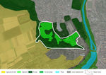
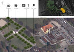
Image:Analysis_galgenberg.jpg|Map of activities | Image:Analysis_galgenberg.jpg|Map of activities | ||
</gallery> | </gallery> | ||
Revision as of 11:29, 27 January 2014
---> back to group page working group 16
Galgenberg Nürtingen - Baden-Württemberg - Germany
| Name | Galgenberg Park | |
| Location | Nürtingen | |
| Country | Germany | |
| Authors | Matthias Klauser, Angelo Angileri, Martina Šekutor | |
| ||
|
| ||
Landscape and/or urban context of your case
- Biogeography, cultural features, overall character, history and dynamics
- you can keep this short
- Illustration: Map; sketches; short descriptive analyses
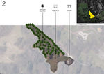
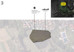
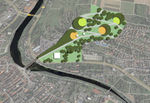
The Galgenberg in Nürtingen is the largest public green space in the city. Unfortunately it is not frequently used although it is close to the center and there are no comparable spaces in the city. It is special, because it has a steep slope and one has a nice view on top, but from the hidden entrance behind the indoor swimming pool you can not see the inside the park.
The park was created more than 100 years ago in the typology of an English landscape garden. In the lower part next to the Bundesstraße has mainly meadows and an old tree stock. Some areas with bushes and trees are under nature protection, which could be a future problem, because they slowly spread out each year and cover more open space due to low maintenance. Trees and shrubs in the higher zones are increasingly dense. Most paths towards are too steep for handicapped people. The paths going through the center of the park mostly provides steps, the way parallel to Galgenbergstraße does not, but has a uncomfortable slope.
In the lower part there is a football field, a playground, a skate park and a indoor swimming pool. In the middle of the 20th century a building was established to serve drinks coming up from a source in the park. Unfortunately highly enriched uranium was found in the water and so the building and the spring are shut down.
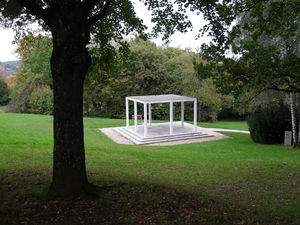
The Pavilion, which was donated by Robert Reiner, whose family emigrated to the USA, is in the middle ground and in the highest spot there is the so called "Schillerhöhe". From the one has one of the most beautiful views of whole Nürtingen. Unfortunately the site is in a worse shape than it deserves. Right there you are at the edge of cultural important agricultural landscape with acres and orchards.
What are the objectives of your design?
Please give a short written argumentation (not more than 150 words). It is ok if you have different or even contradicting objectives within your group. Just make it explicit at the beginning of your process
This area seems nice and strange at the same time, nice because it is the largest green area in the city and it is very close to the center, and strange because an area like that is not very used by people, so the challenge is to create and modify something inside it to attract people.
Inside the area there are lots of interesting activities (swimming pool, soccer field, the Pavilion and so on), and also a wonderful view from the top, so we should merge all the activities and add new ones, for example we could place inside a new building that has the same functionality as the older building (because it was an important building)so that in spring people can enjoy spending time in the park. Also, thematic paths could be added to connect the contents and activities that could end with a nice view.
Analytical drawings
Please add four analytical sketches/drawings (or montages/schemes) of your case. Every group member needs to contribute at least one drawing.
- Analytical Drawings
Projective drawings
Please add four projective sketches/drawings (or montages/schemes), of course with an emphasis on planting design/vegetation aspects. Every group member needs to contribute at least one drawing representing his/her individual ideas.
- Projective Drawings
Design Synthesis
Please analyse the individual approaches presented so far and evaluate their strengths and weaknesses (you may use the SWOTanalysis model). Try to create a synthesis and represent it with a plan and some sketches. You can still use drawings/sketches.
- Design Synthesis Drawings
- Yourfilename1.jpg
synthesis drawing 1
- Yourfilename2.jpg
synthesis drawing 2
- Yourfilename3.jpg
synthesis drawing 3
- Yourfilename4.jpg
synthesis drawing 4
Summary of the collaborative process
Please reflect on your collaborative design process. Which potentials have you encountered? What was most difficult? What does collaborative design mean for you? (approx 150 words).
Image Gallery
You may add a series of images/photos in addition to the sketches/drawings
- Image Gallery
- Yourfilename1.jpg
image 1
- Yourfilename2.jpg
image 2
- Yourfilename3.jpg
image 3
- Yourfilename4.jpg
image 4
References
* Please make sure that you give proper references of all external resources used.
* Do not use images of which you do not hold the copyright.
* Please add internet links to other resources if necessary.
About categories: You can add more categories with this tag: "", add your categories
