File:Topography-wageningen.jpg: Difference between revisions
Jump to navigation
Jump to search
Oana Baloi (talk | contribs) The topography of the area represents the specific flat land of The Netherlands. The average elevation is 25 meters above sea level, with the minimum represented by the Rhine River level and the maximum by the winder dyke. In the surroundings, to the west |
Oana Baloi (talk | contribs) uploaded a new version of "Image:Topography-wageningen.jpg": The topography of the area represents the specific flat land of The Netherlands. The average elevation is 25 meters above sea level, with the minimum represented by the Rhine River level and |
(No difference)
| |
Latest revision as of 04:35, 13 December 2011
The topography of the area represents the specific flat land of The Netherlands. The average elevation is 25 meters above sea level, with the minimum represented by the Rhine River level and the maximum by the winder dyke. In the surroundings, to the western side the topography increases its level through a hill not higher than 30 m.
File history
Click on a date/time to view the file as it appeared at that time.
| Date/Time | Thumbnail | Dimensions | User | Comment | |
|---|---|---|---|---|---|
| current | 04:35, 13 December 2011 | 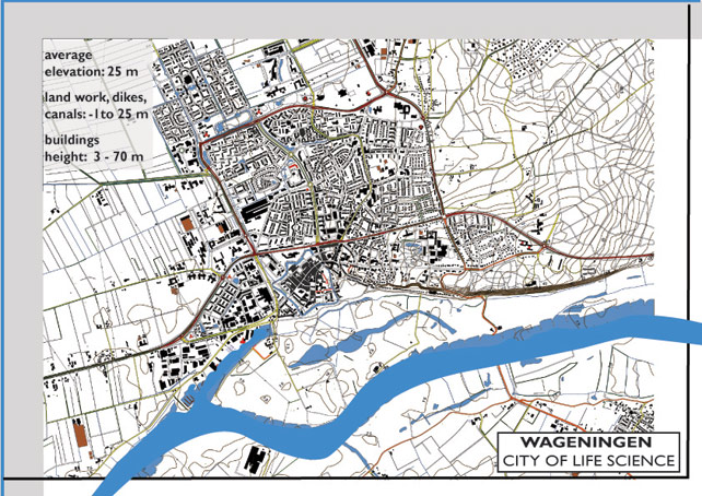 | 642 × 454 (133 KB) | Oana Baloi (talk | contribs) | The topography of the area represents the specific flat land of The Netherlands. The average elevation is 25 meters above sea level, with the minimum represented by the Rhine River level and the maximum by the winder dyke. In the surroundings, to the west |
| 04:33, 13 December 2011 | 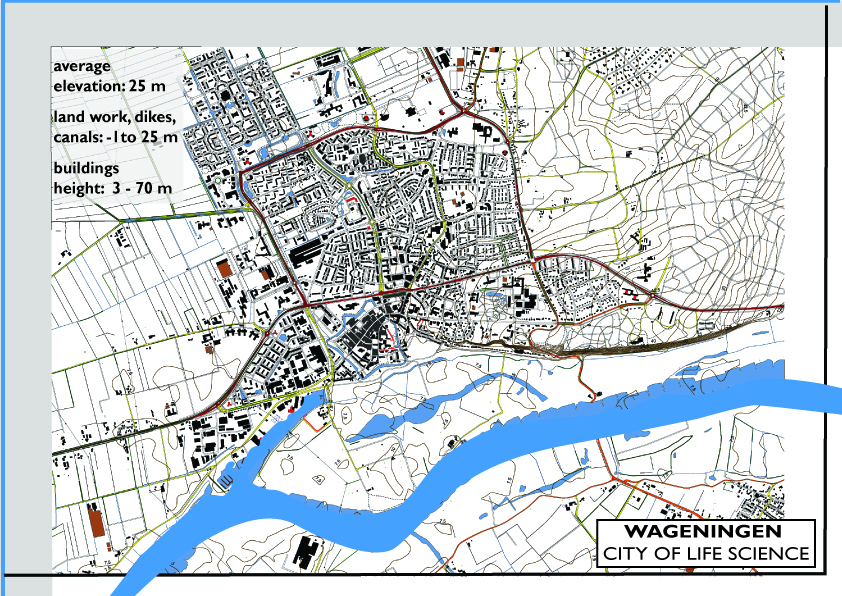 | 842 × 596 (1.42 MB) | Oana Baloi (talk | contribs) | The topography of the area represents the specific flat land of The Netherlands. The average elevation is 25 meters above sea level, with the minimum represented by the Rhine River level and the maximum by the winder dyke. In the surroundings, to the west |
You cannot overwrite this file.
File usage
There are no pages that use this file.