Housing on the Slope: Difference between revisions
| Line 53: | Line 53: | ||
Image:Brdo2.jpg|your image text | Image:Brdo2.jpg|your image text | ||
Image:Brdo3.jpg|your image text | Image:Brdo3.jpg|your image text | ||
Image:Brdo4.jpg|your image text | |||
</gallery> | </gallery> | ||
Revision as of 01:36, 15 November 2011
---> back to overview of Case Study List
add long title of your theme
| Name | Housing on the slope of Banovo brdo | |
| Location | Belgrade | |
| Country | Serbia | |
| Authors | Danijela Lalović, Aleksandra Obrenović, Marko Ivošević, Slobodan Mančić | |

| ||
| <googlemap version="0.9" lat="44.77428" lon="20.418262" type="satellite" zoom="14" width="300" height="300">
44.802416, 20.465601, Belgrade Belgrade Belgrade, Central Serbia 44.775377, 20.41852, Banovo brdo Housing on the slope of Banovo brdo, Čukarica, Belgrade </googlemap> | ||
Short Introduction to the Area of Study
The study area is located in S-W part of Belgrade, approximately 6,5km (≈4 miles) from the center. It is a part of one of the Belgrade’s hills – Banovo brdo, and includes W and N-W hillsides with total size around 1,3km2 (≈0,5 square mile). Height distance (altitude) between the highest and the lowest spot on the slope is 70 meters. Because of the specific form of relief, direction of the streets is parallel to isohypses. Steep streets, that extend perpendicular to isohypses, give long-distance sights. Residential area is mainly consisted of opened and semi-opened urban blocks of medium density, local park, green market and central traffic and pedestrian spine – Pozeska Street. Because it represents community collector, Pozeska Street includes some administrative, commercial and other urban functions. Neighborhood collectors and local streets contain small, private, commercial facilities. Taking into account the value of the neighboring zones (River island Ada from North, farming fields on West and park-forest Kosutnjak on East) and peaceful, almost uniformly residential part concentrated around crowded and lively Pozeska street, it is clear that this area is probably one of a kind in Belgrade. Its specific context, relief, urban structure and presence of many utilities, provides that this area and people in it operate almost apart from rest of the city. Therefore, it would be challenge to assess and improve this unusual everyday landscape. ==
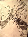
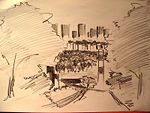
Exercise 1: Sketching the Landscape
Time frame: October 25 - November 15, 2011
Student activities:
- Creation of analytical drawings and sketches
- Presentation of results
Please upload a selection of your drawings/sketches/mental maps and add them to the image gallery
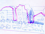
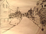
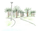
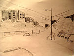
Sketches and Drawings
-
 your image text
 -
 your image text
 -
 your image text
 -
 your image text
 -
 your image text
 -
 your image text


Exercise 2: Landscape Layers
Time frame: November 15 - 29, 2011
- Classical analysis: topography, open spaces, built, green, traffic and water structures on different layers. *Definition of zones with coherent character
- Description of this character.
Please publish your findings here
Exercise 3: Behaviour Patterns
Time frame: December 6 - 20, 2011
- How do people behave in this area? How do they use the space? What is important for them?
- Observation of study area, interviews with local people and mapping of use patterns.
- Preparation of short presentation
Please publish your findings here
Exercise 4: Communication Concepts
Time frame: December 19, 2011 - January 17, 2012
- Based on the different landscape assessment approaches students will develop a communication concept for their area of study
- Which measures would be necessary for enhancing the awareness for the area?
- Students are free to choose their method.
Please publish your findings here
Image Gallery
-
your image text
-
your image text
-
your image text
-
your image text
-
your image text
References
* Please make sure that you give proper references of all external resources used.
* Do not use images of which you do not hold the copyright.
* Please add internet links to other resources if necessary.
About categories: You can add more categories with this tag: "", add your categories