Mauerpark: Difference between revisions
HarisPiplas (talk | contribs) |
HarisPiplas (talk | contribs) |
||
| Line 69: | Line 69: | ||
*What are the main structural features? | *What are the main structural features? | ||
*How has it been shaped? Were there any critical decisions? | *How has it been shaped? Were there any critical decisions? | ||
There are still discussions of what size the park should have-a lot of them in front of the court, citizen initiatives against the authorities which also include demonstrations. The people don't want to let the park are to became another flat-for-rent building. | |||
Illustration: Map/diagram/sketches photos and background notes | Illustration: Map/diagram/sketches photos and background notes | ||
Revision as of 02:38, 25 November 2008
Design in mission to bring people together in Berlin, Germany
Rationale: Why is this case study interesting?
- Please summarise:- e.g. Design Innovation? Planning Exemplar? Theoretical Insights? Lessons learned from its failure? [It doesn’t have to have been successful]
- Think about it from the view of another educator/student in a different country. Why should I use this case study in my teaching/education?
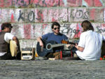
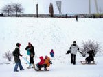
This project is very important because it is created to bring people together and increase their life quality which is the main objective of Landscape Architecture. Former death zone between two world is today one of the most important meeting points for every generation and one of the rare examples of very high frequency of people but peaceful and non-vandalistic use. The park is also very important for the microclimate of the very dense populated area of Berlin. These facts are important and a reason for the completion of the park area.
This project has a countless importance for Berlin's people. A city with a tragical and complex history. This is personally important for me to research about projects, especially in my special field and contribute to the development of the area, to show other people the history of the city and that Landscape Architecture can improve people's lives. I personally feel connected with the city and its history, a city which I consider as my second home.
Author's perspective
- What theoretical or professional perspective do you bring to the case study?
This project has a countless importance for Berlin's people. A city with a tragical and complex history. This is personally important for the author to research about projects, especially in my special field and contribute to the development of the area, to show other people the history of the city and that Landscape Architecture can improve people's lives. The author feels personally connected with the city and its history, a city which he considers as his second home town.
Berlin's Landscape Architecture is on a moderate level but the theoretical and design knowledge has to be connected with the political situation, the history etc. Planning and architecture sociology can play a big role in the completion process.
Landscape and/or urban context
- Biogeography, cultural features, overall character, history and dynamics
Mauerpark is located between former East Berlin's municipality of Prenzlauer Berg (Soviet sector) and West Berlin's municipality of Wedding (French sector). After the restructuration of Berlin's municipalities in 2001 Prenzlauer Berg became a part of municipality Mitte and Wedding a part of municipality Pankow. These city parts are very dense populated and the most inhabitants have lower incomes than Berlin's average.
The park area lies on the Barnim moraine and a parts on a small hill.
Illustration: Map; sketches; short descriptive analyses
Cultural/social/political context
- Brief explanation of culture, political economy, legal framework
As already mentioned the quarters around the park belong to the lower income category and the most inhabitants are students or young families who live in buildings, very typical for Berlin: the most 5 stores, most flats are for renting and they were build in the last decades of the 19. century and the beginnings of the 20. century. So the Berliners say that the most parks visitors are families with children or young people and students-very brindle but representing the creative power of the city.
Illustration: Bullet points, image, background notes
History
- How did the area/project/plan at the focus of the case study evolve?
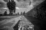
The area was previously an industrial railway station. During the division of Berlin into East and West, it became a very dangerous green area between the two parts of the world. After the removal of the wall, people from both sides met and planted trees besides the spontaneous vegetation. The authorities published in the early 2000's a plan to finish the construction of the 10 ha park area but there are financial problems and the fact that they want to give some areas for building constructions.
Spatial analysis of area/project/plan
- What are the main structural features?
- How has it been shaped? Were there any critical decisions?
There are still discussions of what size the park should have-a lot of them in front of the court, citizen initiatives against the authorities which also include demonstrations. The people don't want to let the park are to became another flat-for-rent building.
Illustration: Map/diagram/sketches photos and background notes
Analysis of program/function
- What are the main functional characteristics?
- How have they been expressed or incorporated?
Illustration: Map/diagram/sketches photos and background notes
Analysis of design/planning process
- How was the area/project/plan formulated and implemented?
- Were there any important consultations/collaborations?
Illustration: Map/diagram/sketches photos and background notes
Analysis of use/users
- How is the area/project/plan used and by whom?
- Is the use changing? Are there any issues?
Illustration: Map/diagram/sketches photos and background notes
Future development directions
- How is the area/project/plan evolving?
- Are there any future goals?
Illustration: Map/diagram/sketches photos and background notes
Peer reviews or critique
- Has the area/ project/plan been reviewed by academic or professional reviewers?
- What were their main evaluations?
Pleas add references, quotes...
Points of success and limitations
- What do you see as the main points of success and limitations of the area/project/plan?
Illustration: Summary table
What can be generalized from this case study?
- Are there any important theoretical insights?
Short statement plus background notes
Which research questions does it generate?
Short statement plus background notes
Image Gallery
- Yourimage.jpg
your image text
- Yourimage.jpg
your image text
- Yourimage.jpg
your image text
- Yourimage.jpg
your image text
- Yourimage.jpg
your image text
References
Please add literature, documentations and weblinks
About categories: You can add more categories by copying the tag and filling in your additional categories

