Mauerpark: Difference between revisions
No edit summary |
HarisPiplas (talk | contribs) No edit summary |
||
| (98 intermediate revisions by 6 users not shown) | |||
| Line 10: | Line 10: | ||
| '''Topic''' || style="background:Lavender"|''Design in mission to bring people together'' | | '''Topic''' || style="background:Lavender"|''Design in mission to bring people together'' | ||
|- | |- | ||
| '''Author(s)''' || style="background:Lavender"|'' | | '''Author(s)''' || style="background:Lavender"|''Prof. Gustav Lange (first phase 1992-94)'' | ||
|- | |- | ||
| '''Completion''' || style="background:Lavender"|'' | | '''Completion''' || style="background:Lavender"|''unknown'' | ||
|- | |- | ||
| '''Client''' || style="background:Lavender"|'' | | '''Client''' || style="background:Lavender"|''Land Berlin'' | ||
|- | |- | ||
| '''Project costs''' || style="background:Lavender"|'' | | '''Project costs''' || style="background:Lavender"|''unknown'' | ||
|- | |- | ||
| colspan="3" align="center" style="background:silver"| [[Image: | | colspan="3" align="center" style="background:silver"| [[Image:Mauerpark.jpg|300px]] | ||
|- | |- | ||
| ||style="background:Lavender"| | | ||style="background:Lavender"| | ||
| Line 29: | Line 29: | ||
=== Rationale: Why is this case study interesting? === | === Rationale: Why is this case study interesting? === | ||
This project is very important because it is created to bring people together and increase their life quality which is the main objective of Landscape Architecture. Former death zone between two worlds, two blocks is today one of the most important meeting points for every generation and one of the rare examples of very high frequency of different groups of people. The park is also very important for the microclimate of the very dense populated area of Berlin. These facts are important and a reason for the completion of the park area. | |||
This project has a countless importance for Berlin's people. A city with a tragical and complex history. This is personally important for me to research about projects, especially in my special field and contribute to the development of the area, to show other people the history of the city and that Landscape Architecture can improve people's lives. I personally feel connected with the city where I am attending my Master studies and I am interested in its history, architecture etc. a city which I know since my childhood. | |||
The area re-connects two worlds who were on different sides during the "Cold war". What open space can be more interesting? | |||
=== Author's perspective === | === Author's perspective === | ||
* What theoretical or professional perspective do you bring to the case study? | * What theoretical or professional perspective do you bring to the case study? | ||
This project has a countless importance for Berlin's people. A city with a tragical and complex history. This is personally important for the author to research about projects and contribute to the development of the area, to show other people the history of the city and that Landscape Architecture can improve people's lives. The author feels personally connected with the city and its history, a city which he considers as his second home town. | |||
The author recently graduated in Sarajevo and is person who has an experience with landscape architecture objects in complex post-conflict areas. The Urban Design Master studies in Berlin allow to give also a very multi disciplinary point of view which is very valuable in the case of Mauerpark. | |||
Berlin's Landscape Architecture is on a moderate level but the theoretical and design knowledge has to be connected with the political situation, the history etc. Planning and architecture sociology can play a big role in the completion process. | |||
=== Landscape and/or urban context=== | === Landscape and/or urban context=== | ||
*Biogeography, cultural features, overall character, history and dynamics | *Biogeography, cultural features, overall character, history and dynamics | ||
Mauerpark is located between former East Berlin's municipality of Prenzlauer Berg (Soviet sector) and West Berlin's municipality of Wedding (French sector). After the restructuration of Berlin's municipalities in 2001 Prenzlauer Berg became a part of municipality Mitte and Wedding a part of municipality Pankow. These city parts are very dense populated and the most inhabitants have lower incomes than Berlin's average. | |||
The park area lies on the Barnim moraine and a parts on a small hill. | |||
=== Cultural/social/political context=== | === Cultural/social/political context=== | ||
*Brief explanation of culture, political economy, legal framework | *Brief explanation of culture, political economy, legal framework | ||
As already mentioned the quarters around the park belong to the lower income category and the most inhabitants are students or young families who live in buildings, very typical for Berlin: the most 5 stores (22 m high), most flats are for renting and they were built during the industralisation in the last decades of the 19. century and the beginnings of the 20. century. So the Berliners say that the most parks visitors are families with children or young people and students-very brindle but representing the creative power of the city but also other people. | |||
=== History === | === History === | ||
*How did the area/project/plan at the focus of the case study evolve? | *How did the area/project/plan at the focus of the case study evolve? | ||
The area was previously an industrial railway station. During the division of Berlin into East and West, it became a very dangerous green area between the two parts of the world. After the removal of the wall, people from both sides met and planted trees besides the spontaneous vegetation. The authorities published in the early 2000's a plan to finish the construction of the 10 ha park area but there are financial problems and the fact that they want to give some areas for building constructions. | |||
=== Spatial analysis of area/project/plan=== | === Spatial analysis of area/project/plan=== | ||
| Line 59: | Line 66: | ||
*How has it been shaped? Were there any critical decisions? | *How has it been shaped? Were there any critical decisions? | ||
There are still discussions of what size the park should have-a lot of them in front of the court, citizen initiatives against the authorities which also include demonstrations. The people don't want to let the park are to became another flat-for-rent building. Basically the area is divided into 4 parts, the fourth part (north from Glein street did not belong to the orginal competition area). | |||
[[#toc|'''Back to top''']] | |||
=== Core questions working group open spaces === | |||
==== How does the design of an open space contribute to a run down neighbourhood? ==== | |||
In the case of Mauerpark, the urban legend says that the park has a big role in the recovering of the people from the separation and the contribution to the rehabilitation. The process of transformation of the grey and boring part of the city into a very popular and multicolor area with its own rules and more legere lifestyle, other than in different parts of Berlin and Germany. | |||
==== How are open spaces linked to the adjacent areas? ==== | |||
The park is very good connected to the city centre and other parts of the city by local streets (main street there are the Danziger&Eberswalder Street as well as the Schoenhauser Alley) and public transport including the urban and metro rail, tramway and buses. There is a strong connection to the "City East"-the area around Alexander square. | |||
==== How are open spaces used? ==== | |||
As already told, in the popular Mauerpark we can find very different groups, from young families to punks. The main function is the recreational and hygienic function of the area because it is situated in a very dense populated area build during the industrialization for the working class. The life conditions back then, in the end of the 19. and at the beginning of the 20. century, missed high quality and especially a immense a lack of open and green spaces. There are evident very frequent visitor rates so the park is sometimes overcrowded (only the first parcel is completed so there is not enough space). There we can meet skaters, artists working outdoor. Ther are also cultural events being organized, exhibitions. Nearby we can find a multifunctional event hall and a local stadium so the people meet in the park before their events start. There is also a bicycle route which is going even from the Baltic Sea to the South-transit function. This area fulfils almost every function an urban open space can have. | |||
==== Which elements make an open space successful and attractive? ==== | |||
There is an endless row of reasons but the method to read the natural landscape combining with a sustainable design with a strong emphasis on the real needs of the local people and other target groups can only result in good visitor rates and satisfaction of those people. Here we see that the multi-culti image of the park in the combination with historical values can be very attractive. | |||
Image: haris.jpg| | |||
==== How can the historical background of an open space be shown to the public? ==== | |||
Not many open spaces in the world have such a turbulent and tragical history. It was the no man's land between the two world powers. As in many similar places in Berlin, there are very interesting projects and ways to show the history of the place besides some text and pictures on the locality. There are more and more art installations but also modern architectural&landscape architectural complexes such as in the Bernauer Street. Very effective ways to show the past are placing and installing of original objects (tanks, sand bags etc.)or replicas (like at Checkpoint Charlie). The proposals go to extremes by proposing to rebuild some parts of the wall and some guarding towers. | |||
[[#toc|'''Back to top''']] | |||
=== Synthesis of core question === | |||
''Working group:'' '''Open spaces''' | |||
''Core question:'' '''How are open spaces used?''' | |||
The topic about usage of open spaces is very broad so we tried in our work to split it into smaller parts rising some main questions, and on this way, to go into details of this important issue. | |||
Analysing those questions (see below) we can come to the conclusion if the landscapes fulfill the objective which they actually were constructed for, are they successful and serve to the people because landscapes are made for people (that is why landscape architects are here). If they are successful and well visited they are the best promotion for the profession. | |||
Another important thing would be to analyse if the open spaces fullfil the intended function or are there another unpredicted by the designers. | |||
We can also read out of these questions, if the opens spaces are less successful and do not completely fullfil their objective, where is still potential to make this open space better. That means to point some not so sucessful aspects and, of couurse, to propose the future development steps. | |||
Our analysis was about 10 different open spaces of different types (parks, gardens, residential and commercial environments) so we raised 7 main questions: | |||
#What kind of visitors are most seen in the open space? | |||
#What is the main function of the open space? | |||
#What are the supplementary functions of the open space? | |||
#What is the frequency of visitors? | |||
#Do the different visitor groups use the same corners or is there an internal space partition? | |||
#Are the visitors local people and are there also tourists and others? | |||
#Are there special events being organized? | |||
This is a short introduction of our concept of analysing and synthetizing this core question. A better overview you will have from these 2 slides where we compressed and visualized our work: | |||
<gallery caption=" " widths="1000px" heights="600px" perrow="1"> | |||
Image:how_are_open_space_used1.jpg| | |||
Image:how_are_open_space_used2.jpg| | |||
</gallery> | |||
[[#toc|'''Back to top''']] | |||
=== Analysis of program/function === | === Analysis of program/function === | ||
* What are the main functional characteristics? | * What are the main functional characteristics? | ||
* How have they been expressed or incorporated? | * How have they been expressed or incorporated? | ||
The main functional characteristic is the free choice of recreation type and the fact that the people visit the park to meet other people so it is very clear view in all directions with not too much planting materials or destroy of the "natural" meeting place by installing structures or devices. This kind of design is perfect for this area and does not require huge costs. | |||
=== Analysis of design/planning process === | === Analysis of design/planning process === | ||
* How was the area/project/plan formulated and implemented? | * How was the area/project/plan formulated and implemented? | ||
*Were there any important consultations/collaborations? | *Were there any important consultations/collaborations? | ||
The first phase was formulated and implemented in the early 90's so we can analyze only this planning period for now on. The best possible of collaboration in the future would be the highest possible level of local participation in the design/planning process but in the combination with professor Lange´s original and juridical official concept of a minimalistic "place of freedom" where he just gives the potential function of different parts of the park in a form of the "sketch" letting the people to decide on theirselves what and ehen they want to use. | |||
=== Analysis of use/users === | === Analysis of use/users === | ||
* How is the area/project/plan used and by whom? | * How is the area/project/plan used and by whom? | ||
* Is the use changing? Are there any issues? | * Is the use changing? Are there any issues? | ||
The area is used by the locals but also by people from other parts of Berlin and by tourists. This part has a cult status as an open space that represents the destroy of the old death zone between the pacts and as an open space that brings various people together, from artists and musicians to young mothers. | |||
=== Future development directions === | === Future development directions === | ||
* How is the area/project/plan evolving? | * How is the area/project/plan evolving? | ||
* Are there any future goals? | * Are there any future goals? | ||
There are many proposals but no definite one so the next step is to study the most official and realistic and predict the best and worst possible case. There are huge discussion between the citizen initiatives, the owners of the land which is planned to be parcel 2&3. Berlin´s authorities took over the maintenance of the park but they just simply fulfiled the wishes of some locals, making a fence around one part promoving it to a "dog park" (totally against Prof. Lange´s concept) and the playground. There are also plans to put an asphalt bicycle road and dismiss the original cobble stone pavement from the 1870´s. | |||
The authorities responsible for the maintenance of the area trying to solve problems such as overcrowding and the lack of green space care often forget the concept and strong message of the area. A huge lack of maintenance causes a strong deterioation of the area including landslides (not typical for Berlin), too. The area is full of garbage and graffiti. The street furniture and the facilities are in a bad condition. The company responsible for the construction became insolvent and in the combination with the politics, authorities and citizen initiatives the finalizing of the park area is always postponing. | |||
=== Peer reviews or critique === | === Peer reviews or critique === | ||
* Has the area/ project/plan been reviewed by academic or professional reviewers? | * Has the area/ project/plan been reviewed by academic or professional reviewers? | ||
* What were their main evaluations? | * What were their main evaluations? | ||
Unfortunately, for this area the Berliners show a lot of interests. There must follow a serious professional discussion about the area which could serve as a model for importance and possible achievements for Landscape Architecture. There are no serious reviews made by professionals on this area. | |||
=== Points of success and limitations === | === Points of success and limitations === | ||
*What do you see as the main points of success and limitations of the area/project/plan? | *What do you see as the main points of success and limitations of the area/project/plan? | ||
There is still no definitely project for the area and limitations are only intentions to make the park smaller and the endless discussions between the authorities, investors, the designer and the inhabitants about the area. | |||
=== What can be generalized from this case study? === | === What can be generalized from this case study? === | ||
*Are there any important theoretical insights? | *Are there any important theoretical insights? | ||
We can conclude that with the completion of this park, Berlin will became a area where people meet together who've lived for almost 40 years just meters away but unreachable and disconnected. This area is also important for the social contact between the new generations and for the life quality in this very dense populated area. This is a perfect example that Landscape Architecture is able to create such spaces, important for the history, the lifes of the inhabitants, urban ecology etc. | |||
=== Which research questions does it generate? === | === Which research questions does it generate? === | ||
The most important one in the first phase of the research: | |||
''Is Landscape Architecture able to bring people together and deal with very complex historical and social conditions?'' | |||
[[#toc|'''Back to top''']] | |||
=== Image Gallery === | === Image Gallery === | ||
| Line 101: | Line 178: | ||
<gallery caption=" " widths="150px" heights="150px" perrow="5"> | <gallery caption=" " widths="150px" heights="150px" perrow="5"> | ||
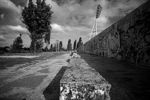
Image: | Image:Mauerpark2.jpg|Das ist unser Mauerpark | ||
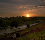
Image: | Image:Mauerpark3.jpg|Sundown-Mauerpark romantic place? | ||
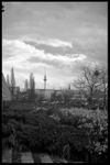
Image: | Image:Mauerpark4.jpg|Plants | ||
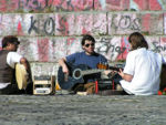
Image: | Image:Mauerpark5.jpg|Mauerpark and its people - summer | ||
Image: | Image:Mauerpark6.jpg|Mauerpark and its people - winter | ||
Image: | Image:Auditorium für die Massen_small.jpg|auditorium for the masses | ||
Image: | Image:Birches on boarder_small.jpg|Birches on boarder | ||
Image: | Image:Furniture&Graffiti_small.jpg|Furniture + graffiti | ||
Image: | Image:Symbolik_small.jpg|Symbolic meaning | ||
Image: | Image:Wege und Topographie_small.jpg|Paths and Topography | ||
Image:CIMG0074.JPG|Path of the Berlin wall | |||
Image:CIMG0080.JPG|No fences - just freedom | |||
Image:CIMG0090.JPG|Right is East - left building is West | |||
Image:CIMG0116.JPG|Maintenance? | |||
Image:CIMG0092.JPG|Original pavement-bicycle road and the view on the "City East" | |||
Image:Mauerpark sketch.jpg | |||
</gallery> | </gallery> | ||
[[#toc|'''Back to top''']] | |||
=== References === | === References === | ||
*http://www.garten-landschaft.de/index.php?Navi=15&Subnavi=19&do=artikel&id=2883 | |||
*http://de.wikipedia.org/wiki/Mauerpark | |||
*http://www.berlinermaueronline.de/berlin-guide/mauerpark.htm | |||
*http://www.gruen-berlin.de/projekte/Mauerpark.php | |||
*http://www.mauerpark.info/?page_id=100 | |||
*http://www.flickr.com | |||
*http://www.e-cityvisit.com/berlin/mauerpark | |||
*http://www.tagesspiegel.de/berlin/Mauerpark-Prenzlauer-Berg-Berliner-Mauer;art270,2590974 | |||
*http://www.gleimviertel.de/archives/category/mauerpark | |||
*http://www.stadtentwicklung.berlin.de/umwelt/stadtgruen/gruenanlagen/de/gruenanlagen.../mauerpark/index.shtml | |||
---- | ---- | ||
| Line 122: | Line 227: | ||
[[Category:Berlin]] | [[Category:Berlin]] | ||
[[Category:Working Group Open Spaces]] | [[Category:Working Group Open Spaces]] | ||
Latest revision as of 17:16, 22 February 2009
Design in mission to bring people together in Berlin, Germany
Rationale: Why is this case study interesting?
This project is very important because it is created to bring people together and increase their life quality which is the main objective of Landscape Architecture. Former death zone between two worlds, two blocks is today one of the most important meeting points for every generation and one of the rare examples of very high frequency of different groups of people. The park is also very important for the microclimate of the very dense populated area of Berlin. These facts are important and a reason for the completion of the park area.
This project has a countless importance for Berlin's people. A city with a tragical and complex history. This is personally important for me to research about projects, especially in my special field and contribute to the development of the area, to show other people the history of the city and that Landscape Architecture can improve people's lives. I personally feel connected with the city where I am attending my Master studies and I am interested in its history, architecture etc. a city which I know since my childhood.
The area re-connects two worlds who were on different sides during the "Cold war". What open space can be more interesting?
Author's perspective
- What theoretical or professional perspective do you bring to the case study?
This project has a countless importance for Berlin's people. A city with a tragical and complex history. This is personally important for the author to research about projects and contribute to the development of the area, to show other people the history of the city and that Landscape Architecture can improve people's lives. The author feels personally connected with the city and its history, a city which he considers as his second home town.
The author recently graduated in Sarajevo and is person who has an experience with landscape architecture objects in complex post-conflict areas. The Urban Design Master studies in Berlin allow to give also a very multi disciplinary point of view which is very valuable in the case of Mauerpark.
Berlin's Landscape Architecture is on a moderate level but the theoretical and design knowledge has to be connected with the political situation, the history etc. Planning and architecture sociology can play a big role in the completion process.
Landscape and/or urban context
- Biogeography, cultural features, overall character, history and dynamics
Mauerpark is located between former East Berlin's municipality of Prenzlauer Berg (Soviet sector) and West Berlin's municipality of Wedding (French sector). After the restructuration of Berlin's municipalities in 2001 Prenzlauer Berg became a part of municipality Mitte and Wedding a part of municipality Pankow. These city parts are very dense populated and the most inhabitants have lower incomes than Berlin's average.
The park area lies on the Barnim moraine and a parts on a small hill.
Cultural/social/political context
- Brief explanation of culture, political economy, legal framework
As already mentioned the quarters around the park belong to the lower income category and the most inhabitants are students or young families who live in buildings, very typical for Berlin: the most 5 stores (22 m high), most flats are for renting and they were built during the industralisation in the last decades of the 19. century and the beginnings of the 20. century. So the Berliners say that the most parks visitors are families with children or young people and students-very brindle but representing the creative power of the city but also other people.
History
- How did the area/project/plan at the focus of the case study evolve?
The area was previously an industrial railway station. During the division of Berlin into East and West, it became a very dangerous green area between the two parts of the world. After the removal of the wall, people from both sides met and planted trees besides the spontaneous vegetation. The authorities published in the early 2000's a plan to finish the construction of the 10 ha park area but there are financial problems and the fact that they want to give some areas for building constructions.
Spatial analysis of area/project/plan
- What are the main structural features?
- How has it been shaped? Were there any critical decisions?
There are still discussions of what size the park should have-a lot of them in front of the court, citizen initiatives against the authorities which also include demonstrations. The people don't want to let the park are to became another flat-for-rent building. Basically the area is divided into 4 parts, the fourth part (north from Glein street did not belong to the orginal competition area).
Core questions working group open spaces
How does the design of an open space contribute to a run down neighbourhood?
In the case of Mauerpark, the urban legend says that the park has a big role in the recovering of the people from the separation and the contribution to the rehabilitation. The process of transformation of the grey and boring part of the city into a very popular and multicolor area with its own rules and more legere lifestyle, other than in different parts of Berlin and Germany.
How are open spaces linked to the adjacent areas?
The park is very good connected to the city centre and other parts of the city by local streets (main street there are the Danziger&Eberswalder Street as well as the Schoenhauser Alley) and public transport including the urban and metro rail, tramway and buses. There is a strong connection to the "City East"-the area around Alexander square.
How are open spaces used?
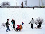
As already told, in the popular Mauerpark we can find very different groups, from young families to punks. The main function is the recreational and hygienic function of the area because it is situated in a very dense populated area build during the industrialization for the working class. The life conditions back then, in the end of the 19. and at the beginning of the 20. century, missed high quality and especially a immense a lack of open and green spaces. There are evident very frequent visitor rates so the park is sometimes overcrowded (only the first parcel is completed so there is not enough space). There we can meet skaters, artists working outdoor. Ther are also cultural events being organized, exhibitions. Nearby we can find a multifunctional event hall and a local stadium so the people meet in the park before their events start. There is also a bicycle route which is going even from the Baltic Sea to the South-transit function. This area fulfils almost every function an urban open space can have.
Which elements make an open space successful and attractive?
There is an endless row of reasons but the method to read the natural landscape combining with a sustainable design with a strong emphasis on the real needs of the local people and other target groups can only result in good visitor rates and satisfaction of those people. Here we see that the multi-culti image of the park in the combination with historical values can be very attractive.
Image: haris.jpg|
How can the historical background of an open space be shown to the public?
Not many open spaces in the world have such a turbulent and tragical history. It was the no man's land between the two world powers. As in many similar places in Berlin, there are very interesting projects and ways to show the history of the place besides some text and pictures on the locality. There are more and more art installations but also modern architectural&landscape architectural complexes such as in the Bernauer Street. Very effective ways to show the past are placing and installing of original objects (tanks, sand bags etc.)or replicas (like at Checkpoint Charlie). The proposals go to extremes by proposing to rebuild some parts of the wall and some guarding towers.
Synthesis of core question
Working group: Open spaces
Core question: How are open spaces used?
The topic about usage of open spaces is very broad so we tried in our work to split it into smaller parts rising some main questions, and on this way, to go into details of this important issue. Analysing those questions (see below) we can come to the conclusion if the landscapes fulfill the objective which they actually were constructed for, are they successful and serve to the people because landscapes are made for people (that is why landscape architects are here). If they are successful and well visited they are the best promotion for the profession. Another important thing would be to analyse if the open spaces fullfil the intended function or are there another unpredicted by the designers. We can also read out of these questions, if the opens spaces are less successful and do not completely fullfil their objective, where is still potential to make this open space better. That means to point some not so sucessful aspects and, of couurse, to propose the future development steps. Our analysis was about 10 different open spaces of different types (parks, gardens, residential and commercial environments) so we raised 7 main questions:
- What kind of visitors are most seen in the open space?
- What is the main function of the open space?
- What are the supplementary functions of the open space?
- What is the frequency of visitors?
- Do the different visitor groups use the same corners or is there an internal space partition?
- Are the visitors local people and are there also tourists and others?
- Are there special events being organized?
This is a short introduction of our concept of analysing and synthetizing this core question. A better overview you will have from these 2 slides where we compressed and visualized our work:
Analysis of program/function
- What are the main functional characteristics?
- How have they been expressed or incorporated?
The main functional characteristic is the free choice of recreation type and the fact that the people visit the park to meet other people so it is very clear view in all directions with not too much planting materials or destroy of the "natural" meeting place by installing structures or devices. This kind of design is perfect for this area and does not require huge costs.
Analysis of design/planning process
- How was the area/project/plan formulated and implemented?
- Were there any important consultations/collaborations?
The first phase was formulated and implemented in the early 90's so we can analyze only this planning period for now on. The best possible of collaboration in the future would be the highest possible level of local participation in the design/planning process but in the combination with professor Lange´s original and juridical official concept of a minimalistic "place of freedom" where he just gives the potential function of different parts of the park in a form of the "sketch" letting the people to decide on theirselves what and ehen they want to use.
Analysis of use/users
- How is the area/project/plan used and by whom?
- Is the use changing? Are there any issues?
The area is used by the locals but also by people from other parts of Berlin and by tourists. This part has a cult status as an open space that represents the destroy of the old death zone between the pacts and as an open space that brings various people together, from artists and musicians to young mothers.
Future development directions
- How is the area/project/plan evolving?
- Are there any future goals?
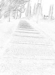
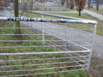
There are many proposals but no definite one so the next step is to study the most official and realistic and predict the best and worst possible case. There are huge discussion between the citizen initiatives, the owners of the land which is planned to be parcel 2&3. Berlin´s authorities took over the maintenance of the park but they just simply fulfiled the wishes of some locals, making a fence around one part promoving it to a "dog park" (totally against Prof. Lange´s concept) and the playground. There are also plans to put an asphalt bicycle road and dismiss the original cobble stone pavement from the 1870´s.
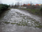
The authorities responsible for the maintenance of the area trying to solve problems such as overcrowding and the lack of green space care often forget the concept and strong message of the area. A huge lack of maintenance causes a strong deterioation of the area including landslides (not typical for Berlin), too. The area is full of garbage and graffiti. The street furniture and the facilities are in a bad condition. The company responsible for the construction became insolvent and in the combination with the politics, authorities and citizen initiatives the finalizing of the park area is always postponing.
Peer reviews or critique
- Has the area/ project/plan been reviewed by academic or professional reviewers?
- What were their main evaluations?
Unfortunately, for this area the Berliners show a lot of interests. There must follow a serious professional discussion about the area which could serve as a model for importance and possible achievements for Landscape Architecture. There are no serious reviews made by professionals on this area.
Points of success and limitations
- What do you see as the main points of success and limitations of the area/project/plan?
There is still no definitely project for the area and limitations are only intentions to make the park smaller and the endless discussions between the authorities, investors, the designer and the inhabitants about the area.
What can be generalized from this case study?
- Are there any important theoretical insights?
We can conclude that with the completion of this park, Berlin will became a area where people meet together who've lived for almost 40 years just meters away but unreachable and disconnected. This area is also important for the social contact between the new generations and for the life quality in this very dense populated area. This is a perfect example that Landscape Architecture is able to create such spaces, important for the history, the lifes of the inhabitants, urban ecology etc.
Which research questions does it generate?
The most important one in the first phase of the research:
Is Landscape Architecture able to bring people together and deal with very complex historical and social conditions?


