Local Parks in Modelia: Difference between revisions
| Line 61: | Line 61: | ||
<gallery caption=" " widths="150px" heights="150px" perrow="5"> | <gallery caption=" " widths="150px" heights="150px" perrow="5"> | ||
Image:Verde. | Image:Verde.png|open space | ||
Image:yourimagename.jpg|your image text | Image:yourimagename.jpg|your image text | ||
Image:yourimagename.jpg|your image text | Image:yourimagename.jpg|your image text | ||
Revision as of 13:36, 29 November 2011
---> back to overview of Case Study List
Local Parks in Residential Area: Modelia, Bogota
| Name | Local Parks in Modelia | |
| Location | Bogota | |
| Country | Colombia | |
| Authors | Victoria Solis Pauwels | |

| ||
| <googlemap version="0.9" lat="4.6645" lon="-74.12467" type="terrain" zoom="15" width="300" height="250" scale="yes" controls="small">
</googlemap> | ||
Short Introduction to the Area of Study
Modelia is a middle class neighborhood of Bogota, belonging to the town of Fontibon. The neighborhood is located in the western part of Bogota. Originally built by Fernando Mazuera around 1965, began with a core commercial reasons which covers about 3 blocks and a group of two-storey houses. The neighborhood was initially characterized by the abundance of parks and green areas. These parks are free areas for recreation, meeting and community integration, covering the needs of neighborhoods. They are generically known as parks, green areas for parks or assignments, assignments were previously called type A. The case study will focus on the southern park that has as main feature the sport, here you can jog and exercise outdoors with many small squares and sports fields, playgrounds and lawns.
its perimeter is 833 meters and a total area of 16,126 square meters (1,61 Hectares) Currently the area includes not only original but has built homes developments with apartment towers of medium height.
The neighborhood is located in a passageway of aircraft to and from El Dorado Airport which is why there is much noise. Additionally, the Avenida de La Esperanza across the district, which carries a lot of traffic and conversions for commercial housing around the passage of the avenue. Also abound in this neighborhood park areas and spaces between houses filled with trees and lush vegetation in almost all parts.
Exercise 1: Sketching the Landscape
Time frame: October 25 - November 15, 2011
Student activities:
- Creation of analytical drawings and sketches
- Presentation of results
Please upload a selection of your drawings/sketches/mental maps and add them to the image gallery
Sketches and Drawings

Parks in the Neighborhood

Park

Sketch

Sketch

Sketch


Exercise 2: Landscape Layers
Time frame: November 15 - 29, 2011
- time based changes and 'landscape biography', and/or:
- topography, open spaces, built, green, traffic and water structures on different layers. *Definition of zones with coherent character
- Description of this character.
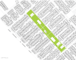
open space
- Yourimagename.jpg
your image text
- Yourimagename.jpg
your image text
- Yourimagename.jpg
your image text
- Yourimagename.jpg
your image text

Please publish your findings here
Exercise 3: Behaviour Patterns
Time frame: December 6 - 20, 2011
- How do people behave in this area? How do they use the space? What is important for them?
- Observation of study area, interviews with local people and mapping of use patterns.
- Preparation of short presentation
Please publish your findings here
Exercise 4: Communication Concepts
Time frame: December 19, 2011 - January 17, 2012
- Based on the different landscape assessment approaches students will develop a communication concept for their area of study
- Which measures would be necessary for enhancing the awareness for the area?
- Students are free to choose their method.
Please publish your findings here
Image Gallery
- Yourimagename.jpg
your image text
- Yourimagename.jpg
your image text
- Yourimagename.jpg
your image text
- Yourimagename.jpg
your image text
- Yourimagename.jpg
your image text
References
* Please make sure that you give proper references of all external resources used.
* Do not use images of which you do not hold the copyright.
* Please add internet links to other resources if necessary.
About categories: You can add more categories with this tag: "", add your categories