Uploads by Totha
Jump to navigation
Jump to search
This special page shows all uploaded files.
| Date | Name | Thumbnail | Size | Description | Versions |
|---|---|---|---|---|---|
| 15:27, 14 November 2014 | Town Centre as the Green Infrastructure Core.jpeg (file) | 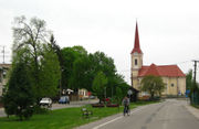 |
0 bytes | The core of the local urban green infrastructure is represented by a linear green space in the central part of the historic streetscape in the town centre. This site has a unique spatial quality & historic legacy as it relates to urban design of the Hi... | 1 |
| 15:20, 18 November 2014 | Green Infrastructure of Tvrdošovce in the Micro-Regional Context.jpeg (file) | 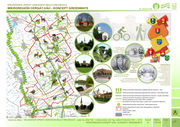 |
0 bytes | Green Infrastructure of the site embeded in the context of the micro-region Cergát Váh which consists of 7 rural settlements of the Nitra Region (administrative context) and the Danube Lowland (geographic context) © Attila Tóth 2012 | 1 |
| 15:24, 18 November 2014 | Changes in the Landscape Structure 18th-21st Century.jpeg (file) |  |
0 bytes | Changes in the landscape and settlements structure from the 18th till the 21st century depicted by a timeline. © Attila Tóth 2014 | 1 |
| 15:38, 18 November 2014 | Current Landscape Structure - Layer Maps.jpeg (file) | 1.32 MB | These thematic layer maps extract different landscape features from the current landscape structure © Attila Tóth 2012 | 3 | |
| 12:43, 24 November 2014 | PotentialsGreenInfrastructureTardoskedd.jpeg (file) | 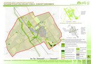 |
0 bytes | This analysis defines the main components of the green infrastructure which are predominantly of linear character due to the agricultural landscape that they are embedded into. There is a huge potential of local tourism or agritourism improvement and d... | 1 |
| 13:06, 24 November 2014 | GreenSpaceConnectivitySettlementLandscapeTardoskedd.jpeg (file) | 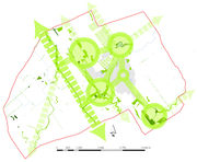 |
0 bytes | This analytical scheme emphasises the core elements of the local green infrastructure (green spaces of a higher ecological stability or spatially/areally most extensive sites - in green circles). These are situated around the settlement. The linkages b... | 1 |
| 13:24, 24 November 2014 | LinkageSettlementLandscape.jpeg (file) | 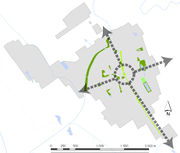 |
0 bytes | This analytical scheme defines the linear green space situated in the village centre as the core element of the local urban green infrastructure. The arrows symbolise the linking function of local green infrastructure (linking the settlement with the s... | 1 |
| 13:37, 24 November 2014 | LandscapeHistory18thCentury.jpg (file) | 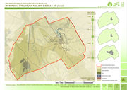 |
1.23 MB | 1 | |
| 13:40, 24 November 2014 | LandscapeHistory19.jpeg (file) | 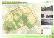 |
0 bytes | 1 | |
| 13:57, 24 November 2014 | GreenInfrastructureCore.jpg (file) | 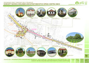 |
1.47 MB | 1 | |
| 14:01, 24 November 2014 | GreenInfrastructureStreetscape.jpeg (file) | 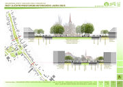 |
0 bytes | 1 | |
| 14:02, 24 November 2014 | GreenInfrastructureStreetscapeII.jpeg (file) | 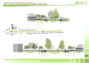 |
0 bytes | 1 | |
| 10:22, 25 November 2014 | LandscapeContextAndStructure1950.jpeg (file) | 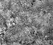 |
0 bytes | This image shows the landscape context and structure of the site in 1950, just before collectivization of agriculture. © Attila Tóth 2014 | 1 |
| 10:45, 25 November 2014 | LandscapeContextAndStructureNOW.jpeg (file) | 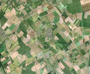 |
0 bytes | This image shows the current landscape context and structure of the site. © Attila Tóth 2014 | 1 |
| 10:10, 1 December 2014 | ConversionTownCentre.jpeg (file) | 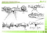 |
0 bytes | Conversion of the Town Centre by Green Infrastructure Tools © Attila Tóth 2012-2014 | 1 |
| 10:17, 1 December 2014 | ChurchGardenTownCentre.jpeg (file) | 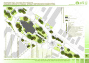 |
0 bytes | Church garden design in the town centre understood as the core of the local green infrastructure © Attila Tóth 2012-2014 | 1 |
| 10:20, 1 December 2014 | CommunityCentre.jpeg (file) | 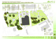 |
0 bytes | Re-Designing the Surroundings of the Community Centre © Attila Tóth 2012-2014 | 1 |
| 10:24, 1 December 2014 | NewGreenMarketSquare.jpeg (file) | 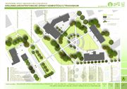 |
0 bytes | Visions for a new green market square in the town centre © Attila Tóth 2012-2014 | 1 |
| 10:28, 1 December 2014 | GreenTownCentre.jpeg (file) | 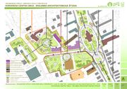 |
0 bytes | Design of a Greener Town Centre © Attila Tóth 2012-2014 | 1 |
| 10:32, 1 December 2014 | GreenTardoskedd.jpeg (file) | 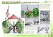 |
0 bytes | Visions for greening the town centre and landscape elements of Tardoskedd © Attila Tóth 2012-2014 | 1 |
| 11:01, 1 December 2014 | LandscapeContext.jpeg (file) | 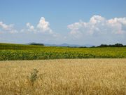 |
0 bytes | Landscape Context © Attila Tóth 2014 | 1 |
| 11:06, 1 December 2014 | LandscapeContext2.jpeg (file) | 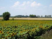 |
0 bytes | Landscape Context © Attila Tóth 2014 | 1 |
| 11:22, 1 December 2014 | AgricultureLegacy.jpeg (file) | 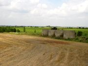 |
0 bytes | Agricultural Legacy in the Landscape © Attila Tóth 2014 | 1 |
| 11:30, 1 December 2014 | ArchitecturalLandmark.jpg (file) | 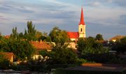 |
876 KB | Reverted to version as of 11:11, 1 December 2014 | 3 |
| 11:38, 1 December 2014 | AgriculturalLandscapes.jpg (file) | 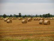 |
1.11 MB | Variability of Agricultural Landscapes © Attila Tóth 2014 | 1 |
| 11:44, 1 December 2014 | SettlementLandscapeImage.jpg (file) | 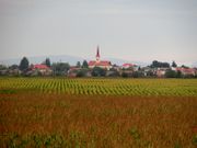 |
1.01 MB | Settlement and Landscape Image © Attila Tóth 2014 | 1 |
| 11:49, 1 December 2014 | WaterLandscape.jpg (file) | 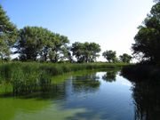 |
1.08 MB | Water in the Landscape © Attila Tóth 2014 | 1 |
| 11:53, 1 December 2014 | ArchLandmark.jpg (file) | 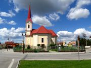 |
916 KB | Architectural Landmark © Attila Tóth 2014 | 1 |
| 12:03, 1 December 2014 | Wildlife.jpg (file) | 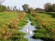 |
1.83 MB | Wildlife © Attila Tóth 2014 | 1 |
| 11:41, 9 December 2014 | GI Assignment3 wgK Page 1.jpg (file) |  |
126 KB | 1 | |
| 11:41, 9 December 2014 | GI Assignment3 wgK Page 2.jpg (file) | 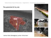 |
219 KB | 1 | |
| 11:42, 9 December 2014 | GI Assignment3 wgK Page 3.jpg (file) | 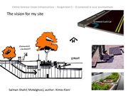 |
178 KB | 1 | |
| 11:42, 9 December 2014 | GI Assignment3 wgK Page 4.jpg (file) | 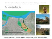 |
98 KB | 1 | |
| 11:43, 9 December 2014 | GI Assignment3 wgK Page 5.jpg (file) | 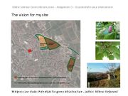 |
83 KB | 1 | |
| 11:43, 9 December 2014 | GI Assignment3 wgK Page 6.jpg (file) | 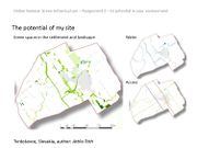 |
97 KB | 1 | |
| 11:43, 9 December 2014 | GI Assignment3 wgK Page 7.jpg (file) | 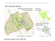 |
112 KB | 1 | |
| 11:45, 9 December 2014 | GI Assignment3 wgK Page 8.jpg (file) |  |
124 KB | 1 | |
| 15:52, 20 January 2015 | CurrentLandscapeStructureAT.jpeg (file) | 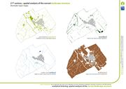 |
0 bytes | Analytical Drawing: Spatial Analysis of the Current Landscape Structure by AT | 1 |
| 16:36, 23 January 2015 | Projective drawing GIseminar at s.jpg (file) | 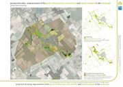 |
1.43 MB | projective drawing: improvement of the green infrastructure connectivity and spatial integrity in the landscape dissertation © Attila Tóth 2012-2015 | 1 |
| 08:54, 26 January 2015 | TVRDOSOCVCE analytical.jpg (file) | 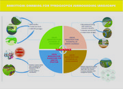 |
1.71 MB | Analytical Drawing by Fadera Williams | 1 |
| 09:11, 3 February 2015 | GI Assignment4 Collaborative Design WG K Page 1.jpg (file) |  |
126 KB | 1 | |
| 09:12, 3 February 2015 | GI Assignment4 Collaborative Design WG K Page 2.jpg (file) | 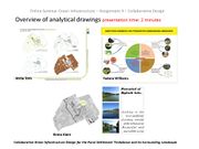 |
170 KB | 1 | |
| 09:14, 3 February 2015 | GI Assignment4 Collaborative Design WG K Page 3.jpg (file) | 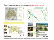 |
159 KB | 1 | |
| 09:14, 3 February 2015 | GI Assignment4 Collaborative Design WG K Page 4.jpg (file) | 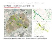 |
145 KB | 1 | |
| 09:15, 3 February 2015 | GI Assignment4 Collaborative Design WG K Page 5.jpg (file) | 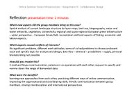 |
254 KB | 1 | |
| 08:14, 23 November 2015 | S.H.Vajanského.Aerial.View.jpg (file) | 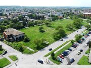 |
160 KB | Aerial View to the green space on the S.H.Vajanského Street in Nové Zámky | 1 |
| 08:33, 23 November 2015 | Public Park or Shopping Mall.jpg (file) | 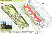 |
118 KB | A collage for the inhabitants to express their opinion on the municipality´s decision and the developer´s intention vs. the master thesis of a local landscape architect | 1 |
| 14:48, 23 November 2015 | Press and Social Network.jpg (file) |  |
1.09 MB | Involvement of the wider public via press, television and social media. | 1 |
| 08:07, 30 November 2015 | Current Situation.jpeg (file) | 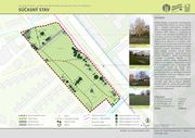 |
0 bytes | Current Situation of the Site (2013-2015) | 1 |
| 08:13, 30 November 2015 | Landscape Architectural Design.jpeg (file) | 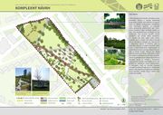 |
0 bytes | Landscape Architectural Design | 1 |