Uploads by Aurora
Jump to navigation
Jump to search
This special page shows all uploaded files.
| Date | Name | Thumbnail | Size | Description | Versions |
|---|---|---|---|---|---|
| 23:07, 17 November 2013 | Obradoiro.jpg (file) | 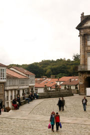 |
325 KB | 1 | |
| 10:14, 29 November 2013 | Gaias from brañas.jpg (file) | 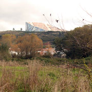 |
1.19 MB | The Gaiás Hill, showing the Cidade da Cultura de Galicia Museum, from the River Sar flood plain pastures. | 1 |
| 12:16, 29 November 2013 | Gaias Sar Compostela.jpg (file) | 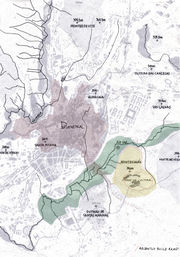 |
599 KB | Map showing rivers and hills in relation to the historic city center of Santiago de Compostela. The drawing marks in yellow tone the Monte Gaiás and in blue tone the river side land. Dotted in red are indicated a newly built road that has cut the traditi | 1 |
| 12:41, 29 November 2013 | Hill side fields.jpg (file) | 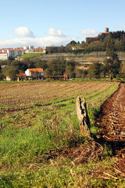 |
1,013 KB | Gaiás hill side fields (still use to cultivate crops). View from newly build road towards city center. | 1 |
| 12:47, 29 November 2013 | Brañas do Sar.jpg (file) | 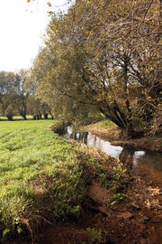 |
1.08 MB | Sar flood plain, traditionally dedicated to pasture. Compostela | 1 |
| 16:22, 2 December 2013 | Spontaneous vegetation Hill spring.jpg (file) | 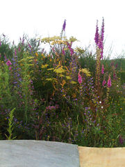 |
1.36 MB | Spontaneous vegetation in the man made hill like topography in the Cidade da Cultura complex | 1 |
| 16:54, 2 December 2013 | Sar-Gaias.jpg (file) | 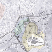 |
512 KB | Drawing showing: -in red inner walls historic city centre, -in green the flooded pastures, protected from buildings, most of then still privately own and use for farming related works -in blue the hill side fields, most of then still privately own and use | 1 |
| 18:35, 2 December 2013 | Section study areas.jpg (file) |  |
193 KB | Section through the Gaias to River Sar showing the main different conditions and vegetation ecosystems and the relationship between them. It also shows the cuts on to the natural water/nutrients flow that together with the abandonment of the land work whi | 1 |
| 22:34, 3 December 2013 | Sar Gaias Veg.jpg (file) | 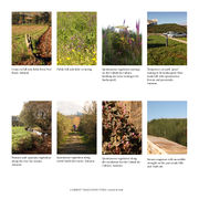 |
1.67 MB | Different vegetation communities from the River Side to the top of the hill where the Cidade da Cultura Cultural Complex is. | 3 |
| 09:19, 16 January 2014 | PR-WATER Managment.jpg (file) |  |
455 KB | Proposed Water Management. The aim of the two cleaning and storing water trenches is to prepare the water that is collected from the city open spaces and the Gaías before being use to irrigate the valley. This land could be, in this way, be fertilized a | 1 |
| 17:36, 22 January 2014 | PR section uses.jpg (file) |  |
605 KB | 2 | |
| 18:01, 22 January 2014 | PR section vegetation.jpg (file) |  |
717 KB | 1 | |
| 00:41, 23 January 2014 | Baubotanik.jpg (file) |  |
575 KB | 4 | |
| 12:09, 26 January 2014 | An-sar-gaias-sm.jpg (file) | 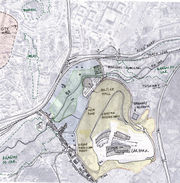 |
232 KB | Plan showing location of Monte Gaiás (yellow tone) in relation to city center and with the River Sar and Brañas do Sar. | 1 |
| 13:28, 26 January 2014 | An-gaias-access.jpg (file) |  |
244 KB | 1 | |
| 17:53, 26 January 2014 | An-cuadrado veg.jpg (file) | 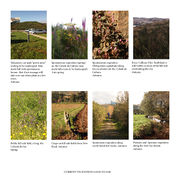 |
324 KB | 1 | |
| 21:45, 26 January 2014 | An-veg gaias.jpg (file) | 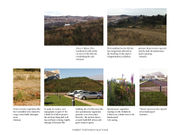 |
298 KB | Pictures showing existing plant communities on the Gaiás hillside and the Cidade da Cultura open areas. | 1 |
| 19:31, 27 January 2014 | Pr gaias hill.jpg (file) | 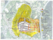 |
642 KB | Vegetation plant comunities for the Gaias hill planting design | 1 |
| 22:01, 28 January 2014 | Gaias from Sar.jpg (file) | 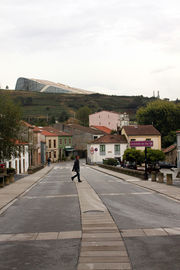 |
378 KB | Monte Gaiàs from the city | 2 |
| 23:28, 28 January 2014 | Tirasbw.jpg (file) | 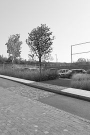 |
158 KB | 2 | |
| 00:04, 29 January 2014 | Caxadoenflor.jpg (file) | 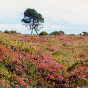 |
558 KB | 1 | |
| 00:04, 29 January 2014 | Sarela.JPG (file) | 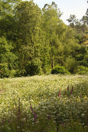 |
689 KB | 1 | |
| 00:05, 29 January 2014 | CdC LaSp.jpg (file) | 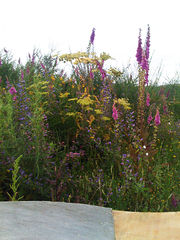 |
516 KB | 1 | |
| 16:13, 3 February 2014 | Monte gaias group 18 aar 1of3.jpg (file) | 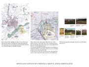 |
297 KB | Shows Santiago as a city of many hills and two rivers. Next picture describe one of these hills (Monte Gaiás); the huge building site and cultural infrastructure on the man made esplanade on the top of it, green areas, relationship with river Sar and ac | 1 |
| 16:26, 3 February 2014 | Monte gaias group 18 aar 2of3.jpg (file) | 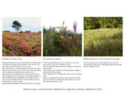 |
425 KB | Pictures of local plant communities that were used as inspiration for Monte Gaiás´s planting design and to describe it´s future atmosphere. | 1 |
| 16:38, 3 February 2014 | Monte gaias group 18 aar 3of3.jpg (file) | 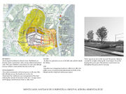 |
347 KB | Sketch showing Monte Gaiás proposed planting design; the heathland restored area, the medium and high meadows and the transitional (towards the heathland planting) areas. The image depicts the car park, how the existing pavement patters are draw through | 1 |